


Refine your search for walks in Autainville
Autainville walks


 From the Forest of Citeaux to the Forest of Marchenoir
 Visorando Member
 5.85 mi
 +39 ft
 -43 ft
 2h 45
2h 45
 Easy
Easy
 Departure from Autainville (Loir-et-Cher)
If you enjoy the forest in all seasons, the game-rich high forests, and don’t mind feeling a bit isolated, then this route is for you.
A circular walk through the Perche and Haut-Vendômois regions starting from Rocheux
 6.53 mi
+131 ft
-131 ft
3h 05
6.53 mi
+131 ft
-131 ft
3h 05
 Moderate
Departure from Lignières (Loir-et-Cher) (Loir-et-Cher)
Moderate
Departure from Lignières (Loir-et-Cher) (Loir-et-Cher)
Starting from Rocheux and its imposing 13th-century castle – which was remodelled in the 19th century and later became the Château des Énigmes – this varied route takes you through wooded areas and pretty hamlets, whilst offering panoramic views of the Haut Vendômois.
Exploring a dry valley in the Beauce region
 5.56 mi
+46 ft
-46 ft
2h 35
Easy
Departure from Baccon (Loiret)
5.56 mi
+46 ft
-46 ft
2h 35
Easy
Departure from Baccon (Loiret)
La Beauce harbours well-kept secrets. Yet some of them are revealed to us during this walk, around a dry valley. Roe deer, wild hares, grape hyacinths and orchids reveal themselves to those who know how to look.
In the Perche Vendômois region from Fréteval
 12.05 mi
+351 ft
-358 ft
5h 50
Moderate
Departure from Fréteval (Loir-et-Cher)
12.05 mi
+351 ft
-358 ft
5h 50
Moderate
Departure from Fréteval (Loir-et-Cher)
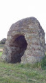
Along this route, natural landscapes—rivers, woods and hedgerows—are enhanced by the undulating terrain, alongside historic monuments and remarkable ruins, such as the feudal castle of Fréteval, whose keep dates from 1100, and the Grisset Tower, the ‘cella’ of an ancient Gallo-Roman temple, unique in Northern Europe.
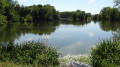
The Étang Saint-Lubin and the Loir Valley as seen from Saint-Hilaire-la-Gravelle
 8.57 mi
+381 ft
-361 ft
4h 15
Moderate
Departure from Saint-Hilaire-la-Gravelle (Loir-et-Cher)
8.57 mi
+381 ft
-361 ft
4h 15
Moderate
Departure from Saint-Hilaire-la-Gravelle (Loir-et-Cher)
In the Haut-Vendômois region, this route runs alongside the Loir valley, then winds its way through the shade of the banks of the Étang Saint-Lubin, takes a detour to the ruins of the feudal castle of Fréteval, before venturing through the fields, across a rolling landscape, to reach the pretty village of Saint-Hilaire-la-Gravelle.
Between Beauce and Perche from Cloyes-sur-le-Loir
 Association / Club / Walk leader
 12.10 mi
+381 ft
-377 ft
5h 55
12.10 mi
+381 ft
-377 ft
5h 55
 Difficult
Departure from Cloyes-sur-le-Loir (Eure-et-Loir)
Difficult
Departure from Cloyes-sur-le-Loir (Eure-et-Loir)
Located between Beauce and Perche, at the crossroads of the Loir Valley and the Route du Blé, Cloyes-sur-le-Loir is a sleeping beauty on the banks of the Loir. This pretty town combines modernity and heritage. The hike takes you through the countryside with its valleys, forests and rolling hills, which are sure to charm you.
Tour of Lailly-en-Val starting from Beaugency
17.57 mi
+52 ft
-52 ft
7 hrs
 Very difficult
Departure from Beaugency (Loiret)
Very difficult
Departure from Beaugency (Loiret)
This circular route starting from Beaugency is half in the Loire Valley and half in Sologne. It takes place mostly on quiet, relatively uncrowded paths.
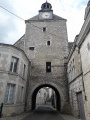
Walk along the Ru in Beaugency
 5.91 mi
+89 ft
-89 ft
2h 50
Easy
Departure from Beaugency (Loiret)
5.91 mi
+89 ft
-89 ft
2h 50
Easy
Departure from Beaugency (Loiret)
The town of Beaugency, steeped in history, owes its economic development from the 11th century onwards to the water mills used for milling. Following the Ru valley, this walk will take you past historic monuments and through varied landscapes.
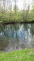
From Beaugency to the Eaux Bleues de Tavers
 8.86 mi
+30 ft
-39 ft
4h 05
Moderate
Departure from Beaugency (Loiret)
8.86 mi
+30 ft
-39 ft
4h 05
Moderate
Departure from Beaugency (Loiret)
Starting in Beaugency, a medieval town rich in heritage, this hike leads to the Eaux Bleues de Tavers, the Ver Chapel and various wash houses, offering superb views of the Loire River.
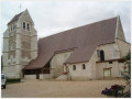
Route de Montigny-le-Gannelon
 3.87 mi
+138 ft
-138 ft
1h 55
Easy
Departure from Montigny-le-Gannelon (Eure-et-Loir)
3.87 mi
+138 ft
-138 ft
1h 55
Easy
Departure from Montigny-le-Gannelon (Eure-et-Loir)
Green route: this route will allow you to explore the western and south-western parts of the village. The route is signposted throughout with the image of a blackbird.
Route de Montigny-le-Gannelon pour les cerfs
 3.74 mi
+56 ft
-56 ft
1h 45
Easy
Departure from Montigny-le-Gannelon (Eure-et-Loir)
3.74 mi
+56 ft
-56 ft
1h 45
Easy
Departure from Montigny-le-Gannelon (Eure-et-Loir)
This route will allow you to explore the northern and north-eastern parts of the village. The route is signposted throughout with the image of a roe deer.
A path, a school: Les Lavoirs
 6.06 mi
+49 ft
-66 ft
2h 50
Easy
Departure from Avaray (Loir-et-Cher)
6.06 mi
+49 ft
-66 ft
2h 50
Easy
Departure from Avaray (Loir-et-Cher)
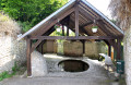
Walking and hiking trails winding along the hillside above the Loire floodplain between Lestiou and Avaray. An excuse to discover two pretty little villages on the Loire, it also offers the surprise of six wash houses in just five kilometres. Very discreetly located, you have to take the time to look for them: the walk then becomes a treasure hunt with well-hidden treasures. The commune of Lestiou has two, while Avaray has four, including one oval wash house.
The Yerre Valley
 Tourism professional11.03 mi
+262 ft
-262 ft
5h 20
Moderate
Departure from Saint-Hilaire-sur-Yerre (Eure-et-Loir)
Tourism professional11.03 mi
+262 ft
-262 ft
5h 20
Moderate
Departure from Saint-Hilaire-sur-Yerre (Eure-et-Loir)
The Yerre river approaches, accompanied by scents and sounds that it seems to have carried from the depths of the forest, before flowing along the edge of the Perche region and joining the Loir river above Cloyes.
Circular walk around Saint-Pierre Chapel in Vouvray and the ponds
6.40 mi
+62 ft
-62 ft
3h 00
Easy
Departure from Douy (Eure-et-Loir)
Walk starting from the car park at Douy church to explore Courgain Mill, situated at the bridge over the Loir. The route then passes near a castle at La Boulidière, descends along the road between the ponds and then follows a path towards the Vouvray footbridge to the old wash house and Saint-Pierre Chapel. The return journey follows the same route for part of the way, then veers off to skirt the ponds of the Basse Plaine, where you can spot coots and grey herons. The end of the walk leads to another bridge over the Loir, then past the Château du Prieuré before returning to Douy church.
Heading back up towards the source of the Tronne
 5.82 mi
+98 ft
-98 ft
2h 45
Moderate
Departure from Mer (Loir-et-Cher)
5.82 mi
+98 ft
-98 ft
2h 45
Moderate
Departure from Mer (Loir-et-Cher)
A small stream originates in a place called Bausdisson.
It flows through the town from north to south and joins the Loire after a journey of around twelve kilometres.
This small river, called the Tronne, gives the town of Mer a certain charm.
In fact, Mera means "marsh" or "place covered with water" in Latin, which is the origin of the name Mer.
The Bois des Gâts forest in Châteaudun
 Tourist office
 5.57 mi
+174 ft
-190 ft
2h 45
Easy
Departure from Châteaudun (Eure-et-Loir)
5.57 mi
+174 ft
-190 ft
2h 45
Easy
Departure from Châteaudun (Eure-et-Loir)
Located on the natural border between Beauce and Perche formed by the Loir River, Châteaudun is built on a rocky spur. The route circles the remarkable natural site of the Bois des Gâts or Gas. Open to the public, this 23-hectare site is protected by the Natura 2000 programme.
The old quarters of Châteaudun
 1.58 mi
+121 ft
-138 ft
0h 50
Easy
Departure from Châteaudun (Eure-et-Loir)
1.58 mi
+121 ft
-138 ft
0h 50
Easy
Departure from Châteaudun (Eure-et-Loir)
From the upper town to the lower town, this walking route allows you to explore the historic centre of Châteaudun and its finest monuments, as well as a section of the banks of the Loir, offering beautiful panoramic views of the town.
The woods of Saint-Martin
 11.34 mi
+367 ft
-364 ft
5h 30
Moderate
Departure from Châteaudun (Eure-et-Loir)
11.34 mi
+367 ft
-364 ft
5h 30
Moderate
Departure from Châteaudun (Eure-et-Loir)
Situated on the natural boundary formed by the River Loir between the Beauce and the Perche regions, Châteaudun is built on a rocky outcrop. The route takes you to Île Chemars along the River Loir before heading towards the Bois de Saint-Martin near Saint-Denis-les-Ponts.