Passing through La Motte Longuet

A route mainly through woodland, dotted with numerous ponds. Ideal for nature lovers seeking peace and quiet. An alternative route allows you to shorten the distance considerably.

Details

886749
Creation:
Last update:
Last review:
  • Walking
    Activity: Walking
  • ↔
    Distance: 8.38 mi
  • ◔
    Average duration: 3h 55 
  • ▲
    Difficulty: Moderate

  • ⚐
    Back to start: Yes
  • ↗
    Ascent: + 52 ft
  • ↘
    Descent: - 52 ft

  • ▲
    Highest point: 338 ft
  • ▼
    Lowest point: 279 ft

Photos

Description of the walk

The start of the walk is at the car park next to the cemetery at La Ferté-Saint-Cyr, on the Route de Bonneville (D925).

(S/E) Follow the Route de Bonneville (D925) towards the village to the north. Pass the Route de Dhuizon, then the Route de Chambord, on your left, and turn right onto the Route de Saint-Cyr at the junction. Pass the road leading to the housing estate shortly after the fire station on your right.

(1) Turn right onto the CR27 or Chemin de Villeny. Continue along the forest track where the tarmac ends. Pass under a power line.

Old red-and-white markings

(2) At the crossroads, ignore the CR27 on the right and take the CR23, orGR®3C, on the left. This north-east-bound path crosses the Route de Saint Cyr. Ignore all side turnings leading to private roads.

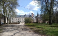
(3) Leave the CR32 on your right and stay on the CR23 orGR® de Pays de Sologne heading north-east. Ignore the paths on the right. Opposite the Château de la Motte-Longuet, the lane turns right.

(4) At the crossroads, turn right onto the CR5 towards Les Mottets, turning your back on the VC11 towards Ligny-le-Ribault. This lane heads mainly south-west. Again, ignore the various side lanes.

(5) Pass the CR32 towards Lauray on your right and head towards the hamlet of Saint-Cyr on your left. At the crossroads, follow the sign for ‘La Brosse CR35’ by veering left.

(6) Ignore the CR36 on the left and stay on the CR35, which turns right; pass La Brosse, then Le Cordon on your right. You can just make out the Étang du Bout du Monde behind the vegetation on your left.

(7) At the crossroads, turn right onto the CR27 orGR®31(GR® de Pays de Sologne), pass an old barrier, then the hamlet of La Fosse and a pond on your right.

(8) At the Croix Gérat, continue along the CR27 orGR®31heading north-west, ignoring the CR40. Ignore the various side lanes.

(2) At the crossroads, pass through the old barrier then turn onto the CR23, the left-hand-most road, which runs alongside some ponds. A commemorative plaque marks the spot where a fighter aircraft was shot down on 1 July 1944.

(9) At the crossroads, turn right onto the D925, Route de Bonneville, which leads to the village via the cemetery (S/E).


Waypoints

  1. S/E : mi 0 - alt. 285 ft - Parking area alongside the cemetery
  2. 1 : mi 0.19 - alt. 285 ft - Turn right onto the Chemin de Villeny
  3. 2 : mi 0.77 - alt. 305 ft - Turn left towards the CR23, or GR3C
  4. 3 : mi 1.89 - alt. 289 ft - Carry on straight ahead. Near the - Cosson (rivière) - Affluent du Beuvron
  5. 4 : mi 2.9 - alt. 292 ft - Turn right onto the CR5 towards Les Mottets
  6. 5 : mi 3.87 - alt. 312 ft - Turn left towards the hamlet of Saint-Cyr
  7. 6 : mi 4.64 - alt. 305 ft - Turn right towards La Brosse
  8. 7 : mi 5.45 - alt. 338 ft - Turn right onto the CR27
  9. 8 : mi 6.55 - alt. 318 ft - Croix Gérat, straight ahead
  10. 9 : mi 8.04 - alt. 315 ft - Turn right onto the D925, the Bonneville road
  11. S/E : mi 8.38 - alt. 285 ft - Parking area alongside the cemetery

Notes

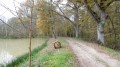
The paths taken are mainly forest tracks.

Avoid this route in wet weather and during the hunting season.

Watch out for signs indicating private property. There are many of them and their placement is often confusing. Stick to the route and do not take any shortcuts.

Alternative route: you can shorten the route by taking the cross-country path between (3) and (8) (distance = 7.86 km)

(3) Turn right onto the CR32, which heads due south.

(5) At the junction, ignore the lane on the left, then turn right onto the Clos de Saint-Cyr. At the crossroads in the hamlet of Saint-Cyr, take the Chemin de la Croix Gérat on the left (CR40), which heads due south.

(8) At the Croix Gérat, turn onto the CR27, orGR®31, heading north-west.

Worth a visit

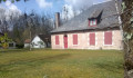
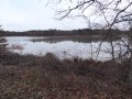
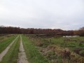
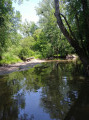
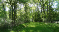
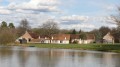
You’ll see numerous ponds in a wooded area consisting of deciduous trees and a few pine groves.

Nearby: Chambord Castle, about 15 km to the west.

Always be cautious and plan ahead when you're outdoors. Visorando and the author of this route cannot be held responsible for any accidents occurring on this route.

The GR® and PR® markings are the intellectual property of the Fédération Française de Randonnée Pédestre.

Reviews and comments

4.6 / 5
Based on 3 reviews

Reliability of the description
4 / 5
Ease of following the route
5 / 5
Route interest
4.7 / 5
HERVE PHILIPPE
HERVE PHILIPPE

Overall rating : 4.7 / 5

Date of your route : May 19, 2025
Reliability of the description : ★★★★☆ Good
Ease of following the route : ★★★★★ Very good
Route interest : ★★★★★ Very good
Very busy route : No

The succession of woods, clearings, ponds and pastures prevents the walk from becoming monotonous. The route also offers a glimpse of what Sologne used to be like, with its isolated farmhouses, but today the meadows lie empty...

Machine-translated

Jean-Louis Pinault
Jean-Louis Pinault

Thank you for taking the time to post these comments,
Have a lovely day,
Jean-Louis

Machine-translated

Lulu41220
Lulu41220

Overall rating : 5 / 5

Date of your route : Dec 05, 2022
Reliability of the description : ★★★★★ Very good
Ease of following the route : ★★★★★ Very good
Route interest : ★★★★★ Very good
Very busy route : Yes

Thank you very much for this lovely route, with some beautiful lakes to explore and, best of all, very little tarmac
A real treat!!
See you soon on the next routes

Machine-translated

Jean-Louis Pinault
Jean-Louis Pinault

Thank you for your comments. Among the many walks on offer in Sologne, you should be able to find some that better suit your needs.
Have a lovely day,
Jean-Louis

Machine-translated

BelleSologne41
BelleSologne41

Overall rating : 4 / 5

Date of your route : Jul 17, 2019
Reliability of the description : ★★★☆☆ Average
Ease of following the route : ★★★★★ Very good
Route interest : ★★★★☆ Good

We completed the walk in ideal weather conditions. A lovely walk, but nothing more. We’re madly in love with the Sologne, and this isn’t really the Sologne: there’s not much heather, ferns or birch trees, and we don’t walk alongside any ponds – we can only guess they’re there. A shame.

Machine-translated

Other walks in the area

For more walks, use our search engine .

The GPS track and description are the property of this route's author. Please do not copy them without permission.