Circular route in Sologne around La Ferté-Saint-Cyr

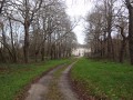
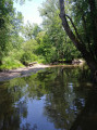
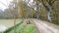
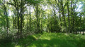
A route that runs mainly through woodland. The dense or sparse vegetation, consisting mainly of deciduous trees, along with streams and ponds, provides ideal habitats for birds and large wild animals.

Details

883228
Creation:
Last update:
Last review:
  • Walking
    Activity: Walking
  • ↔
    Distance: 8.84 mi
  • ◔
    Average duration: 4h 05 
  • ▲
    Difficulty: Moderate

  • ⚐
    Back to start: Yes
  • ↗
    Ascent: + 66 ft
  • ↘
    Descent: - 66 ft

  • ▲
    Highest point: 354 ft
  • ▼
    Lowest point: 276 ft

Photos

Description of the walk

The walk starts at the car park next to the cemetery in La Ferté-Saint-Cyr, on the Route de Dhuizon (D13).

Old yellow-red markings

(S/E) Follow the Route de Dhuizon (D13) towards the village to the north. Leave the Route de Bonneville on your right and turn left onto the Route de Chambord at the entrance to the village. This section ofthe GR® de Pays de Sologne is tarmac-surfaced. Ignore the various side paths. Pass the Étang le Paradis on your left; a bridge spans the Rau des Veillas.

GR®3Cwhite-and-red markings

(1) Turn left at the ‘Les Coudrays’ sign to join the CR3. The path, initially tarmac, becomes a forest track used by the ‘Loire à vélo’ cycle route. Continue south-east, ignoring the various side paths. Pass the Bois Georget and Les Grands Coudrays on your right.

(2) At the crossroads, carry on straight ahead towards the track, the entrance to which is partially blocked to prevent motor vehicles from entering. Turn left onto the first track you come to. Go through the barrier to cross the D13 (take care) and head north-east-east. The tarmac gives way to bare earth at a place called La Ronce.

(3) Leave the tracks on your right and continue north-east, then north towards the Étang du Temple on your right.

(4) At the Fork in the road, follow the CR41, leaving the CR42 on your right. Turn left at the crossroads. The path turns left after Étang de Fambron, which is on your right.

(5) Ignore the path leading towards the Étang de Rhuys and turn right to walk alongside the Frelonnière on your left, then head north-west.

(6) Cross the D13 (take care) and take the CR22 opposite, which you’ll soon leave behind to take the CR23 on the right, leading you to cross the D13 once more.

(7) At the crossroads, turn left towards the north, then north-north-east.

(8) When you reach the hamlet of La Platine, turn left onto the Chemin de la Platine (CR20), which passes through a residential area before joining the Route de Dhuizon (D13); turn right onto this road to return to the car park alongside the cemetery (S/E).


Waypoints

  1. S/E : mi 0 - alt. 289 ft - Car park near the cemetery
  2. 1 : mi 2.06 - alt. 295 ft - Turn left at the ‘Les Coudrays’ sign
  3. 2 : mi 4.46 - alt. 354 ft - Go straight on towards the partially blocked path
  4. 3 : mi 5.41 - alt. 335 ft - Heading north-east
  5. 4 : mi 6.19 - alt. 312 ft - Straight on along the CR41
  6. 5 : mi 6.98 - alt. 299 ft - Turn right to follow the Frelonnière
  7. 6 : mi 7.5 - alt. 312 ft - Crossing the D13
  8. 7 : mi 7.94 - alt. 322 ft - Turn left towards the north
  9. 8 : mi 8.46 - alt. 312 ft - Turn left onto the Chemin de la Platine (CR20)
  10. S/E : mi 8.84 - alt. 289 ft - Car park near the cemetery

Notes

The paths used, which are mainly forest tracks, can be recognised by their two clearly defined ruts (or their stabilised surface), which distinguishes them from most private side roads.

TheGR® signposting is old, so you should remain vigilant. Do not rely on the ‘La Loire à vélo’ signposting, as this only covers a small part of the walking route.

Avoid this route in wet weather and during the hunting season.

Watch out for signs indicating private property. There are many of them and their placement is often confusing. Stick to the route and do not take any shortcuts.

Worth a visit

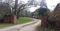
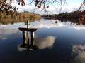
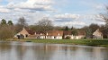
You will come across numerous ponds in a wooded area consisting of deciduous trees and a few scattered pine groves.

Nearby: Chambord Castle, about fifteen kilometres to the west.

Always be cautious and plan ahead when you're outdoors. Visorando and the author of this route cannot be held responsible for any accidents occurring on this route.

The GR® and PR® markings are the intellectual property of the Fédération Française de Randonnée Pédestre.

Reviews and comments

4.6 / 5
Based on 3 reviews

Reliability of the description
4.3 / 5
Ease of following the route
5 / 5
Route interest
4.3 / 5
User 27695463

Overall rating : 4.3 / 5

Date of your route : Sep 22, 2025
Reliability of the description : ★★★★☆ Good
Ease of following the route : ★★★★★ Very good
Route interest : ★★★★☆ Good
Very busy route : No

A lovely walk with the sound of deer bellowing, mushroom picking, and a few deer and a roe deer spotted!

Machine-translated

Jean-Louis Pinault
Jean-Louis Pinault

Thank you, bionat, for this additional information.
Have a nice day,
Jean-Louis

Machine-translated

bionat
bionat
• Edited:

Overall rating : 4.7 / 5

Date of your route : Mar 27, 2023
Reliability of the description : ★★★★★ Very good
Ease of following the route : ★★★★★ Very good
Route interest : ★★★★☆ Good
Very busy route : No

An easy walk, mostly along wide forest tracks (the first 5 km are on tarmac).
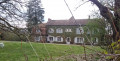
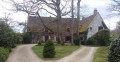
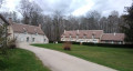
A few beautiful Sologne-style houses.
We started the walk at the car park by the River Cosson, just after the bridge on the D13, which takes you through the village and brings the total distance to 15 km.

Machine-translated

AnneBihan
AnneBihan
• Edited:

Overall rating : 4.7 / 5

Date of your route : May 27, 2018
Reliability of the description : ★★★★☆ Good
Ease of following the route : ★★★★★ Very good
Route interest : ★★★★★ Very good

The scenery is magnificent and very varied. We didn’t come across a single soul along the way. It’s completely peaceful; it’s a real immersion in nature!
There’s just a small error in point 4 of the route description. You do need to turn right, with your back to the VC11 heading towards Ligny-le-Ribault, but don’t take the CR5 towards Les Mottets! That’s not the right direction.
.

Machine-translated

Other walks in the area

For more walks, use our search engine .

The GPS track and description are the property of this route's author. Please do not copy them without permission.