


Refine your search for walks in Argentré-du-Plessis
Argentré-du-Plessis walks


 Moulin Neuf, Grotte de la Vierge and Jardin du Hill in Argentré-du-Plessis
 Visorando Member
 4.30 mi
 +171 ft
 -177 ft
 2h 10
2h 10
 Easy
Easy
 Departure from Argentré-du-Plessis (Ille-et-Vilaine)
A short, refreshing walk in lush green surroundings – a little time for yourself or with the family, combining nature with a touch of history. Whatever the season, you’ll be treated to magnificent colours.
The Heron Trail in Argentré-du-Plessis
 Local authority3.84 mi
+102 ft
-102 ft
1h 50
Easy
Departure from Argentré-du-Plessis (Ille-et-Vilaine)
Local authority3.84 mi
+102 ft
-102 ft
1h 50
Easy
Departure from Argentré-du-Plessis (Ille-et-Vilaine)
This idyllic route (No. 79 in the Vitré Communauté walking guide), set in the heart of the Argentré-du-Plessis bocage, south of Vitré, connects the town’s two old mills (Neuf aux Moines) and their ponds over a distance of just over six kilometres.
Route de Plessis-Sévigné, Argentré-du-Plessis
 9.92 mi
+292 ft
-269 ft
4h 50
9.92 mi
+292 ft
-269 ft
4h 50
 Moderate
Departure from Argentré-du-Plessis (Ille-et-Vilaine)
Moderate
Departure from Argentré-du-Plessis (Ille-et-Vilaine)
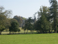
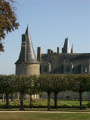
The village of Argentré-du-Plessis lived for five centuries in the shadow of the Château du Plessis. This family remained the owners of almost the entire village until the early 20th century, and Alain d’Argentré was mayor until 1983. You will pass close to the Château du Plessis during this walk.
Route certified by FFRandonnée.
Suitable for both walking and cycling.
The Chemin des Loups in Argentré-du-Plessis
 8.93 mi
+282 ft
-279 ft
4h 20
Moderate
Departure from Argentré-du-Plessis (Ille-et-Vilaine)
8.93 mi
+282 ft
-279 ft
4h 20
Moderate
Departure from Argentré-du-Plessis (Ille-et-Vilaine)
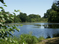
Wolves were very common in Brittany until the 19th century. The Argentré-du-Plessis region was no exception. Although its refuge was the Pertre forest, which we will cross in its western part, its hunting ground extended over the entire municipality, as evidenced by the names of certain localities such as Louveaudière, Cul de Loup and even the Bois de Noirloup, which we will pass by. But you can hike in complete safety, as the wolf has been extinct in the region for over a century.
Route de la Valière, Vitré
 5.64 mi
+39 ft
-39 ft
2h 40
Easy
Departure from Vitré (Ille-et-Vilaine)
5.64 mi
+39 ft
-39 ft
2h 40
Easy
Departure from Vitré (Ille-et-Vilaine)
This reservoir, which has supplied drinking water since 1978, is also used to control flood peaks and maintain low water levels as required.
This route is FFRandonnée-certified. It can be enjoyed on foot or by bike.
The Cinq Chemins route in Argentré-du-Plessis
3.57 mi
+164 ft
-164 ft
1h 45
Easy
Departure from Argentré-du-Plessis (Ille-et-Vilaine)
A short circular route through the countryside between Argentré-du-Plessis and Le Pertre.
La route de la Crossonière in Brielles
 10.18 mi
+331 ft
-308 ft
5h 00
Moderate
Departure from Brielles (Ille-et-Vilaine)
10.18 mi
+331 ft
-308 ft
5h 00
Moderate
Departure from Brielles (Ille-et-Vilaine)
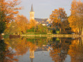
Although the high-speed rail line (LGV) runs through Brielles from east to west, the town, together with the neighbouring commune of Le Pertre, offers a network of beautiful trails.Suitable for both walking and mountain biking.
A stroll through Vitré
 4.81 mi
+194 ft
-194 ft
2h 25
Easy
Departure from Vitré (Ille-et-Vilaine)
4.81 mi
+194 ft
-194 ft
2h 25
Easy
Departure from Vitré (Ille-et-Vilaine)
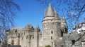
Whether you’re exploring this ‘City of Art and History’ or simply taking a stroll, here’s a short route that takes you through the historic quarter, past the castle, along narrow streets and through the Jardin du Parc.
The Vau Follet to Le Pertre route
 5.40 mi
+217 ft
-217 ft
2h 40
Easy
Departure from Le Pertre (Ille-et-Vilaine)
5.40 mi
+217 ft
-217 ft
2h 40
Easy
Departure from Le Pertre (Ille-et-Vilaine)
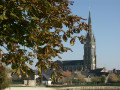
A welcoming destination on the edge of the Mayenne region and a true paradise for walkers, the village and countryside of Le Pertre offer stunning panoramic views: from the viewing platform behind the church, you can see 39 church spires.
From Vitré to Argentré-du-Plessis via the Valière lake
 13.51 mi
+377 ft
-390 ft
6h 35
13.51 mi
+377 ft
-390 ft
6h 35
 Difficult
Departure from Vitré (Ille-et-Vilaine)
Difficult
Departure from Vitré (Ille-et-Vilaine)
This route is the first stage of a 96 km circular through the Vitré countryside. Consisting mainly of sunken lanes, this route will take you, among other places, to the Château des Rochers-Sévigné and the Valière lake.
The Pré des Lavandières route in Vitré
 2.84 mi
+174 ft
-148 ft
1h 30
Easy
Departure from Vitré (Ille-et-Vilaine)
2.84 mi
+174 ft
-148 ft
1h 30
Easy
Departure from Vitré (Ille-et-Vilaine)
This route will take you on a timeless stroll through the medieval alleyways of old Vitré. You’ll also have the chance to explore the Pré des Lavandières and the Promenade du Val.
Signposted in a clockwise direction.
FFRP-certified route.
Sightseeing tour of Vitré
 5.34 mi
+243 ft
-217 ft
2h 40
Easy
Departure from Vitré (Ille-et-Vilaine)
5.34 mi
+243 ft
-217 ft
2h 40
Easy
Departure from Vitré (Ille-et-Vilaine)
Explore the historic heart of Vitré, a town of art and history, with its streets and alleyways dating back to medieval times.Stroll and wander in search of hidden gems with this route taking in all the must-see sights.A real getaway into the heart of history and the Vitré way of life! Finish the walk with a visit to the medieval castle.Follow the step-by-step guide rather than the GPX track for ease of use.
Sightseeing tour of Vitré
 5.33 mi
+177 ft
-157 ft
2h 35
Easy
Departure from Vitré (Ille-et-Vilaine)
5.33 mi
+177 ft
-157 ft
2h 35
Easy
Departure from Vitré (Ille-et-Vilaine)
Stroll through the historical heart of Vitré, city of art and history, with its medieval streets and alleys.
Wander in quest of the heritage wonders with this trail.
A true escape through history and the vitréen "art de vivre".
End the walk by a visit of the medieval castle and its museum before going back to the starting point.
Follow the description rather than the GPX tracks.
Circuit de Vassé-Pierre Galate, Torcé
 4.26 mi
+30 ft
-30 ft
2h 00
Easy
Departure from Torcé (Ille-et-Vilaine)
4.26 mi
+30 ft
-30 ft
2h 00
Easy
Departure from Torcé (Ille-et-Vilaine)
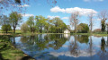
The Vassé Pond was created as ecological compensation for the construction of the Paris-Rennes high-speed rail line. There are educational panels on biodiversity and an old manor house. Many animals have found a home here, including sheep, Scottish cows, donkeys and ducks. Picnic tables, dry toilets, a shelter and a barbecue area are available.
Circuit de la Voie Romaine à Torcé
6.96 mi
+138 ft
-167 ft
3h 20
Moderate
Departure from Torcé (Ille-et-Vilaine)
Discover Torcé and its surroundings with this 11.4 km circular, which can be shortened to an 8 km route without the northern circular at Haut Montigné.
The historic railway route between Argentré-du-Plessis and Vitré
 6.58 mi
+308 ft
-308 ft
3h 20
Difficult
Departure from Vitré (Ille-et-Vilaine)
6.58 mi
+308 ft
-308 ft
3h 20
Difficult
Departure from Vitré (Ille-et-Vilaine)
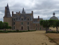
As its name suggests, it is clear that this route follows the greenway for a considerable distance, along which the railway line to Argentré-du-Plessis and then La Guerche-de-Bretagne once ran. It is now reserved for walkers, hikers and cycle tourists.
The route continues with a brief glimpse of Madame de Sévigné’s residence before returning towards Vitré via small, shaded roads and paths.
Lake Haute Vilaine at La Chapelle-Erbrée
 8.66 mi
+249 ft
-249 ft
4h 10
Moderate
Departure from Saint-M'Hervé (Ille-et-Vilaine)
8.66 mi
+249 ft
-249 ft
4h 10
Moderate
Departure from Saint-M'Hervé (Ille-et-Vilaine)
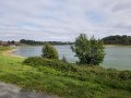
The Haute Vilaine Lake covers an area of 155 hectares and holds 8 million cubic metres of water, with a maximum depth of 13 metres.
Created in 1982, its purpose is to regulate winter floods on the Vilaine for Vitré and Rennes, located downstream.
Walking around the lake allows you to enjoy the lake and the forest paths.
Route des Petits Ponts de Bois (Montreuil-sous-Pérouse)
 4.81 mi
+440 ft
-423 ft
2h 35
Easy
Departure from Montreuil-sous-Pérouse (Ille-et-Vilaine)
4.81 mi
+440 ft
-423 ft
2h 35
Easy
Departure from Montreuil-sous-Pérouse (Ille-et-Vilaine)
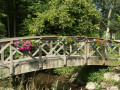
Take a stroll through the countryside of Montreuil-sous-Pérouse and its valleys. On this route, you’ll cross charming little wooden bridges spanning the Ruisseau de la Pérouse.
The Cantache tour in Pocé-les-Bois
 7.56 mi
+79 ft
-72 ft
3h 35
Moderate
Departure from Montreuil-sous-Pérouse (Ille-et-Vilaine)
7.56 mi
+79 ft
-72 ft
3h 35
Moderate
Departure from Montreuil-sous-Pérouse (Ille-et-Vilaine)
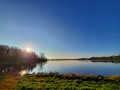
A stone's throw from Vitré, a historic town in the Marches de Bretagne region, Lake Cantache stretches across three municipalities: Champeaux, Monteuil-sous-Pérouse and Pocé-les-Bois. A winter stopover for migratory birds, their presence is a source of wonder.
More walks in Argentré-du-Plessis
Select a point of interest below: