Country:
 City:


Start at Place de la Pérouse, library car park, near the church in Montreuil-sous-Pérouse.
YellowPR® signposting supplemented by green arrows marked with the number 6
(S/E) From the car park, head towards the church. Go round it on the left.
(1) Once opposite the town hall, take a small path on the right. At the junction, turn right, then left onto the road. Continue for about 100 m.
(2) Take the road on the right and follow it for about 300 m, then take the first left. Continue to the hamlet of La Stardière and go round it via the path on its right. Follow this path until you pass the treatment works’ ponds on your right.
(3) Turn right. Carry on straight ahead until you reach an industrial estate. Go straight through it, then, at the end of Rue Denis Papin, turn left to reach the Stop sign.
(4) Turn right and head towards Lac de la Cantache. Take the path on the right before the bridge, which runs alongside the small lake, and, at the end of the lake, carry on straight ahead until you reach the road.
(5) Cross the road, head straight ahead and join the dirt track at the end of the road. You’ll come out at a bend in a small road.
(6) Turn right and carry on straight ahead at the junctions until you reach the top of a hill.
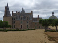
(7) Turn left, walk past the Manoir de la Faucillonnais and carry on until you reach a junction. Take the path on the right leading down towards the village of Montreuil.
(8) Take the first right and walk through part of the housing estate. Turn left after the third house. At the bend in the road, take the path opposite and walk straight down to the town hall.
(1) From the town hall, head down towards the church, then turn right to return to the starting point (S/E).

 Local authority


 Moderate
 Difficult