


Refine your search for walks in Amponville
Amponville walks


 The Pierre Larmoire Dolmen
 Visorando Member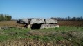
 3.49 mi
 +36 ft
 -36 ft
 1h 40
1h 40
 Easy
Easy
 Departure from Amponville (Seine-et-Marne)
The main aim of this short walk through farmland is to discover one of the finest dolmens in the Île-de-France region. The church at Amponville, at the start of the walk, is also well worth a visit.
Wooded trail around Boissy-aux-Cailles
9.66 mi
+417 ft
-407 ft
4h 50
 Moderate
Departure from Boissy-aux-Cailles (Seine-et-Marne)
Moderate
Departure from Boissy-aux-Cailles (Seine-et-Marne)
We pass on either side of a valley where the beautiful village of Boissy-aux-Cailles is located, following paths wide enough to walk two abreast while chatting, or trails in single file. The variety of tree species is surprising: oak, chestnut, birch, beech, pine, etc. And also on the edges of agricultural fields where lavender grows alongside beetroot and cereals.The best times to enjoy it to the full are late spring (May-June), when the flora dazzles us with its colours and scents, and autumn (mid-September-October), when the leaves of the trees are adorned with their yellow, ochre and red colours and accompanied by the rich and subtle smells of mushrooms and sometimes game.
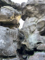
In the Massif de la Dame Jouanne
 5.84 mi
+430 ft
-407 ft
3h 05
Moderate
Departure from Larchant (Seine-et-Marne)
5.84 mi
+430 ft
-407 ft
3h 05
Moderate
Departure from Larchant (Seine-et-Marne)
Beautiful walk in the Dame Jouanne massif with magnificent views and a few curiosities.
Commanderie National Forest
5.57 mi
+394 ft
-374 ft
2h 55
Moderate
Departure from Larchant (Seine-et-Marne)
Tour of the Commanderie Forest, with numerous viewpoints over the village of Larchant and its basilica. Nine kilometres with some steep climbs and a few rocky sections on a very shady route. If you don't make any noise, you may be surprised by the passing of a deer or a roe deer.
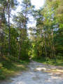
Circuit around Larchant
 4.45 mi
+397 ft
-394 ft
2h 25
Easy
Departure from Larchant (Seine-et-Marne)
4.45 mi
+397 ft
-394 ft
2h 25
Easy
Departure from Larchant (Seine-et-Marne)
The very enjoyable scent of pine is everywhere. And the small sand dune that I would the "Little Dune of Pyla" is lovely.
Chemin des hauteurs de Bardilly from Desmonts (45)
 Association / Club / Walk leader3.97 mi
+102 ft
-118 ft
1h 55
Easy
Departure from Desmonts (Loiret)
Association / Club / Walk leader3.97 mi
+102 ft
-118 ft
1h 55
Easy
Departure from Desmonts (Loiret)
Mainly a country trail that passes through the hills of Bardilly and offers a panoramic view of the Gâtinais. No particular difficulty.
Tour of the Buthiers Caves
5.95 mi
+344 ft
-315 ft
3h 00
 Difficult
Departure from Buthiers (Seine-et-Marne) (Seine-et-Marne)
Difficult
Departure from Buthiers (Seine-et-Marne) (Seine-et-Marne)
A walk through the forest of the Île de Loisirs de Buthiers, taking in caves, rocks and forest paths.
The southern circular route is fairly easy and smooth, offering beautiful forest views, whilst the northern circular route is more technical, with several challenging sections over rocky terrain.
Jacques Cœur trail from Augerville-la-Rivière
3.76 mi
+157 ft
-138 ft
1h 50
Easy
Departure from Augerville-la-Rivière (Loiret)
A bucolic trail through woods, bordering the large estate of Augerville-la-Rivière, with its château and golf course. A footpath is accessible in the park.
This hike takes you through the picturesque village of Orville with its wash house and mill.
Spirou route around the Buthiers leisure centre
5.51 mi
+374 ft
-381 ft
2h 50
Moderate
Departure from Buthiers (Seine-et-Marne) (Seine-et-Marne)
Welcome to the Buthiers Leisure Island. This discovery hike was specially created for a Year7 integration trip. Relatively easy and easily adaptable, it will allow you to have a great time. It allows you to discover all the landscapes of the Fontainebleau forest around the base and, of course, to observe the many activities on offer there.
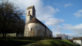
Heritage and forest in Le Vaudoué
 10.40 mi
+417 ft
-410 ft
5h 10
Moderate
Departure from Le Vaudoué (Seine-et-Marne)
10.40 mi
+417 ft
-410 ft
5h 10
Moderate
Departure from Le Vaudoué (Seine-et-Marne)
A pleasant walk, mainly through forest for the first two-thirds, taking in two superb Romanesque churches and the remains of the chapel of a former Templar commandery.
Chemin de Saint-Fiacre from Dimancheville (45)
2.85 mi
+69 ft
-69 ft
1h 20
Easy
Departure from Dimancheville (Loiret)
Route through the Gâtinais countryside in Dimancheville (45), the smallest municipality in the canton of Puiseaux. The route runs alongside several properties (Orville mill, Augerville-la-Rivière castle park) and returns, across fields, to the municipality of Dimancheville along the Malesherbes - Puiseaux railway line.
This route presents no particular difficulties.
From Le Vaudoué to Malesherbes
9.40 mi
+417 ft
-292 ft
4h 40
Moderate
Departure from Le Vaudoué (Seine-et-Marne)
After crossing the Rambouillet Forest in the previous stage, this section is a restful one. It takes you to Malesherbes station. This is one of the easiest stages of the GR®1. The start is at Le Vaudoué. It is the only stage of the GR®1 that does not start at a station. The hike alternates between sections in the woods and more rural sections. The first interesting sight on the route is the church in Le Vaudoué. The path then leads to the former Templar Commandery before crossing woods and fields towards the Essonne and Saint-Martin Church in Malesherbes.
Rock art in the Forest of Fontainebleau
 2.51 mi
+148 ft
-148 ft
1h 15
Easy
Departure from Le Vaudoué (Seine-et-Marne)
2.51 mi
+148 ft
-148 ft
1h 15
Easy
Departure from Le Vaudoué (Seine-et-Marne)
A short, easy themed route showcasing rock art discovered in the Forest of Fontainebleau and in the south of the Île-de-France region. Seven chronological information panels, with representations of the landscape at the time, photos and casts of engravings, take us on a journey from the Palaeolithic era to the present day.
The route was designed, developed and is maintained by the ONF.
Chatillon Valley Trail from Puiseaux (45)
5.55 mi
+33 ft
-36 ft
2h 35
Easy
Departure from Puiseaux (Loiret)
The Gatinais trail leads through woods and fields, heading first to the hamlet of Le Pont. In the second half, the passage through the Chatillon valley offers pleasant views of Puiseaux.
Chemin des Treize Places de Puiseaux
3.10 mi
+23 ft
-23 ft
1h 25
Easy
Departure from Puiseaux (Loiret)
This urban route is exclusively intramural, exploring all the existing squares in the town of Puiseaux, in northern Loiret. It is a route without any particular difficulty.
Chemin du Larris from Briarres sur Essonne (45)
4.23 mi
+157 ft
-154 ft
2h 05
Easy
Departure from Briarres-sur-Essonne (Loiret)
A pleasant trail through woods and fields that climbs to the heights of Briarres-sur-Essonne, where the sheep pastures offer a magnificent panorama of the Essonne valley. A bucolic passage along the banks of the Essonne.
The mills of the upper Essonne valley
 6.68 mi
+66 ft
-69 ft
3h 10
Moderate
Departure from Briarres-sur-Essonne (Loiret)
6.68 mi
+66 ft
-69 ft
3h 10
Moderate
Departure from Briarres-sur-Essonne (Loiret)
Before motorisation, milling was highly developed along the banks of the Essonne. This hike sets out to discover no fewer than five old water mills, whose presence has been documented since the 18th century. The route along the river is full of charm and the numerous reed beds add a touch of natural heritage to this very diverse hike.
The Route des 25 Bosses
 9.42 mi
+1,949 ft
-1,942 ft
6h 00
Difficult
Departure from Le Vaudoué (Seine-et-Marne)
9.42 mi
+1,949 ft
-1,942 ft
6h 00
Difficult
Departure from Le Vaudoué (Seine-et-Marne)
As the name suggests, the route involves climbing 25 hillocks that form a loop around the Forêt des Trois Pignons. A challenging hike, amidst the rocks, which makes for excellent training ahead of summer mountain hikes.
N.B. The elevation gain is underestimated: expect a cumulative elevation gain of between 800 and 900 metres. It would be hard to find a greater climb in the Île-de-France region, unless you were to climb up and down the Eiffel Tower on foot three times in a row... Allow between 6 and 7 hours of walking.
Walk among remarkable trees in the Barnolets area
 3.11 mi
+10 ft
-10 ft
1h 25
Easy
Departure from Fontainebleau (Seine-et-Marne)
3.11 mi
+10 ft
-10 ft
1h 25
Easy
Departure from Fontainebleau (Seine-et-Marne)
A peaceful walk to discover the remarkable trees of a little-visited part of the Forest of Fontainebleau
Around the Trois Pignons
 4.80 mi
+203 ft
-184 ft
2h 25
Moderate
Departure from Noisy-sur-École (Seine-et-Marne)
4.80 mi
+203 ft
-184 ft
2h 25
Moderate
Departure from Noisy-sur-École (Seine-et-Marne)
A pretty hike in the Massif des Trois Pignons, on the edge of Fontainebleau forest.
Chemin de la Butte Jaune starting from Bromeilles
5.69 mi
+125 ft
-121 ft
2h 45
Easy
Departure from Bromeilles (Loiret)
The route follows, for the most part, farm tracks situated below the Butte Jaune, offering a constant view of Bromeilles church, nicknamed the Mont Saint-Michel of the Gatinais as its bell tower can be seen from a great distance. The route passes through the outskirts of Puiseaux and the magnificent Parc Dumesnil.
A route with no particular difficulties.
Chemin de la Pierre aux Coqs from Bromeilles
4.85 mi
+144 ft
-144 ft
2h 20
Easy
Departure from Bromeilles (Loiret)
The route starts at the church in Bromeilles, nicknamed the Mont Saint-Michel of the Gatinais as it is perched on a hilltop and its bell tower can be seen from a great distance. The route passes through fields and woods, offering a beautiful view of the village of Puiseaux from the Butte Jaune.
L'Abri des Francs and circular loop via the Carrefour des Ventes to Galène
 5.85 mi
+279 ft
-253 ft
2h 55
Moderate
Departure from Recloses (Seine-et-Marne)
5.85 mi
+279 ft
-253 ft
2h 55
Moderate
Departure from Recloses (Seine-et-Marne)
A route in the very south of the Fontainebleau Forest, comprising two distinctly different sections. The route begins, outside the national forest, on the Denecourt-Colinet path no. 20, which winds its way through the Rochers de Recloses, featuring several rock shelters, including one known as the “Abri des Francs”. We continue north of this area to complete a circular route via forest paths. At the end of the route, the church at Recloses adds a lovely touch of heritage.
The Hautes Plaines viewpoint
 5.85 mi
+131 ft
-131 ft
2h 50
Moderate
Departure from Fontainebleau (Seine-et-Marne)
5.85 mi
+131 ft
-131 ft
2h 50
Moderate
Departure from Fontainebleau (Seine-et-Marne)
An easy route, ideal for a family outing. The hike takes you through varied landscapes: deciduous forest, coniferous forest, heathland, rocks, etc.
Les Platières des Béorlots and the Mare des Couleuvreux
 6.50 mi
+52 ft
-52 ft
3h 00
Moderate
Departure from Fontainebleau (Seine-et-Marne)
6.50 mi
+52 ft
-52 ft
3h 00
Moderate
Departure from Fontainebleau (Seine-et-Marne)
A varied route in the Fontainebleau forest, off the beaten track and within biological reserves. High forests, moors, plateaus and rocks alternate, with the Mare des Couleuvreux adding a touch of mystery to these landscapes.
The Stormwind viewpoint
 10.97 mi
+607 ft
-607 ft
5h 35
Difficult
Departure from Fontainebleau (Seine-et-Marne)
10.97 mi
+607 ft
-607 ft
5h 35
Difficult
Departure from Fontainebleau (Seine-et-Marne)
A varied hike in the southern part of the Forest of Fontainebleau, off the beaten track. Wide forest paths alternate with trails that zigzag between rocky outcrops or across plateaus.
The Carte du Tendre in the Forest of Fontainebleau
 8.41 mi
+194 ft
-197 ft
4h 00
Moderate
Departure from Fontainebleau (Seine-et-Marne)
8.41 mi
+194 ft
-197 ft
4h 00
Moderate
Departure from Fontainebleau (Seine-et-Marne)
Embark on a journey to Cythera, follow paths of seduction and tenderness, and make a date with happiness on this hike in the southern part of the Forest of Fontainebleau. In one area of this vast forest, the paths have been named after romantic figures... On this very wooded route, other references are used to name the paths: different kinds of birds, bandits and other criminals, and even the pope...
More walks in Amponville
Select a point of interest below: