


Refine your search for walks in Église Note-Dame de l'Assomption (Amponville)
Église Note-Dame de l'Assomption (Amponville) walks


 The Pierre Larmoire Dolmen
 Visorando Member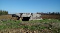
 3.49 mi
 +36 ft
 -36 ft
 1h 40
1h 40
 Easy
Easy
 Departure from Amponville (Seine-et-Marne)
The main aim of this short walk through farmland is to discover one of the finest dolmens in the Île-de-France region. The church at Amponville, at the start of the walk, is also well worth a visit.
Walks near Église Note-Dame de l'Assomption (Amponville)
From Le Vaudoué to Malesherbes
9.40 mi
+417 ft
-292 ft
4h 40
 Moderate
Departure from Le Vaudoué (Seine-et-Marne)
Moderate
Departure from Le Vaudoué (Seine-et-Marne)
After crossing the Rambouillet Forest in the previous stage, this section is a restful one. It takes you to Malesherbes station. This is one of the easiest stages of the GR®1. The start is at Le Vaudoué. It is the only stage of the GR®1 that does not start at a station. The hike alternates between sections in the woods and more rural sections. The first interesting sight on the route is the church in Le Vaudoué. The path then leads to the former Templar Commandery before crossing woods and fields towards the Essonne and Saint-Martin Church in Malesherbes.
From Malesherbes to Boutigny-sur-Essonne via the GR®1
16.44 mi
+686 ft
-843 ft
8 hrs
 Very difficult
Departure from Malesherbes (Loiret)
Very difficult
Departure from Malesherbes (Loiret)
Taking place almost entirely in the Gâtinais Français Regional Nature Park, this stage follows the course of the Essonne river for quite a long time, sometimes on the right bank, sometimes on the left bank. The only section through fields is when leaving Buno-Bonnevaux. The rest of the route is unique in that it runs through woodland, with some parts reminiscent of the Forest of Fontainebleau with pine trees, sandstone outcrops and sandy areas. This hike can be divided into four sections as it passes not far from the stations of Boigneville, Buno-Gironville and Maisse.
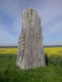
From Malesherbes to Maisse via the Menhir de la Pierre Droite
 10.16 mi
+404 ft
-577 ft
5h 00
Moderate
Departure from Malesherbes (Loiret)
10.16 mi
+404 ft
-577 ft
5h 00
Moderate
Departure from Malesherbes (Loiret)
On the edge of the Ile-de-France region, this hike from station to station follows the Essonne Valley from south to north. It takes forest paths, small roads with little traffic and paths between fields. This route allows you to discover an interesting heritage: mills, churches and castles, as well as a menhir and a polisher that attest to the ancient human occupation of the area.
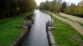
From Nemours to Montigny, following the Loing river closely.
 9.35 mi
+131 ft
-66 ft
4h 25
Moderate
Departure from Saint-Pierre-lès-Nemours (Seine-et-Marne)
9.35 mi
+131 ft
-66 ft
4h 25
Moderate
Departure from Saint-Pierre-lès-Nemours (Seine-et-Marne)
A hike from station to station that starts along the Canal du Loing and the river that gave it its name. A circular hike around the Étang de la Clarette allows you to observe numerous birds before admiring the rich heritage of the commune of Grez-sur-Loing. The hike ends mainly through fields.
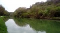
From Nemours to Souppes-sur-Loing along the canal
 8.76 mi
+118 ft
-108 ft
4h 10
Moderate
Departure from Saint-Pierre-lès-Nemours (Seine-et-Marne)
8.76 mi
+118 ft
-108 ft
4h 10
Moderate
Departure from Saint-Pierre-lès-Nemours (Seine-et-Marne)
A hike from station to station that mainly follows the towpath of the Canal Loing. Before reaching the canal, you cross a municipal park and a small maze of rocks. Along the way, the canal's surroundings become increasingly bucolic and reveal an interesting industrial heritage.
From Bourron-Marlotte to Nemours via Dame Jouanne
 14.00 mi
+558 ft
-577 ft
6h 55
14.00 mi
+558 ft
-577 ft
6h 55
 Difficult
Departure from Bourron-Marlotte (Seine-et-Marne)
Difficult
Departure from Bourron-Marlotte (Seine-et-Marne)
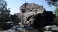
A hike from station to station, mainly through forest, crossing the rocky chaos of Maunoury, Dame Jouanne and Éléphant, which are every bit as impressive as those in the neighbouring Fontainebleau Forest. The village of Larchant, with its church and a few old houses, adds a superb touch of heritage.
From Bourron-Marlotte to Bois-le-Roi through the Forest of Fontainebleau
 18.17 mi
+725 ft
-679 ft
8 hrs
Very difficult
Departure from Bourron-Marlotte (Seine-et-Marne)
18.17 mi
+725 ft
-679 ft
8 hrs
Very difficult
Departure from Bourron-Marlotte (Seine-et-Marne)
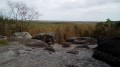
A south-to-north traverse of the Forest of Fontainebleau, from station to station! The long route showcases all aspects of this vast forest: high forests of various species, heathland plateaus, ponds, sweeping views and, of course, rocky outcrops.
N.B. Due to the winding paths through the rocky sections, the distance and elevation gain are likely underestimated: expect around 30km and between 300 and 400m of elevation gain.
From Bourron-Marlotte to Montigny-sur-Loing via the Rocher des Étroitures
 8.71 mi
+699 ft
-686 ft
4h 35
Moderate
Departure from Bourron-Marlotte (Seine-et-Marne)
8.71 mi
+699 ft
-686 ft
4h 35
Moderate
Departure from Bourron-Marlotte (Seine-et-Marne)
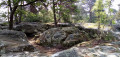
A hike from station to station in the south-east of the Forest of Fontainebleau. In addition to passing through two pretty villages, the start and end of this route follow good forest paths. In between, you follow trails that wind through rocky terrain, with several beautiful viewpoints, the lovely Mare aux Fées and the Grotte Béatrix.
In the heart of the Coquibus massif
 11.88 mi
+778 ft
-787 ft
6h 10
Difficult
Departure from Arbonne-la-Forêt (Seine-et-Marne)
11.88 mi
+778 ft
-787 ft
6h 10
Difficult
Departure from Arbonne-la-Forêt (Seine-et-Marne)
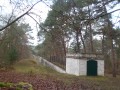
This long hike takes you on a fairly comprehensive tour of the magnificent Coquibus massif: heather-covered plateaus and water holes, deciduous woods, rocks, viewpoints, the Vanne aqueduct (sandstone steps), etc.
From station to station: Bagneaux-sur-Loing to Nemours via the Rochers de Beauregard
 11.03 mi
+548 ft
-558 ft
5h 35
Moderate
Departure from Bagneaux-sur-Loing (Seine-et-Marne)
11.03 mi
+548 ft
-558 ft
5h 35
Moderate
Departure from Bagneaux-sur-Loing (Seine-et-Marne)
A very varied walk, with the first third through a beautiful forest, then a landscape that gradually becomes more varied, with rocks strongly reminiscent of those at Fontainebleau. There is also a very beautiful plateau and large sandy hollows.
There is the option of a visit, en route, to the Museum of Prehistory and, towards the end of the route, the old town of Nemours with its castle, the branches of the Loing and its canal.
The paths and trails are mainly on well-drained sandy ground, so they are not muddy, even after rain. Most sections are well signposted,GR® or PR®.