Country:
 City:




Start at the Basilica of Saint-Mathurin in Larchant (77), on theGR®13route. Markings: horizontal red and white stripes.
(S) From the Place des Tilleuls, situated behind the basilica, take Rue de la Cave de Chatenoy. At the Fork in the road, take Chemin des Postes to the left.
(1) At the second Fork in the road, continue left again until you reach the Chemin de Bonnevault (D16). Turn left, then immediately right, pass the equestrian centre and carry on straight ahead. After crossing a small road, take the second path on the right.
(2) Follow this track and go round a paintball field.
(3) Take the first track on the left towards La Roche du Paradis. At the next junction, turn right, then keep an eye out so as not to miss the next track on the left.
(4) Follow it for a few metres, then turn right towards Mont Sarrasin. Cross the first junction and, at the next one, head straight ahead, leaving two paths on your left.
(5) Turn right onto Rue des Ormes and walk through the hamlet of Puiselet. After passing Rue Grande on your right, take the first left.
(6) Follow Impasse de la Carabine until you reach the four-way junction.
(7) Take the path on the right, then turn right again at the next path. Continue straight on.
(8) After passing a semi-buried reservoir, turn left at the next Fork in the road and head for the next crossroads.
(9) Carry on to the left and head towards Saint-Pierre-les-Nemours. Cross Rue des Rochers Gréau. Enter the Rochers Gréau hills and reach Avenue Léopold Pelletier. Turn right onto this road until you reach Avenue d’Ormesson (D403).
(10) Turn left. Go round the roundabout and cross the river “Le Loing” to reach Nemours. Head towards Avenue Victor Hugo on the left until you reach Rue Girault, following a branch of the Loing.
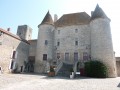
(11) At the junction, head towards the town centre on the right. Pass Rue du Docteur Chopy and Rue Bezout. At the next junction, turn right onto Rue Gautier 1er, then take the first left. Go round the back of the château. Follow the main branch of the Loing, pass the church and continue to the Pue de Paris bridge (D607, formerly the RN7).
(12) Cross it to the right and continue straight ahead on the D403. Take Allée du Châtelet on the right, head towards Place du Châtelet, then continue left along Rue du Châtelet. Cross Rue Georges Clémenceau and turn left onto Rue de Montgagnant until you reach Chemin des Dames.
(13) Turn right at the Fork in the road after Rue des Chaudins, head straight on and then turn left. In the forest, follow the red and white markings ofthe GR®13.
(14) At the bottom of a descent, turn right onto the Chemin des Crottes au Loup. After about 200 metres, turn left through the Nemours Forest.
(15) Join the Chemin de Nemours à Poligny on the left.
(16) Near the path, you’ll see the Pierre le Sault quarry. At the next junction, turn left.
(17) At the crossroads, continue along the path to the right.
(18) At the crossroads, turn left, then right, then left again. Turn right onto a road and follow it for 100 metres.
(19) Take the path on the right and head towards Poligny via Rue de la Gouttière and then Rue de la Forêt (E).

 Visorando Member
 Moderate
 Easy