The Pierre Larmoire Dolmen

The main aim of this short walk through farmland is to discover one of the finest dolmens in the Île-de-France region. The church at Amponville, at the start of the walk, is also well worth a visit.

Details

390584
Creation:
Last update:
Last review:
  • Walking
    Activity: Walking
  • ↔
    Distance: 3.49 mi
  • ◔
    Average duration: 1h 40 
  • ▲
    Difficulty: Easy

  • ⚐
    Back to start: Yes
  • ↗
    Ascent: + 36 ft
  • ↘
    Descent: - 36 ft

  • ▲
    Highest point: 410 ft
  • ▼
    Lowest point: 374 ft
  • ⚐ Country: France
  • ⚐ City: Amponville (77760)
  • ⚑
    Start/End: N 48.278908° / E 2.529036°
  • ❏
    IGN map(s): Ref. 2318E, 2417OT, 2417OTR
  • Hour-by-hour weather

Photos

Description of the walk

Start from Amponville church. Parking is available along the small street running alongside the town hall, opposite the church. If there are no spaces available, head to Rue de la Mare, at the very start of the walking route, where marked parking spaces are provided.

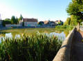
(S/E) Opposite the church, turn right and follow Rue Grande (D36) towards La Chapelle-la-Reine. Stay on this main road and walk along the right-hand side of a large pond bordered by a low wall. At the crossroads on leaving the village, take the first road on the left, the Chemin de Ronde. At the Fork in the road that follows, take the road on the right and pass between two farm sheds.

(1) At the three-way junction, turn right onto a small tarmac road (with very little traffic). Ignoring all the side paths, follow this road as it descends slightly until you reach a water tank on the left-hand side.

(2) At the corner by the water tank, leave the road and turn left onto a grassy track that climbs slightly. At the top of the ‘hill’, veer right (south-west) and ignore the track that branches off sharply to the left.

(3) At the next junction (elevation 124), at the corner of a wasteland overgrown with shrubs, turn right. Walk alongside a copse on your right and note the dolmen in the field on your left.

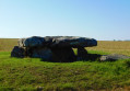
(4) At the junction on the edge of another woodland, turn left at a right angle. Walk a few metres along the edge of the woodland, then follow the path as it first turns right then left to run alongside the woodland on your left. After a few dozen metres, turn left onto a path that cuts through the woodland (there is a stone across the path at the start). You’ll emerge at the edge of the field you saw earlier: the dolmen is situated about 25 metres away, inside the field (see access conditions in the practical information).

(5) Retrace your steps, turn right immediately as you leave the woodland, follow the path as it bends left then right, and head for the junction at the edge of a woodland. First turn left then right.

(4) Turn left and walk alongside the woodland on your left.

(6) At the next junction, turn sharply right onto a farm track. Walk past two woods on your left in succession and ignore the paths branching off to the left. After the second wood, the track gives way to a tarmac road.

(2) When you reach the water tank, carry straight on along the tarmac road you took on the way there.

(1) At the three-way junction, take the road on the right. At the next junction, turn right and then follow the road as it bends left. Immediately turn left onto Rue de la Porte Verte. At the next junction, continue straight ahead onto Rue Grande (D36). Follow this road to the church (S/E).


Waypoints

  1. S/E : mi 0 - alt. 374 ft - Église Note-Dame de l'Assomption (Amponville)
  2. 1 : mi 0.43 - alt. 387 ft - Three-way junction
  3. 2 : mi 0.83 - alt. 381 ft - T-junction – Citerne
  4. 3 : mi 1.27 - alt. 404 ft - Crossroads
  5. 4 : mi 1.59 - alt. 381 ft - Crossroads at the edge of a woodland
  6. 5 : mi 1.78 - alt. 381 ft - Dolmen de la Pierre Larmoire
  7. 6 : mi 2.19 - alt. 374 ft - T-junction
  8. S/E : mi 3.49 - alt. 374 ft - Église Note-Dame de l'Assomption (Amponville)

Notes

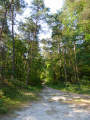
In dry weather, a good pair of trainers is sufficient for this short walk over almost flat terrain. In wet weather, the paths between the fields are muddy.

The route is not signposted; a map is essential (at the very least, the one accompanying this description).

Access to the dolmen:
The dolmen is situated within a cultivated field which is on private land. There is no access path to the dolmen; only a small uncultivated area has been left around the monument. This may be regrettable, but it is the reality of the situation. Consequently,
- Once crops have been sown, do not enter the field, even if the vegetation is still at the seedling stage. Simply view the dolmen from the edge of the field. N.B. If the crop is maize, visibility may be completely obstructed from summer onwards...
- The only time when the dolmen can be viewed at close quarters is the period immediately following the harvest, up until the first tillage operations for the next crop. The dates of this period obviously depend on the type of crops in question...

Walk undertaken by the author on 3 December 2016.

Worth a visit

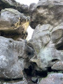
The Pierre Larmoire Dolmen (5) is the main destination of this walk. Situated in the neighbouring commune of Rumont, it was discovered in 1855.

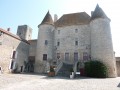
The Church of Notre Dame de l’Assomption (S/E) (12th–15th centuries) has a lovely Romanesque bell tower. Inside (the church was open on a Saturday in December 2016), a beautiful ancient fresco depicts the ‘legend’ of the three dead and the three living.

Reviews and comments

4.3 / 5
Based on 3 reviews

Reliability of the description
4.3 / 5
Ease of following the route
4.7 / 5
Route interest
4 / 5
Domipau
Domipau

Overall rating : 4.7 / 5

Date of your route : Jan 25, 2020
Reliability of the description : ★★★★★ Very good
Ease of following the route : ★★★★★ Very good
Route interest : ★★★★☆ Good

It’s hard to say whether it’s worth a visit… The dolmen isn’t anything special. But for a walk with an 80-year-old lady, it was perfect: no steep inclines, and an easy route. I think it’s also a good route for young children; there aren’t many roads, just paths through the fields.

Machine-translated

boucles d'or
boucles d'or

Overall rating : 5 / 5

Date of your route : Aug 25, 2019
Reliability of the description : ★★★★★ Very good
Ease of following the route : ★★★★★ Very good
Route interest : ★★★★★ Very good

A short, gentle and pleasant walk, with no difficulty at all. Best avoided in hot weather, as there is very little shade along the route.
I also got a bit confused at point (5), where you have to retrace your steps. Once you’ve reoriented yourself on the map, it makes much more sense.

Machine-translated

SAHB45
SAHB45

Hello Étienne,

Thanks for the change, but if I’d used the map as intended, I’d have quickly realised which way to go.

Have a good evening.
Kind regards.
Serge

Machine-translated

Netra
Netra ★

Hello Sahb45, and thank you for your comments.

I’ve amended the description of the dolmen’s return to avoid any ambiguity.

Machine-translated

SAHB45
SAHB45

Overall rating : 3.3 / 5

Date of your route : Jul 27, 2019
Reliability of the description : ★★★☆☆ Average
Ease of following the route : ★★★★☆ Good
Route interest : ★★★☆☆ Average

A short, unpretentious but pleasant walk.

Just one slight point of confusion in the description: on the way back from the dolmen, you need to retrace your steps, including the left/right turn.
As I hadn’t looked at the map, I turned left as I came out of the small copse, which was on my left-hand side.
I quickly corrected this detour when I realised I was heading towards a road that didn’t match the description.

Thank you for this walk.

Machine-translated

Other walks in the area

For more walks, use our search engine .

The GPS track and description are the property of this route's author. Please do not copy them without permission.