


Refine your search for walks in Alagnon (rivière)
Alagnon (rivière) walks


 Rocher du Bec de l'Aigle, Téton de Vénus and Puy Bataillouse loop
 Visorando Member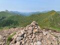
 5.46 mi
 +2,208 ft
 -2,195 ft
 4h 25
4h 25
 Moderate
 Departure from Laveissière (Cantal)
An extraordinary ridge route allowing you to visit three peaks and enjoy a splendid panoramic view of the entire Cantalian puys for much of the route.
La Roche Percée
 3.79 mi
+968 ft
-971 ft
2h 35
Moderate
Departure from Laveissière (Cantal)
3.79 mi
+968 ft
-971 ft
2h 35
Moderate
Departure from Laveissière (Cantal)
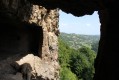
A short hike but with a steep climb through the woods, the Roche Percée site is well worth a visit.
Col de Font de Cère - La Brèche de Rolland - Puy Mary - Puy de Peyre Arse
 10.14 mi
+3,068 ft
-3,071 ft
7h 20
10.14 mi
+3,068 ft
-3,071 ft
7h 20
 Difficult
Departure from Saint-Jacques-des-Blats (Cantal)
Difficult
Departure from Saint-Jacques-des-Blats (Cantal)
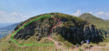
This beautiful route, starting from the Col de Font de Cère, crosses the pastures of the Cantal, passing successively through the Col de Rombière and the Puy de Peyre Arse, ending at the Puy Mary, the second highest peak in the Cantal, via the iconic Brèche de Rolland, a slightly technical passage.
Those who are prone to vertigo should take care on this section.
Throughout this hike, the 360° panoramic views allow you to admire the beautiful mountainous countryside of the Monts du Cantal.
Le Puy Griou via Bec d'Aigle and Téton de Vénus
 8.56 mi
+2,707 ft
-2,677 ft
6h 15
Difficult
Departure from Laveissière (Cantal)
8.56 mi
+2,707 ft
-2,677 ft
6h 15
Difficult
Departure from Laveissière (Cantal)
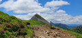
Fond d'Alagnon will be the starting point for your hike. Follow the ridge towards Puy Griou, passing by Bec de l'Aigle and Téton de Vénus. Along the way, you will enjoy numerous views of Plomb Cantal, Puy Mary, Peyre Arse and many other peaks.
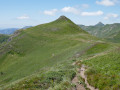
The Téton de Vénus above Le Lioran
 4.92 mi
+1,791 ft
-1,798 ft
3h 50
Moderate
Departure from Laveissière (Cantal)
4.92 mi
+1,791 ft
-1,798 ft
3h 50
Moderate
Departure from Laveissière (Cantal)
The tour of the Font d'Alagnon cirque, passing by two peaks, is the programme for this walk above the small resort of Le Lioran, which offers beautiful panoramic views of the Cantal volcanic massif.
The Orgues de Chadecol
 5.73 mi
+748 ft
-755 ft
3h 15
Moderate
Departure from Blesle (Haute-Loire)
5.73 mi
+748 ft
-755 ft
3h 15
Moderate
Departure from Blesle (Haute-Loire)
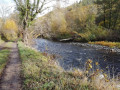
A hike to discover the site of Chadecol, inhabited 10,000 years ago by the first farmers and herders.
A walk to admire the basalt columns of Chadecol, the Allagnon valley and the village of Blesle.
The Church of Bredons
4.75 mi
+938 ft
-935 ft
3h 00
 Easy
Departure from Murat (Cantal) (Cantal)
Easy
Departure from Murat (Cantal) (Cantal)
Walk in the hills above Murat. Beautiful views over the Alagnon and Benet valleys. Beautiful old houses in the village of Bredons and the remarkable site of Bredons Church, an 11th-century Cluniac site.
The Alagnon Gorges and the Buron de Belles Aigues
 2.05 mi
+420 ft
-417 ft
1h 20
Easy
Departure from Laveissière (Cantal)
2.05 mi
+420 ft
-417 ft
1h 20
Easy
Departure from Laveissière (Cantal)
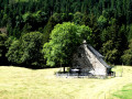
A relaxing walk through the heart of the forest, following a path that runs alongside the Alagnon, dotted with amusing sculptures. Next, a visit to the Buron de Belles Aigues mountain pastures (Maison du Buronnier), which can be visited, is a must.
Puy Griou via Meijes Costes above Le Lioran
 5.88 mi
+1,722 ft
-1,729 ft
4h 10
Moderate
Departure from Laveissière (Cantal)
5.88 mi
+1,722 ft
-1,729 ft
4h 10
Moderate
Departure from Laveissière (Cantal)
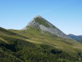
A short walk above the Font d’Alagnon valley, in the family-friendly resort of Lioran-Laveissière. Beautiful views on either side of the Col de Rombière, and the more adventurous can climb Puy Griou.
At the end of summer, you can even pick a few blueberries on the sunny slopes.
Chambezon - Le Caure
 4.37 mi
+909 ft
-909 ft
2h 50
Difficult
Departure from Chambezon (Haute-Loire)
4.37 mi
+909 ft
-909 ft
2h 50
Difficult
Departure from Chambezon (Haute-Loire)
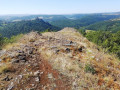
A physically demanding route halfway down the descent into the valley, offering magnificent views of the Alagnon Valley and Léotoing Castle.
Chalet - Montgon
6.95 mi
+866 ft
-889 ft
3h 55
Moderate
Departure from Massiac (Cantal)
To the north-east of the Cantal volcano, Massiac lies in a small basin formed by the Alagnon and its two tributaries: the Alagnonette and the Arcueil. From the top of the Plateau de Chalet, a basalt plateau, one of many left by volcanic flows in the landscape, there is a beautiful view over the valley.
Around Laveissière
 4.08 mi
+679 ft
-679 ft
2h 30
Easy
Departure from Laveissière (Cantal)
4.08 mi
+679 ft
-679 ft
2h 30
Easy
Departure from Laveissière (Cantal)
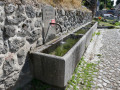
We set off at a leisurely pace for this short stroll around the little village of Laveissière, in the Alagnon valley, as our original aim was to pick blackberries. We did just that, but this little route was well worth sharing as it’s full of lovely things to see.
The Oudeyre hut
 3.79 mi
+860 ft
-860 ft
2h 30
Easy
Departure from Massiac (Cantal)
3.79 mi
+860 ft
-860 ft
2h 30
Easy
Departure from Massiac (Cantal)
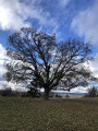
My favourite walk in Massiac. Starting from the centre of Massiac, this route allows you, after 400 m, to walk through countryside with no roads, no houses and no fences. On the ascent, it follows the old royal, then imperial, road from Paris to Perpignan as far as the Baraque d’Oudeyre, a ruined former coaching inn. On the descent, it returns along the ridge through heathland and woods of pine and oak trees.
The Lempdes Hills
 5.22 mi
+584 ft
-574 ft
2h 55
Easy
Departure from Lempdes-sur-Allagnon (Haute-Loire)
5.22 mi
+584 ft
-574 ft
2h 55
Easy
Departure from Lempdes-sur-Allagnon (Haute-Loire)
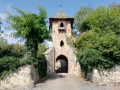
Landscapes on the edge of the Lembron valley and at the start of the Allagnon Gorges, a landscape of plateaus and plains in the Limagne region, punctuated by the villages of Lempdes and Moriat.
The area around Massiac via the high plateaus
8.18 mi
+1,260 ft
-1,250 ft
4h 50
Moderate
Departure from Massiac (Cantal)
Visit the town of Massiac and the surrounding high plateaus
From the ‘Gueules Noires’ to the ‘Bateliers’
 5.93 mi
+436 ft
-413 ft
3h 05
Easy
Departure from Brassac-les-Mines (Puy-de-Dôme)
5.93 mi
+436 ft
-413 ft
3h 05
Easy
Departure from Brassac-les-Mines (Puy-de-Dôme)
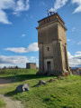
This varied walk illustrates the link between coal mining and its transport on the ‘sapinières’ (timber-tracked wagons) that travelled as far as Paris.
Murat – Prat de Bouc
 10.24 mi
+2,474 ft
-899 ft
6h 50
Difficult
Departure from Murat (Cantal) (Cantal)
10.24 mi
+2,474 ft
-899 ft
6h 50
Difficult
Departure from Murat (Cantal) (Cantal)
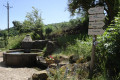
First stage ofthe GR® 400 walking clockwise (the official guidebook follows the opposite direction).
The landscape gradually takes on its typical Cantalian character, particularly in the Cirque de Chamalière and, of course, beneath the Plomb du Cantal at Prat de Bouc.
Le Claux – Super Lioran
 11.22 mi
+2,979 ft
-2,559 ft
7h 45
Difficult
Departure from Le Claux (Cantal)
11.22 mi
+2,979 ft
-2,559 ft
7h 45
Difficult
Departure from Le Claux (Cantal)
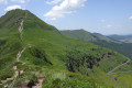
A major stage, set against a breathtaking landscape, with sweeping views in all directions. A long ridge walk starting from Puy Mary.
Le Puy du Rocher as seen from Chambeuil
 13.58 mi
+3,720 ft
-3,704 ft
7 hrs
13.58 mi
+3,720 ft
-3,704 ft
7 hrs
 Very difficult
Departure from Laveissière (Cantal)
Very difficult
Departure from Laveissière (Cantal)
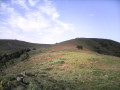
To stay largely off the marked and well-trodden paths, the route to the summit starts from a fairly low point, following the very gentle ridge south of the Alagnon. This hike requires a good sense of direction due to the lack of signposting and sections through ‘summer pastures’ without a defined path; a GPS is a great help.
The return journey along the lower section follows a fairly long stretch of road, though it is very pleasant and has very little traffic.
Circuit of the Cantalien volcano via the GR®400, clockwise
 88.49 mi
+21,634 ft
-21,604 ft
8 days
Difficult
Departure from Murat (Cantal) (Cantal)
88.49 mi
+21,634 ft
-21,604 ft
8 days
Difficult
Departure from Murat (Cantal) (Cantal)
This 8-day route covers the entireGR®®400, in a clockwise direction (the FFRP guidebook describes it in the opposite direction).
Exploring Charbonnier-les-Mines, extended version
3.51 mi
+174 ft
-203 ft
1h 45
Easy
Departure from Charbonnier-les-Mines (Puy-de-Dôme)
Three walks, of gradually increasing lengths, have been created on the initiative of the Charbonnier-les-Mines Youth Town Council (CMJ).
These walks were created to enable everyone, from the very young to the elderly, to discover or rediscover the village and to enjoy a simple, natural activity in a remarkable setting.
Three colours of waymarkers have been used – green, blue and red – from the shortest to the longest route.
Along the way, you’ll discover some truly beautiful scenery, including the Allagnon – that famous river home to trout and a few salmon – the remains of the castle, the vestiges of the mining past and the even older remains of the Gallo-Romans.
 Prat de Bouc – Le Lioran
 6.29 mi
+1,693 ft
-2,346 ft
3 hrs
Difficult
Departure from Albepierre-Bredons (Cantal)
6.29 mi
+1,693 ft
-2,346 ft
3 hrs
Difficult
Departure from Albepierre-Bredons (Cantal)
A ski mountaineering route linking Prat de Bouc to Le Lioran via the Plomb du Cantal (1,856 m).
Tour du Cantal
 53.24 mi
+13,753 ft
-14,701 ft
7 days
Difficult
Departure from Laveissière (Cantal)
53.24 mi
+13,753 ft
-14,701 ft
7 days
Difficult
Departure from Laveissière (Cantal)
Tour of the Cantal in seven stages: Murat [Laveissiere] - Meije Costes - Le Falgoux - Le Fau - Mandailles - Le Lioran - Prat de Bouc - Murat [Laveissiere]
Very beautiful stages between the Cère, Jordanne and Alagnon valleys. Between the ridges offering unforgettable views (360° panoramas), the ascent of the puys adding a touch of "mountain" to the experience, the summer pastures dotted with flower-filled meadows and encounters with both the flora and fauna and the people who live in this corner of the Cantal and are happy to share their territory.
Puy de Peyre Arse from Font Alagnon
7.20 mi
+2,113 ft
-2,100 ft
5h 10
Moderate
Departure from Laveissière (Cantal)
Although far less well-known than the Plomb du Cantal, the Puy Mary or the Puy Griou, the Puy de Peyre Arse is nonetheless the second-highest peak in the massif. Nor is it the easiest to reach. From the Font d’Alagnon, you must first head up towards the Col de Rombière, then go round the Puy Bataillouse to reach the Col de Cabre. It is from the latter that the ascent begins, first following the south-eastern ridge, then scrambling as best you can up the final few metres leading to the summit. The return route follows the opposite ridge to a small pass where you rejoin the GR®4, leading back to the Col de Rombière. After this, head towards the Col de Font de Cère for a change of scenery.
Château d'Aurouze and Palhàs de Molompize
3.68 mi
+883 ft
-853 ft
2h 30
Easy
Departure from Molompize (Cantal)
This walk takes in two iconic sites in the Alagnon Valley: the ruined Château d'Aurouze and its beautiful view over the valley, followed by the vineyard terraces (known in our valley as "Palhàs") of Molompize.
Prat de Bouc–Lavessière
9.12 mi
+814 ft
-2,316 ft
4h 55
Moderate
Departure from Albepierre-Bredons (Cantal)
Stage 7 of our Tour du Cantal. This is the final stage of the Tour du Cantal, with another change to the GR®400 route: instead of returning to Murat, we head back to Laveissière (where we left our vehicle, see episode 1). Most of this stage is in the shade, but the descent brings the heat..