Country:

 City:
City:


Start from Chambeuil (accessible from Murat via the N122 then the D139). There is a car park above the village, after passing under the railway bridge.
(S/E) Follow the path which passes near the Moulin de Chambeuil and leads to the waterfall. After 200 metres, before the waterfall, turn right and follow a few hairpin bends.
(1) You’ll come out onto a track; follow it to the left for just under a kilometre, continuing uphill and ignoring any turn-offs to the left.
(2) Take the road to the right for about a hundred metres and take the first path on the left. Further on, at a Fork in the road, continue to the right for about fifty metres along the main path.
(3) At the second Fork in the road, take the path on the left and start along the ridge path.
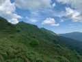
Stay on the ridge through the woods for 4 km (the path to the left or right is lower down) and ignore the offshoots to the left. The path is clear and little-used; there are no signposts, just the red markings on the trees indicating plot boundaries.
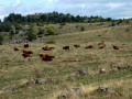
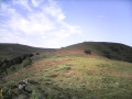
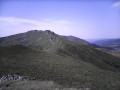
(4) Things get a bit trickier here… You’ll reach the area near the summer pasture and the path comes to an end: a brand-new plantation ahead of you has obliterated a section of the path. You must now cross the woodland to the right, heading uphill, to reach the clear-cut area which is the continuation of the ridge (elevation 1521). Now climb as the terrain dictates to reach the summit of Peyre Ourse.
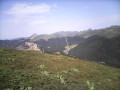
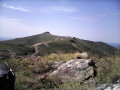
(5) Continue along the ridge south-westwards then southwards, passing the summits of Peyre de l’Âne and Rocher de la Sagne du Porc. Finish with a gentle descent to L’Aiguillon.
(6) Follow theGR® 4 and 400 southwards to the Puy du Rocher, the highest point of the hike (1811m).
(7) Descend south-west towards the cable car’s lower station.
(8) Turn right onto the path that starts just before the cable car (you can make a detour to the summit of the Plomb du Cantal before this). Descend via a series of hairpin bends, pass under the cable car line and continue down to the Buron des Gardes water reservoir.
(9) Go round the water reservoir on the right and head down a wide track (heading broadly north). This leads to the resort car park.
(10) At the tourist office, take the path leading down towards the station, on the right-hand side of the stream (another boardwalk starts on the other side, from the chapel; both lead to the same place).
(11) Leave Lioran station on your left. A little further on, pass under the railway line and follow the road to the right for about 2 km. You’ll reach the buronnier’s house, with tables and parasols...
(12) Continue along the road through the woods and pass under the Passadou Viaduct.
(13) At Les Plots (a popular picnic spot), carry on along the road.
(14) Just before you reach the N122, leave the small road and take the path on the right which leads uphill through the woods.
(15) Join a signposted path and follow it to the right uphill. Stay on this path for about 2.5 km, keeping close to the railway line – initially below it, then above it once you’ve passed under the track.
(16) At the junction, head downhill for about 100 metres and then turn right onto the first track towards Combrelles. Ignore a turn-off on the left and continue to the hamlet.
(17) Follow the small road to the car park (S/E).

 Visorando Member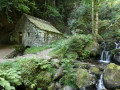
 Easy
Easy 
 Moderate
 Difficult