Le Claux – Super Lioran

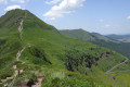
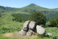
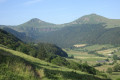
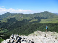
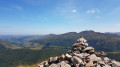
A major stage, set against a breathtaking landscape, with sweeping views in all directions. A long ridge walk starting from Puy Mary.

This walk is part of a multi-day hike: Circuit of the Cantalien volcano via the GR®400, clockwise

Details

n°1937100
Creation:
Last update:
Last review:
  • Walking
    Activity: Walking
  • ↔
    Distance: 11.22 mi
  • ◔
    Average duration: 7h 45 
  • ▲
    Difficulty: Difficult

  • ⚐
    Back to start: No
  • ↗
    Ascent: + 2,979 ft
  • ↘
    Descent: - 2,559 ft

  • ▲
    Highest point: 5,843 ft
  • ▼
    Lowest point: 3,638 ft

Photos

Description of the walk

(S) From the lodge, retrace your steps towards the road and turn right onto it. Take a left-hand bend and, shortly afterwards, turn right onto the path. Head due south, climbing through the meadows before entering the woods. Cross the Ruisseau de la Blatte. Keep to theGR®® as it winds its way up. Pass a path on the right, then join the GR®4coming from the left. These combinedGR®® routes join the road at the Col de Serre.

(1) Here, look out for the path that climbs up the hill opposite on the right. Cross a sort of open area, leaving the buildings on your right, then head uphill to the left. The path runs some distance from the trees on the right. After a short climb, head back down towards the burons of Eylac and join the road. Walk along it carefully, then veer right to cut across the hairpin bend and reach the junction ofthe GR®® and its variant.

(2) Find theGR®® on the right and start climbing the foothills of Puy Mary. Pass a path on the left that goes round the mountain, and head towards the Pas de Peyrol. Reach it by walking carefully alongside the road.

(3) Begin the ascent of Puy Mary on the marked path.

(4) On the other side of Puy Mary, continue along the ridge to the Brèche de Roland.

(5) Here, there is a short descent where you must take care. Climb back up the opposite side to reach the junction with the GR®® alternative route.

(6) Cross over to the southern face of Puy de Peyre Arse and, via a long traverse, head for the Col de Cabre.

(7) You’ll pass close to the source of the Jordanne (river).

(8) Continue straight on, ignoring the paths leading down on either side, and, still traversing, reach the Col de Rombière. Ignore the path leading down to the left and reach the top station of the Rombière chairlift.

(9) Turn left onto the path, which becomes a track. Descend towards the Super Lioran resort. Join a small road near the Col de Font de Cère. Follow it to the left until you reach a sharp bend.

(10) Follow theGR®® to the right. You’ll pass some mountain-bike facilities in varying states of repair. Ignore a track to the left and head down towards the resort via a ski run. Cross the road via a bridge. Reach the start of the ski lifts, then head to your lodge or hotel depending on your chosen accommodation – today’s stage (E).

Waypoints

  1. S : mi 0 - alt. 3,638 ft - Gîte du Puy Mary
  2. 1 : mi 2.95 - alt. 4,367 ft - Col de Serre (1331m)
  3. 2 : mi 4.82 - alt. 4,829 ft - GR ascending to the right of the road
  4. 3 : mi 5.68 - alt. 5,210 ft - Pas de Peyrol
  5. 4 : mi 6.14 - alt. 5,843 ft - Continue along the ridge to the Brèche de Roland - Puy Mary
  6. 5 : mi 6.76 - alt. 5,318 ft - Brèche de Roland
  7. 6 : mi 7.57 - alt. 5,361 ft - Crossroads of paths below Peyre Arse
  8. 7 : mi 8.1 - alt. 5,240 ft - Source of the - Jordanne (rivière)
  9. 8 : mi 8.53 - alt. 5,033 ft - Col de Cabre (Cantal)
  10. 9 : mi 9.42 - alt. 4,980 ft - Top station of the Rombière chairlift
  11. 10 : mi 10.65 - alt. 4,134 ft - GR to the right of the road. Near the - Alagnon (rivière)
  12. E : mi 11.22 - alt. 4,058 ft - Super Lioran

Notes

No particular difficulties with navigation, but the signposting for the climb to the Pas de Peyrol does not correspond to what is shown on the map: theGR®®, after crossing the road at (2), cuts across it towards the Pas, climbs to the left (south), then continues to the right towards the pass.
The route along the ridge to the chairlift is obvious.
There are restaurants at Pas de Peyrol; water is available at the chairlift.

Worth a visit

Always be cautious and plan ahead when you're outdoors. Visorando and the author of this route cannot be held responsible for any accidents occurring on this route.

The GR® and PR® markings are the intellectual property of the Fédération Française de Randonnée Pédestre.

Reviews and comments

4 / 5
Based on 3 reviews

Reliability of the description
3.3 / 5
Ease of following the route
3.7 / 5
Route interest
5 / 5
Jacqed
Jacqed

Overall rating : 4.7 / 5

Date of your route : Jun 23, 2026
Reliability of the description : ★★★★☆ Good
Ease of following the route : ★★★★★ Very good
Route interest : ★★★★★ Very good
Very busy route : Yes

The 7th and final stage of our GR 400 tour of the Cantal Volcano.
A truly beautiful stage, culminating in Puy Mary.
From LAVIALLE to the Col de Serre, a gentle climb along a wide, very even forest track.
From the Col de Serre to the Pas de Peyrol, the route was rather uninteresting as it ran parallel to the road. The only highlight was the constant view of Puy Mary. We climbed Puy Mary via the marked path and descended via the same route to avoid the Brèche de Roland. We then took the GR 400 variant, which starts at the Col d’Eylac and winds its way up along a ridge below the Brèche de Roland.
A pleasant route and consistently well signposted.
At Pas de Peyrol, it was very busy, but there was a very nice bar-restaurant offering good quality food at reasonable prices.
Return to Murat from Le Lioran by TER (12 mins)

Machine-translated

danielrollet
danielrollet

Overall rating : 3 / 5

Date of your route : Jun 20, 2021
Reliability of the description : ★★☆☆☆ Disappointing
Ease of following the route : ★★☆☆☆ Disappointing
Route interest : ★★★★★ Very good
Very busy route : Yes

Calm weather as we set off from the lodge, followed by a storm, hail and gusts of wind on Puy Mary. The ridge was impassable. We didn’t tackle the Brèche de Rolland. We took the alternative route to the alternative route… A balcony path through the mist… Didn’t see much
Spent 30 minutes in the toilets at Pas de Peyrol to dry off.
Took a shortcut at the Col d’Eylac – extremely dangerous when you come out onto the road without being able to see a thing.
Otherwise, the route was fine
Puy Mary was very busy
Water and toilets at the foot of Puy Mary
Water and toilets at the Maison de la Montagne at the Col de Serre

Machine-translated

bernardgemenos
bernardgemenos

Overall rating : 4.3 / 5

Date of your route : Jun 09, 2021
Reliability of the description : ★★★★☆ Good
Ease of following the route : ★★★★☆ Good
Route interest : ★★★★★ Very good
Very busy route : No

A magnificent hike enjoyed in fine weather, following the route in the opposite direction to the description. The start from Super Lioran isn’t straightforward due to roadworks on the tracks. After wandering through the woods, we eventually found the GR at the Col de la Font de Serre. We encountered the same problem after the Pas de Pérol all the way to the Col d’Eylac, where the GR – which is supposed to run above the road – had disappeared in places. Finally, the last section through the woods is very pleasant but would benefit from slightly more frequent signposting. Otherwise, a very beautiful, long and challenging walk offering magnificent views from the ridges. The section through the Brèche de Roland requires caution but isn’t particularly difficult.
.

Machine-translated

Other walks in the area

For more walks, use our search engine .

The GPS track and description are the property of this route's author. Please do not copy them without permission.