Around Laveissière

We set off at a leisurely pace for this short stroll around the little village of Laveissière, in the Alagnon valley, as our original aim was to pick blackberries. We did just that, but this little route was well worth sharing as it’s full of lovely things to see.

Details

4235338
Creation:
Last update:
Last review:
  • Walking
    Activity: Walking
  • ↔
    Distance: 4.08 mi
  • ◔
    Average duration: 2h 30 
  • ▲
    Difficulty: Easy

  • ⚐
    Back to start: Yes
  • ↗
    Ascent: + 679 ft
  • ↘
    Descent: - 679 ft

  • ▲
    Highest point: 3,717 ft
  • ▼
    Lowest point: 3,038 ft

Photos

Description of the walk

Coming from Aurillac via Super-Lioran towards Murat, turn left towards “Laveissière”, first passing through the hamlet of Fraisse-Haut, then, in the village of Laveissière, turn right to pass in front of the cemetery, before arriving at the car park by the lake.

Coming from Murat towards Aurillac, after passing the hamlet of Fraisse-Bas (on your right), take the turn-off for Laveissière in the middle of the large bend. Drive past the campsite, through half the village, then turn left to go past the cemetery and reach the lake. Park in the car park in front of the lake entrance.

(S/E) Set off towards the cemetery.

(1) Head up towards the village centre, skirting the cemetery on the left. Walk through the village along its main street, passing the town hall.

(2) Ignore the road leading uphill to the left towards La Chevade, and carry on straight ahead along the main street. You’ll soon look down on Le Vallagnon campsite (bottom right), then you’ll come to a small service area for motorhomes on your left.

(3) Just after the service area, take the unpaved track that climbs up to the left.

Continue along this gently sloping track, passing another track that descends to the right towards Fraisse-Bas. You’ll gradually approach the Route du Meynial, which runs above you.

(4) At a bend going uphill to the left, pass a grassier track on your right which runs horizontally due east, and stay on the path which joins the road after 100 metres. Turn right towards Le Meynial.

(5) In the hamlet of Le Meynial, turn left towards “Les Cheyrouses”. Pass through two small hamlets before reaching Cheyrouze. Stay on the road to the left. At the next hamlet (Les Pindorios), continue along the road to the left, which descends slightly.

(6) About 300 m past Les Pindorios, where the road continues towards private property, take the path that winds down to the left. This path passes beneath the hamlet of Les Pindorios.

(7) After a manure heap (which may no longer be there when you pass by but which seems to have been there for years), the track follows a hairpin bend to the right. Follow it, ignoring a path that heads eastwards into the field, coming directly from Les Pindorios.

You’ll arrive in Laveissière and come out onto the main street. Turn right, walk past the cemetery and head down towards the lake.

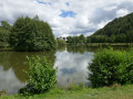
(S/E) Before retrieving your car from the car park, you can round off this walk nicely by strolling around the pretty lake, which is dotted with some interesting tree species.

Waypoints

  1. S/E : mi 0 - alt. 3,038 ft - Car park at the - Plan d'eau de Laveissière
  2. 1 : mi 0.06 - alt. 3,051 ft - Cemetery
  3. 2 : mi 0.35 - alt. 3,064 ft - Fork in the road
  4. 3 : mi 0.59 - alt. 3,041 ft - Start of the path
  5. 4 : mi 1.09 - alt. 3,330 ft - Junction
  6. 5 : mi 1.52 - alt. 3,530 ft - Le Meynial
  7. 6 : mi 2.71 - alt. 3,612 ft - Junction
  8. 7 : mi 2.97 - alt. 3,517 ft - Downhill hairpin bend
  9. S/E : mi 4.08 - alt. 3,038 ft - Car park by the lake - Alagnon (rivière)

Notes

There are no difficulties requiring any special equipment. Just bear in mind that the first part of the route, along the river and the campsite, is often on grass and may be more or less soggy if it has rained.

Furthermore, the descent to Laveissière below Les Pinborios can be slippery in places if the weather is damp.

In very hot weather, the Meynial fountain is a good place to cool off, but not to quench your thirst, as the water is classified as undrinkable.

N.B. In a previous version of this walk, I had the route running alongside the Alagnon river, skirting the campsite. As I have been informed that crossing the campsite is prohibited, I am waiting to check on the ground whether there is a path allowing you to walk alongside the river without encroaching on the campsite’s grounds. For the time being, therefore, to reach the point (3), I have opted to walk through the village, which is still a pleasant option as it is very pretty.

Worth a visit

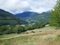
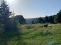
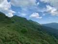
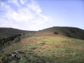
For almost the entire walk, there are lovely views of the Alagnon Valley, one of the valleys radiating out from the centre of the Cantal volcano.

At Le Meynial, it is possible to continue along the road a little further before turning left onto theGR® 400 (Chemin de Compostelle), which runs along a balcony-like path about a hundred metres higher up before descending to Cheyrouze; however, our aim was to keep the walk short whilst making the most of the blackberries, which were lovely and plentiful in August 2020.

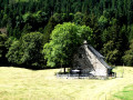
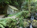
Notable examples of local heritage include the beautiful fountain at Le Meynial, with its four basins which I assume served as drinking troughs, and the restored communal oven at the entrance to Cheyrouse.

Always be cautious and plan ahead when you're outdoors. Visorando and the author of this route cannot be held responsible for any accidents occurring on this route.

The GR® and PR® markings are the intellectual property of the Fédération Française de Randonnée Pédestre.

Reviews and comments

4.7 / 5
Based on 3 reviews

Reliability of the description
5 / 5
Ease of following the route
4.7 / 5
Route interest
4.3 / 5
User 26481449

Overall rating : 4.7 / 5

Date of your route : Jul 23, 2026
Reliability of the description : ★★★★★ Very good
Ease of following the route : ★★★★★ Very good
Route interest : ★★★★☆ Good
Very busy route : No

A lovely little walk – easy and partly shaded.

Machine-translated

Grosse  Valérie
Grosse Valérie

Overall rating : 5 / 5

Date of your route : Sep 13, 2024
Reliability of the description : ★★★★★ Very good
Ease of following the route : ★★★★★ Very good
Route interest : ★★★★★ Very good
Very busy route : No

Beautiful views

Machine-translated

lubert
lubert

Overall rating : 4.3 / 5

Date of your route : Aug 03, 2023
Reliability of the description : ★★★★★ Very good
Ease of following the route : ★★★★☆ Good
Route interest : ★★★★☆ Good
Very busy route : No

A short hike on a day of bad weather, which meant we couldn’t climb any higher. An easy walk with a few lovely views

Machine-translated

Other walks in the area

For more walks, use our search engine .

The GPS track and description are the property of this route's author. Please do not copy them without permission.