


Refine your search for walks in Agly (fleuve)
Agly (fleuve) walks


 The dolmens of Trilla
 Visorando Member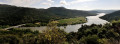
 4.56 mi
 +912 ft
 -922 ft
 2h 55
2h 55
 Moderate
 Departure from Ansignan (Pyrénées-Orientales)
On the heights between Ansignan and Lac de Caramany, the village of Truilla clings to its granite mountain. The first inhabitants used the boulders scattered across the area to build their tombs. The trail winds through this landscape of ridges and granite chaos, connecting two of these dolmens lost in the heart of the vineyards.
Recent information: fences have been installed between points 6 and 7, preventing access.
Pic Vergès and Saint-Arnac
 9.10 mi
+1,768 ft
-1,768 ft
5h 45
Moderate
Departure from Ansignan (Pyrénées-Orientales)
9.10 mi
+1,768 ft
-1,768 ft
5h 45
Moderate
Departure from Ansignan (Pyrénées-Orientales)
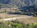
An exceptional route starting from Ansignan and its famous Roman aqueduct, where you will discover the beautiful village of Saint-Arnac and a sumptuous panorama at Pic Vergès.
Le Pech de Bugarach from the Col du Linas
 7.42 mi
+3,061 ft
-3,061 ft
6h 05
7.42 mi
+3,061 ft
-3,061 ft
6h 05
 Difficult
Departure from Bugarach (Aude)
Difficult
Departure from Bugarach (Aude)
Route providing access to Pech de Bugarach.Warning: the access path is extremely damaged and eroded. It is more like a mountain trail.Do not underestimate this short hike, where you will need to use your hands in places. I have classified it as difficult.Please stay on the marked path. Warning signs saying "Hors Sentier" (off trail) have been installed in many places. Thank you.
5 May 2025. Route updated following user comments. So please follow the advice above: stay on the marked paths.
Around Lake Caramany
 6.13 mi
+745 ft
-761 ft
3h 30
Moderate
Departure from Caramany (Pyrénées-Orientales)
6.13 mi
+745 ft
-761 ft
3h 30
Moderate
Departure from Caramany (Pyrénées-Orientales)
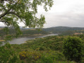
A beautiful approach to Lake Caramany with views along the route.
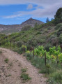
The Tautavel Tower
 5.05 mi
+1,555 ft
-1,558 ft
3h 40
Moderate
Departure from Cases-de-Pène (Pyrénées-Orientales)
5.05 mi
+1,555 ft
-1,558 ft
3h 40
Moderate
Departure from Cases-de-Pène (Pyrénées-Orientales)
This is an alternative way to the Tour de Tautavel from Cases-de-Pène. Advantage: sheltered from the tramontana wind. Disadvantage: sunny in summer.
Around the Galamus Gorges
7.44 mi
+2,907 ft
-2,927 ft
5h 55
Difficult
Departure from Saint-Paul-de-Fenouillet (Pyrénées-Orientales)
A beautiful, challenging hike around the Galamus Gorges, which you will follow from the start of the route.
The arrival at Pla de Brézou is also magnificent. A huge space at this location.
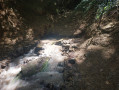
The Source of the Agly and the Salt Spring
 8.76 mi
+1,978 ft
-1,939 ft
5h 45
Difficult
Departure from Camps-sur-l'Agly (Aude)
8.76 mi
+1,978 ft
-1,939 ft
5h 45
Difficult
Departure from Camps-sur-l'Agly (Aude)
A very pleasant hike, but best avoided in summer.
Beautiful views of Bugarach and the Corbières. Along the route, you can see the site of the old glass furnaces and taste the saltwater spring.
The hike is classified as difficult because you need to know how to find your way, read a map and/or follow the GPS track.
The GPS track and map are almost essential as there are many paths and the trails are not always well marked.
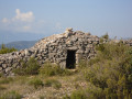
The mysterious Touréze
 6.97 mi
+1,250 ft
-1,230 ft
4h 20
Moderate
Departure from Latour-de-France (Pyrénées-Orientales)
6.97 mi
+1,250 ft
-1,230 ft
4h 20
Moderate
Departure from Latour-de-France (Pyrénées-Orientales)
This circular loop, starting from Latour-de-France, takes you around the Touréze massif, with visits to several stone orri dotted along the route. Southern heath and a mix of tracks, roads and paths.
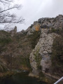
Around the Galamus Gorges
 7.20 mi
+2,388 ft
-2,398 ft
5h 25
Difficult
Departure from Saint-Paul-de-Fenouillet (Pyrénées-Orientales)
7.20 mi
+2,388 ft
-2,398 ft
5h 25
Difficult
Departure from Saint-Paul-de-Fenouillet (Pyrénées-Orientales)
Rocky landscapes, forest trails, views of the Canigou and Bugarach.A GPS is useful on certain sections.This hike is not recommended if you are prone to vertigo.
Caudiès-de-Fenouillèdes - Cubières-sur-Cinoble
 15.07 mi
+3,287 ft
-3,009 ft
9h 45
Difficult
Departure from Caudiès-de-Fenouillèdes (Pyrénées-Orientales)
15.07 mi
+3,287 ft
-3,009 ft
9h 45
Difficult
Departure from Caudiès-de-Fenouillèdes (Pyrénées-Orientales)
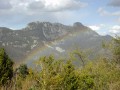
First stage of a 2-day circular route starting from Caudiès-de-Fenouillèdes, taking you to Cubières-sur-Cinoble on thefirst day.
This is a fairly long stage with a significant elevation gain. It is possible to adapt the route as you wish, as there are numerousPR®,GR® 36, Cathar TrailGR®367- 367A andGRP® Tour des Fenouillèdes paths.
Cubières-sur-Cinoble – Caudiès-de-Fenouillède
 13.53 mi
+3,714 ft
-3,963 ft
9h 25
Difficult
Departure from Cubières-sur-Cinoble (Aude)
13.53 mi
+3,714 ft
-3,963 ft
9h 25
Difficult
Departure from Cubières-sur-Cinoble (Aude)
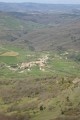
Day two: return to Caudiès-de-Fenouillède via the Pic or Pech de Bugarach.
 Circular route between Estagel and Tautavel
14.28 mi
+702 ft
-666 ft
1h 13
Moderate
Departure from Estagel (Pyrénées-Orientales)
A short cycle route between the Corbières and the Fenouillet plain, through vineyards and the heath. The village of Tautavel is world-famous for the discovery, at the ‘Grotte de la Caune de l’Arago’ site, of the skull of the oldest man in Europe.
From Saint-Paul-de-Fenouillet to Caudiès-de-Fenouillèdes via Ansignan
24.50 mi
+1,194 ft
-1,135 ft
2h 02
Moderate
Departure from Saint-Paul-de-Fenouillet (Pyrénées-Orientales)
A cycle ride through the Fenouillet region, along small roads offering varied landscapes ranging from vineyards to forests. The villages are small and seem frozen in a bygone era. This route features some steep climbs and fairly fast descents.
From Saint-Paul-de-Fenouillet to Lesquerde via Saint-Arnac
10.49 mi
+1,480 ft
-1,490 ft
1 hr
Moderate
Departure from Saint-Paul-de-Fenouillet (Pyrénées-Orientales)
A cycle ride through the Fenouille region. Initially, you follow the River Agly, then cycle through the vineyards, with the added bonus of a beautiful view of the Canigou massif. All the villages produce wine bearing the ‘Agly’ appellation followed by the village name.
The Galamus Gorges via Cucugnan
26.77 mi
+3,156 ft
-3,179 ft
2.5 hrs
Moderate
Departure from Saint-Paul-de-Fenouillet (Pyrénées-Orientales)
A walk between the Corbières and the Fenouillèdes in the Corbières-Fenouillèdes Regional Nature Park. The walk through the gorges is impressive *. A touch of history with the castles of Peyrepertuse and Quéribus, listed as UNESCO World Heritage Sites.
Ansignan–Le Vivier circular route, starting from Saint-Paul-de-Fenouillet
19.39 mi
+1,017 ft
-1,253 ft
1h 34
Moderate
Departure from Saint-Paul-de-Fenouillet (Pyrénées-Orientales)
A cycle ride through the Fenouillet region along small roads offering varied landscapes ranging from vineyards to forests. The villages are small and seem frozen in a bygone era. This route features some steep climbs and fairly fast descents.
The Agly Valley and the Wine Route via Maury
14.22 mi
+1,060 ft
-1,086 ft
2 hrs
Moderate
Departure from Saint-Paul-de-Fenouillet (Pyrénées-Orientales)
A pleasant cycle ride through part of the Fenouillèdes region, taking in the ancient thermal baths of Saint-Paul, its hot springs at 28°C and its Via Ferrata. The route follows part of the River Agly, then climbs to offer views of the Canigou mountain range and the village of Maury with its trompe-l’œil murals and its AOP wine.
Lake Caramany, via the Agly Valley and the Wine Route
20.47 mi
+1,345 ft
-1,371 ft
1h 36
Moderate
Departure from Saint-Paul-de-Fenouillet (Pyrénées-Orientales)
A pleasant 33 km route through the Fenouillèdes, following the Agly as far as Ansignan and Lake Caramany, then climbing towards the villages of Lansac and Lesquerde. This is part of the Wine Route. For enthusiasts, there are numerous dolmens to see.
Through vineyards and orchards via Caudiès-de-Fenouillèdes
15.61 mi
+587 ft
-614 ft
1h 15
Moderate
Departure from Saint-Paul-de-Fenouillet (Pyrénées-Orientales)
A short cycle ride through the vineyards and orchards. No particular difficulties apart from a steep descent before reaching Caudiès-de-Fenouillèdes, and the final section being along the D117,
Tirounère Crag (climbing routes) – round trip
1.68 mi
+404 ft
-404 ft
1h 05
 Easy
Departure from Saint-Paul-de-Fenouillet (Pyrénées-Orientales)
Easy
Departure from Saint-Paul-de-Fenouillet (Pyrénées-Orientales)
This route describes the access path to the cliff at the Tirounère climbing site from the Gorges de Galamus car park. It is not a hike in itself but is intended to facilitate climbers’ access to this cliff nestled in the forest.
The Agly and the Bugarach
28.61 mi
+6,995 ft
-6,972 ft
2 days
Difficult
Departure from Caudiès-de-Fenouillèdes (Pyrénées-Orientales)
Here is a 45 km circular route that will allow you to explore the former natural border between France and Spain, between the Aude and the Pyrénées-Orientales, as well as the upper Agly valley and its magnificent Galamus Gorges, before climbing up to the Pic de Bugarach.The route starts from Caudiès-de-Fenouillèdes towards Duilhac-sous-Peyrepertuse, then descends towards Cubières-sur-Cinoble.On the second day, approach and climb up to the Pech de Bugarach, then descend and return to Caudiès.