


Refine your search for walks in Saint-Pierre (La Réunion)
Saint-Pierre (La Réunion) walks


 Bassin Dix-Huit and the Terre Rouge circular loop
 Visorando Member
 2.69 mi
 +299 ft
 -289 ft
 1h 30
 Moderate
 Departure from Saint-Pierre (La Réunion) (Réunion)
Bassin Dix-Huit (or Bassin 18) is one of the best-known pools in the south. Several legends circulate about it. The approach is very short but quite technical: best avoided with children, which explains its ‘medium’ difficulty rating. The pool is deep and the water is beautifully clear! To extend the walk, this route suggests completing a circular route at Pointe du Bois de Buis. This section, which follows the coast and offers some lovely views, presents no difficulty whatsoever.
 From Bois d’Olives to the Bras de Pontho viewpoint
 13.55 mi
+1,801 ft
-1,814 ft
2 hrs
Moderate
Departure from Saint-Pierre (La Réunion) (Réunion)
Bras de Pontho is a small village situated at an altitude of 600 metres. Just behind its church, it offers a stunning view over the Bras la Plaine, which is far less well-known than the one at Bois-Court. This route, comprising two circular loops, starts at Bois-d’Olives and leads to the Bras de Pontho viewpoint, passing via the Bras de la Plaine Bridge, the Pouzzolane cliffs and the Parc des Palmiers.
The Ouaki circular route
 3.27 mi
+630 ft
-653 ft
2h 05
 Easy
Departure from Saint-Pierre (La Réunion) (Réunion)
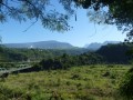
A relatively easy route with a picnic by the water’s edge.
Piton de Mont-Vert
1.07 mi
+351 ft
-351 ft
0h 50
Moderate
Departure from Saint-Pierre (La Réunion) (Réunion)
Rising to an altitude of 636 metres, the Piton de Mont Vert is an iconic peak in the south of the island. It is an ancient crater dating back 30,000 years! Visible for kilometres around, it is criss-crossed by several kilometres of footpaths. Winding through a beautiful forest, these paths are the best way to discover the flora and fauna of this piton. The climb is sometimes steep but only for short stretches.
The Ligne d’Équerre from Bérive
5.71 mi
+1,476 ft
-1,480 ft
3h 55
Moderate
Departure from Le Tampon (Réunion)
La Ligne d’Équerre is a small hamlet situated at an altitude of around 900 metres. Just a short walk from the village lies a beautiful forest criss-crossed by a number of paths. This guide takes you along these paths, starting from Bérive via the Piton Nathalie trails. There are plenty of scenic viewpoints along this circular route, which follows tracks for part of the way, as well as roads winding through crops and sugarcane fields.
Saint-Louis – l’Étang-Salé les Bains
 11.19 mi
+102 ft
-285 ft
5h 15
Moderate
Departure from Saint-Louis (La Réunion) (Réunion)
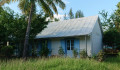
The second stage of the walk runs closest to the railway line; it begins in the multicultural town of Saint-Louis and takes you past two branch lines of the railway. It then winds through the Étang-Salé forest, following the main railway line as closely as possible, before arriving at the peaceful seaside village of Étang-Salé les Bains. Of course, you’ll come across a few remnants of the railway line.
Part of the Sentier des Foulées de la Fraise
 4.57 mi
+1,198 ft
-1,217 ft
3h 10
Moderate
Departure from Saint-Pierre (La Réunion) (Réunion)
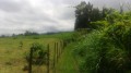
This walk is part of the Sentier des Foulées de la Fraise trail. It is also a section of the Grand Raid. As you pass by the pastures, you’ll also have the chance to enjoy beautiful views towards the west and south. This section follows the Sentier des Foulées de la Fraise trail between Domaine Vidot and the first strawberry field. Fairly easy, although with a few steep steps, it is possible to continue much higher up towards Notre-Dame de la Paix.
The Beach and the Piton de Grande Anse
 1.59 mi
+262 ft
-262 ft
1h 00
Easy
Departure from Petite-Île (Réunion)
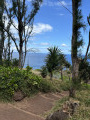
Grande Anse beach is renowned for being almost perfectly suited to a family picnic. For tourists, it also offers the chance to enjoy a fairly short, relaxing discovery walk with a lovely view from the top of the piton.
Beach, shaded areas, picnic spots and viewpoints overlooking the sea or the beach: the epitome of Réunion’s hospitality!
Walk at Le Tampon
 3.38 mi
+587 ft
-587 ft
2h 05
Easy
Departure from Le Tampon (Réunion)
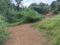
A short family walk there and back with a few variations, either along the Rivière d’Abord or alongside the sugarcane fields. On the riverside path, you can admire the pools carved into the rock.
A circular walk in Curepipe
 4.15 mi
+725 ft
-725 ft
2h 30
Easy
Departure from Saint-Louis (La Réunion) (Réunion)
It’s always possible to go for a walk in an area where there are no marked footpaths. This walk, which starts in the Curepipe neighbourhood at La Rivière, follows dirt tracks and offers beautiful views of the ocean and the plains.
The climb up Ravine Barrage
 4.74 mi
+449 ft
-449 ft
2h 35
Moderate
Departure from Saint-Louis (La Réunion) (Réunion)
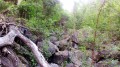
The Ravine du Gol is fed by three main branches: the Ravine de Bellevue, the Ravine Barrage and the Ravine Goyaves. This guide allows you to hike the entire length of the Ravine Barrage as far as the Source de l’Éperon. The stream is usually dry, but a few springs provide patches of water here and there. The going isn’t too difficult over the pebbles, and those who enjoy large boulders will be in their element!
The Bras de la Plaine Gorges from the Entre-Deux
6.10 mi
+3,150 ft
-3,173 ft
5h 35
Moderate
Departure from L'Entre-Deux (Réunion)
Here is an extraordinary water-based hike. This ascent of the Bras de la Plaine through the gorges is a hike that has to be earned. All along the way, it is a succession of caves, rock formations and very narrow passages where light struggles to penetrate. You will very often get your feet wet in this magnificent area, and that is what makes this hike so charming. However, GPS reception is very poor in the steep-sided sections.
The Bassin Sassa
 1.46 mi
+157 ft
-157 ft
0h 50
Easy
Departure from L'Entre-Deux (Réunion)
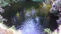
The Bassin Sassa takes its name from a slave called Sassa. This short circular walk takes you as close as possible to the basin, allows you to walk along part of the Bras Long and explore the town of L’Entre-Deux. This family-friendly route is one of the easiest in the area. However, it should be avoided during or after heavy rain, as nearly half the route runs along the bottom of a ravine.
Dassy Trail - Pont de la Liane
 1.92 mi
+1,099 ft
-1,099 ft
1h 50
Moderate
Departure from L'Entre-Deux (Réunion)
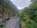
A fairly short, easily accessible walk that follows a route well known to trail running enthusiasts: do not try to keep up with those training for the Diagonale des Fous. A quick and deep immersion in nature in the Ravine des Citrons; beautiful views, lots of vegetation and birds. Beautiful view of the ravine and the river before starting the climb.
Les Canaux from Gol-les-Hauts via the Ravine des Merles
 3.69 mi
+571 ft
-561 ft
2h 10
Easy
Departure from Saint-Louis (La Réunion) (Réunion)
Here’s a lovely idea for a family walk off the beaten track. This route lets you explore the Canaux and Gol-les-Hauts area via a few small paths and old alleyways. The route offers some stunning panoramic views, especially when the reeds have been cut back!
The tour of the Chaîne du Bois de Nèfles
11.42 mi
+3,301 ft
-3,301 ft
8h 05
 Difficult
Departure from Saint-Louis (La Réunion) (Réunion)
The Chaîne du Bois de Nèfles is recognisable from a great distance thanks to its distinctive shape and its ridges and valleys, formed by the numerous ravines. It shares the same geological origin as the Dimitile. It is possible to walk all the way round it. This offers the chance to enjoy stunning views across varied terrain. It is best to walk the circular route anti-clockwise to make the most of the views over Cilaos and the south of the island.
The Ruisseau Loop
7.98 mi
+1,332 ft
-1,332 ft
4h 50
Moderate
Departure from Saint-Louis (La Réunion) (Réunion)
This walk, located at La Rivière, takes you round the Ruisseau, alternating between roads, tracks and footpaths. It offers access to beautiful panoramic views of the south of the island. This route follows a few small footpaths that are still passable. I recommend doing this walk in early December, as the cut sugarcane offers sweeping views and walkers will be treated to lychees.
I would advise against taking children on certain sections as they are overgrown or tricky.
Circular route through the Étang-Salé Forest
 5.82 mi
+443 ft
-443 ft
1.5 hrs
Moderate
Departure from L'Étang-Salé (Réunion)
Located in the south-west of the island, the Étang-Salé Forest attracts large numbers of people every weekend who come to walk, run, go mountain biking or even go horse riding. This route passes by the three peaks of the Étang-Salé Forest (Piton Rouge, Piton Reinette and Gros Piton) as well as the old quarries at Gros Piton. Around 10 kilometres long, it offers beautiful panoramic views of the Étang-Salé region, with little elevation gain but some technical sections.
Bois-Blanc and the Piton la Mare circuit
 7.63 mi
+1,444 ft
-1,444 ft
1.5 hrs
Moderate
Departure from Les Avirons (Réunion)
Piton la Mare is visible for kilometres around. This is because there is a high-voltage pylon on its summit, making it visible and recognisable from a distance despite its relatively low altitude (617m).
Walking around the piton is pleasant and fairly easy, but it would be a shame to do this route without visiting Bois Blanc, which is less than a kilometre away. This mini cirque is well worth a visit and can be distinguished from Réunion’s three main cirques as it shares the same characteristics.