


 Country:
 City:
City:


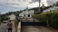
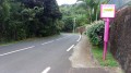
How to get there: Head towards Étang-Salé-les-Hauts, then drive towards Les Avirons via the D11. Once you’ve left the village, take the first departmental road on the left (D18) towards Ravine Sèche (a sign points the way to Ravine Sèche). Stay on the D18 until you reach the Ravine Sèche church and find a place to park near the church.
(S/E) Visit the church at Ravine Sèche before rejoining the D18 towards Les Avirons. Follow it for a few hundred metres until you reach the first junction.
(1) Then turn right onto Chemin Dozenval. This road climbs gently in a series of hairpin bends. Make the most of the views when they appear, as they’ll be rather limited on this first part of the route. The path makes its way slowly but surely towards the hamlet of La Mare, though the gradient doesn’t get any steeper for the time being. After about 2.6 km, round yet another hairpin bend, you’ll finally catch sight of Piton la Mare, recognisable by its high-voltage pylon! Indeed, up until now, it’s been barely visible!
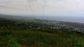
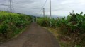
(2) At the first junction, turn right onto Chemin la Mare. This concrete track runs through the hamlet of La Mare. From this point onwards, there will be more and more views. You’ll therefore have plenty of opportunity to admire Piton la Mare and the southern part of the island. The gradient is gentle at first but becomes steeper and steeper. Ignore the dirt tracks branching off to the left and right of the road and stay on the concrete track.
(3) The path passes a pumping station and a wooden hut.
(4) You will then reach a sort of pass from where you can see Piton de la Croix and the Ravine Renonce valley, into which you will be descending. You will thus go round Piton la Mare by crossing over and then following this ravine. Continue to the end of the concrete path.
(5) Turn left towards Bois Blanc. The slope is gentle at first but becomes steeper as you go on.
(6) You’ll pass a small cave on the left-hand side of the path, which is easily spotted when heading uphill! This is because it’s obscured by some tall vegetation when heading downhill. 500 metres further up, a gap in the vegetation offers a view of the whole of Bois-Blanc, its tiny cirque and its few inhabitants, who live far from civilisation!
(7) The path then becomes tarmac and crosses the Ravine des Princes before reaching Bois-Blanc. A glance back reveals the Ravine des Princes valley and the ocean in the distance.
(8) The concrete path soon splits into two further concrete paths. Continue along the longer of the two by turning left, leaving the one on the right for later. The slope becomes steeper again. The path passes close to a waterfall (which was dry that day) and winds its way round a few bends.
(9) Continue to the end of the concrete path, marked by the start of two tracks. From here, you can see the north face of Piton la Mare.
Then return to the previous junction via the same route.
(8) Turn left; the path crosses a tributary of the Ravine des Princes before climbing steeply towards some houses. At the first bend, you’ll have a lovely view of the mini cirque known as Bois Blanc! Continue to the end of the concrete path.
(10) Then return to the junction via the same route.
(8) Turn left and head for the junction of the paths after the cave.
(5) Carry on straight ahead. The path then winds in wide hairpin bends, offering panoramic views of part of the south coast. You’ll soon reach Ravine Sèche.
(11) Passing a school signals that the descent is nearly over.
(12) At the end of the road, turn right onto the D18. Then return to the starting point by staying on the D18 (S/E).

 Visorando Member
 Easy
Easy 

