


 Country:
 City:


Access:
From Saint-Louis:
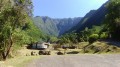
Head towards Saint-Pierre via the N1. After crossing the Rivière Saint-Étienne, take the next exit onto the D26 towards l’Entre-Deux. At the roundabout, take the third exit, then the opposite exit at the next two roundabouts. After the third roundabout, take the first departmental road on the left. Park at the next picnic area, which is situated on the left-hand side of the road just before crossing the Bras de la Plaine.
From Saint-Pierre:
Head towards Saint-Louis via the N1. After crossing the Ravine des Cabris, take the next exit onto the D26. At the roundabout, take the first exit, then the second at the next one. Then take the first departmental road on the left. Park at the next picnic area, which is situated on the left-hand side of the road just before crossing the Bras de la Plaine.
(S/E) Return to the D26.
(1) Head up towards L’Entre-Deux by turning left onto the D26. This road goes round the picnic area on the right whilst running alongside the pozzolan cliffs, which are riddled with countless cavities. After the first bend, a gap in the trees offers a view of the Chaîne du Bois de Nèfles, the Tapage, the Dimitile, the Gros Morne, the Grand Bénare and the Bras de la Plaine metal bridge! A great way to start with some stunning views!
(2) You’ll reach the Bras de la Plaine metal bridge in a matter of seconds. On the right, you can see the spillway of the Bras de la Plaine Power Station, which can be more or less impressive depending on the time of year. Cross the Bras de la Plaine river.
(3) At the junction, carry straight on. The winding path occasionally offers beautiful panoramic views of the surrounding countryside. A designated viewpoint, at the second bend, provides a view of the spillway of the Bras de la Plaine Power Station. After the bends, the path becomes straighter and runs alongside some plantations at a place called La Pointe.
(4) Stay on the same road until it ends, then turn right towards the Bras de la Plaine Bridge.
(5) At the bridge, cross over the Bras de la Plaine, which lies 100 metres below! On the right, you can see the Bras de la Plaine spillway, Bois Noirs and the chimney of a former sugar factory; and to the left, the eastern part of the Dimitile Massif, the Piton Bleu, the Petits Pitons, the Piton Hyacinthe, the Piton de la Ravine Blanche, as well as the bell tower of the church at Bras de Pontho, which is our destination and which you’ll be able to see on numerous occasions if the cane has been cut!
(6) At the roundabout, take the second exit. A picnic area and kiosks are available here. Pass through just after the hamlet of Mahavel – not to be confused with the natural dam of the same name on the Rivière des Remparts.
The path then becomes undulating after passing this hamlet. You’ll cross fields of sugarcane, which, when harvested, offer very wide and beautiful panoramic views of the surrounding countryside. Follow a large drainage channel for over 2 km. As well as the sugarcane fields, you’ll also pass a few plots of lettuce, cauliflower, large red chillies and aubergines.
(7) After about 30 minutes’ climb, you’ll reach a wayside shrine, marking the point where more than half the ascent is complete. Continue to the left for a few metres.
(8) Leave the path on your right that heads towards the Parc des Palmiers and carry on straight ahead along the D27. This road runs close to the ramparts. You’ll get a better view of the town of L’Entre-Deux, provided the sugarcane has been cut!
(9) A few bends further up, you’ll pass the Pont de la Liane footpath, which is very popular with walkers!
(10) At the junction with the D3, turn left towards Bras de Pontho. It’s less than 1 km to the viewpoint! This will also be the most challenging part of the walk. Immediately cross the famous Bras de Pontho, which gave its name to the village.
(11) Look out for the Bras de Pontho church on your left. Take the street that leads straight to it, passing a chemist’s on the way.
(12) When you reach the church, go round it to the right. The viewpoint is just behind it. There’s a water tap in the church car park.
(13) From the viewpoint, enjoy the stunning panorama over the Bras de la Plaine! Admittedly, it’s far less well-known than the one at Bois Court, but it’s well worth the detour! At the far end of the Bras de la Plaine, you can see the Coteau de Cendres and the Piton Bleu. At our feet lies a rocky spur known as La Crête. To the left, you can see the Kiosque Jean Lauret, which offers yet another viewpoint over the Bras de la Plaine, and opposite us, the Dimitile as well as a few waterfalls (which were dry that day). After taking in the view, follow the same route back to the junction of the D27 and the D3, just after the Bras de Pontho bridge.
(10) Turn left onto the D3. You’ll then be following the famous and historic Route Hubert Delisle. The road climbs slightly before descending towards Trois-Mares. When the sugarcane has been cut, you can see the coastline stretching from Saint-Louis to Saint-Pierre. Stay on the same road until you reach the sign indicating the entrance to the village of Trois-Mares.
(14) At the first junction, turn right and, a few bends further on, you’ll reach the Parc des Palmiers.
(15) Parc des Palmiers is a lovely place for a stroll. Then carry on along the same road until it ends at the junction with the D27. Do stop to enjoy the views, especially when the sugarcane has been cut.
(8) Carry on to the left, then follow the same route you took on the way there, just after the hamlet of Mahavel.
(6) Take the second exit towards Bois-d’Olives. Follow the large pipeline you passed on the way there once again before passing an old sugar factory.
(16) At the roundabout, take the first exit. The path runs straight ahead and passes through the town of Bois-d’Olives, passing a few flamboyant trees (trees of tropical origin with red flowers).
(17) At the roundabout, take the first exit. The path then descends gently towards the River Saint-Étienne before crossing the Canal Saint-Étienne.
(18) Just after the canal, take the departmental road on the right (you can’t miss it, as there’s a sign indicating the D26 and the direction to La Rivière). Stay on the same road until you reach the starting point (S/E).


 Visorando Member
 Easy


