The Ouaki circular route

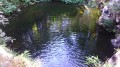
A relatively easy route with a picnic by the water’s edge.

Details

5475
Creation:
Last update:
Last review:
  • Walking
    Activity: Walking
  • ↔
    Distance: 3.27 mi
  • ◔
    Average duration: 2h 05 
  • ▲
    Difficulty: Easy

  • ⚐
    Back to start: Yes
  • ↗
    Ascent: + 630 ft
  • ↘
    Descent: - 653 ft

  • ▲
    Highest point: 719 ft
  • ▼
    Lowest point: 358 ft

Photos

Description of the walk

Set off from Pierrefonds (near Réunion’s southern airport) towards Mahavel (Bois-D’olive) and park near the EDF power station.

(S/E) Take the Rangama track a little way past the power station until you reach the sign marking the start of the path (Ti Kartié de Bois-d’Olive association) near No. 92; from there, follow the path down to the old Entre-deux bridge.

(1) Cross the bridge and turn left towards Le Ouaki (signposted).

(2) Cross the Bras de Cilaos and keep to the right-hand side of the road until you reach the first set of bends after the small chapel and into the first bend.

(3) Turn right onto the track that begins at the hairpin bend and follow it to the start of the steps on the left. During the climb, stop once to follow the canal in both directions and again to reach the climbing wall. Continue up the steps and, at the first junction, turn right into a gap in the wall to reach the picnic area (another path leads off to the right and joins the rampart). Head back towards the sports ground and rejoin the paved path.

(4) Turn right at the second path branching off to the right. Cross the terraced gardens and reach the road. Immediately turn left onto the shortcut and rejoin the road, which you follow.

(3) Return to the junction you passed on the way out at the bend and follow the same route back to your car (S/E).

Waypoints

  1. S/E : mi 0 - alt. 669 ft - Car park near the EDF power station
  2. 1 : mi 0.49 - alt. 377 ft - Towards the bridge over the - Gorges du Bras de la Plaine
  3. 2 : mi 1.02 - alt. 364 ft - Bras de Cilaos (rivière) - La Réunion -
  4. 3 : mi 1.28 - alt. 446 ft - Turn right onto the track
  5. 4 : mi 1.7 - alt. 696 ft - Turn right
  6. S/E : mi 3.27 - alt. 669 ft - Car park near the EDF power station

Notes

Crossing the Saint-Etienne tributary (water not safe to drink during the rainy season) and the River Ouaki.
Equipment: a light rucksack with water and some food, and a good camera.

Worth a visit

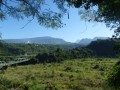
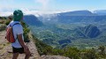
The panoramic view of the Capitaine Dimitile plateau.
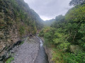
The old canal that carried water from the Cilaos branch to the Gol sugar factory.
The section of the canal with its tunnels.
A climbing spot.
A viewpoint overlooking the Cilaos inlet.
The old bridge leading towards l’Entre-Deux, which is still in use.

Reviews and comments

3.1 / 5
Based on 8 reviews

Reliability of the description
3.1 / 5
Ease of following the route
3.4 / 5
Route interest
2.6 / 5
fredchristine14
fredchristine14

Overall rating : 5 / 5

Date of your route : Jan 24, 2026
Reliability of the description : ★★★★★ Very good
Ease of following the route : ★★★★★ Very good
Route interest : ★★★★★ Very good
Very busy route : No

A nice, relaxing hike in nature, with a few chameleons trying to make a hole for themselves, crossing the Cilaos bridge where families were meeting up in the water, then climbing stairs among countless pitayas.
Easy to do with children.

Machine-translated

VAN DEN BERGHE Christian

Overall rating : 1.7 / 5

Date of your route : Oct 19, 2025
Reliability of the description : ★★☆☆☆ Disappointing
Ease of following the route : ★★☆☆☆ Disappointing
Route interest : ★☆☆☆☆ Very disappointing
Very busy route : No

The start and the route are difficult to find, and we made several mistakes despite the help of local residents. The trail offers a beautiful view of the river below once or twice, but it is not maintained (branches, fallen trees, etc.) and is sometimes dangerous (collapsed sections). In addition, the trail is dirty and littered with rubbish (plastic and glass bottles, metal sheets, etc.). The road section is much too long and dirty (plastic bags, bin bags, cigarette butts, glass bottles) and dangerous and excessively noisy due to the heavy traffic of cars and motorbikes.
An unpleasant and uninteresting hike, to be avoided at all costs!

Machine-translated

danielfr40
danielfr40

Overall rating : 3 / 5

Date of your route : Mar 10, 2022
Reliability of the description : ★★★☆☆ Average
Ease of following the route : ★★★☆☆ Average
Route interest : ★★★☆☆ Average
Very busy route : No

Hello
At the start, from the road, the path is blocked by a private property, so you’ll need to take another one further down
Then watch out for the mosquitoes
At point 3, at the first junction, turn left towards the picnic area – you’ll see signs for two right turns
If you go right, it ends up on a via ferrata with a cable attached to the rock
After point 4, there’s no longer a path back along the circular route – it’s been taken over by buildings – so I retraced my steps along the way I’d come
Some lovely views of the river
Thanks for this walk

Machine-translated

Mamich
Mamich

Overall rating : 4 / 5

Date of your route : Aug 15, 2018
Reliability of the description : ★★★★☆ Good
Ease of following the route : ★★★★☆ Good
Route interest : ★★★★☆ Good

Hike done yesterday. Actually, the directions given for the starting point are out of date: you can park your car near No. 92, more or less opposite No. 94, but you can no longer take the path as indicated. Fortunately, a very friendly Creole man stopped us and showed us the right way: go back the way you came to reach the path on the right, near a car wreck, which starts with a flight of steps. The path would be brilliant, but unfortunately there’s loads of rubbish! The stretch along the road, crossing the bridge and heading towards the ramparts, isn’t very pleasant, due to the road and the traffic.
The rest of the route is as described. It’s easy to reach the kiosks; the spot would be magical if the kiosks weren’t surrounded by rubbish, so we ended up having our picnic on the way back, sitting on stones surrounded by greenery, and we took our rubbish home with us!
We’ve been living on Réunion for 17 years; we love walking, but sadly the island is becoming as dirty as it was before the chikungunya outbreak....

Machine-translated

Orando974
Orando974 ★

Overall rating : 3 / 5

Date of your route : Jul 20, 2017
Reliability of the description : Not used / Not applicable
Ease of following the route : Not used / Not applicable
Route interest : ★★★☆☆ Average

A hike I did a few days ago. Still just as much rubbish! A few rare views from the heights right at the start of the descent. Not a great deal to see apart from the Canal des Aloès, the Canal St-Etienne (in a rather sorry state), and the pouzzolane cliffs. A section of the Canal des Aloès is in good condition and easy to walk along, which is what I’d recommend. Several sections of the route can be dangerous if you’re not careful, so I’d advise taking the route along the river instead (I haven’t tried this one yet).

Machine-translated

bibi
bibi ★

If you can confirm that this walk isn’t described in sufficient detail or is dangerous… I’ll remove it, as you’re not the first walker to give this walk a poor rating.
Kind regards

Machine-translated

babsaudade
babsaudade

Overall rating : 2.3 / 5

Date of your route : Jul 25, 2017
Reliability of the description : ★★☆☆☆ Disappointing
Ease of following the route : ★★★☆☆ Average
Route interest : ★★☆☆☆ Disappointing

Hello,

My opinion is very subjective, as I wasn’t able to complete the whole walk. After crossing the two streams (Bras du Cilaos) – one of which had a bridge – I didn’t realise the path was on the road! So, from point 1 to point 2 on the route description (I didn’t have a 1:25,000 map and needed to save my mobile battery)
I didn’t spot the sign for the Ti Kartié association mentioned in the description! It would be helpful to include the year of publication.
The starting point is opposite a bus stop
The descent towards the old Entre-deux bridge is, unfortunately, littered with rubbish. This really spoils the charm that this path might otherwise have, as it seems to be used by locals (I saw three young people walking up it).

Too much road for my liking, especially as the verges are neither maintained nor cleared (dead dog, mangled birds, rubbish… (perhaps people from Réunion haven’t quite got the eco-conscious mindset yet)); at the bridge, there’s about 40 cm of pavement. Take care
Perhaps the climb would have been nicer towards Ouaki
In any case, on the way back, as I couldn’t find the turn-off between the Rangama track and the main road, a local woman from her garden, seeing me searching, pointed it out to me.
There’s a small climbing spot after passing the Cialos arms on the way towards Ouaki: no signs… I just saw some pitons and route names down below. It’s near a small Hindu temple.
Blimey, I’ve only just spotted the previous comments whilst writing this message… I’m new to Visorando
Sorry, gazok54 – even with the EDF power station as a landmark, the start isn’t easy to find… and not everyone has a GPS ;-)

:

Machine-translated

Fabrice79
Fabrice79

Overall rating : 3 / 5

Date of your route : Dec 05, 2016
Reliability of the description : ★★★★☆ Good
Ease of following the route : ★★★☆☆ Average
Route interest : ★★☆☆☆ Disappointing

Part of this route is on a dangerous road with no hard shoulder.
Parking is only permitted at the side of the road; the circular loop is the main attraction.
Fabrice.

Machine-translated

gazok54
gazok54 ★

Hello Leelou21
Was it solely the problem you had finding the starting point that led you to rate this walk as ‘Disappointing’?
It’s true that finding the Rangama path mentioned by the author might not be straightforward, and the map isn’t detailed enough. Ideally, you’d have made an enlarged copy of this map before setting off.
Otherwise, when it comes to finding the starting point for a walk, Visorando offers you plenty of options:
- the GPS coordinates of the starting point
- a link in the practical information section: “Click here to find out how to get to the start of the walk”, which allows you to get directions from a given location to the starting point
- an IGN map that helps you locate this point (although, as mentioned above, you sometimes need to zoom in)
and, in this case, a very distinctive landmark mentioned in the description: “the EDF power station”.

Machine-translated

Leelou21
Leelou21

Overall rating : 2.3 / 5

Date of your route : Jan 08, 2017
Reliability of the description : ★★☆☆☆ Disappointing
Ease of following the route : ★★★★☆ Good
Route interest : ★☆☆☆☆ Very disappointing

We had a lot of trouble finding where the walk started and which path to take.
What’s more, the walk is dangerous and not particularly scenic, as we spent a third of the time on the road, so we turned back partway to enjoy the water in the ravine.

Machine-translated

Other walks in the area

For more walks, use our search engine .

The GPS track and description are the property of this route's author. Please do not copy them without permission.