Country:
 City:


Access: From Saint-Louis, take the road leading to Les Makes, which passes the Antoine Roussin secondary school and Gol Park. Pass the park and continue to the end of the road, taking the second exit at each roundabout. From there, turn right towards La Rivière (signposted). After the bridge over the Ravine Goyave, take the second road on the left (Rue Évariste de Parny). Carry on straight ahead until you reach the Alcide Barret school, situated at the end of the long straight stretch.
(S/E) Continue uphill along Rue Évariste de Parny. Keep to the right at the first junction.
(1) At the second junction, turn left onto Rue Juliette Dodue. The road winds gently uphill through the houses of Gol les Hauts. Enjoy a brief glimpse of the ocean just before the first hairpin bend. There is a wayside shrine at this point. After the first series of hairpin bends, you’ll catch your first view of the Chaîne du Bois de Nèfles. This range may seem vast, but it’s possible to walk all the way round it in less than a day. The path then plunges into the reed beds, offering a few views towards Le Tapage.
(2) Take the first path on the right (Chemin de la Pompe). The gradient is steep on this short 700-metre stretch, where you’ll need to climb around 130 metres in elevation! But you’ll gain the height quickly, and you can catch a few glimpses of the ocean and Saint-Louis if you look back. Then ignore the first path on the left.
(3) Keep to the right at the end of the track. When the reeds have been cut back, you can see as far as the village of Les Canaux from this spot.
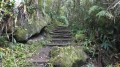
Take the first path on the right. It starts near a house and avoids a stretch of road. However, it is very slippery and the steps are as treacherous as soap.
You’ll come to Chemin Ligne Montegü: follow it to the left. Major works have recently been carried out on this section following the damage caused by the latest cyclones. A few bends further up, there are several views over the south of the island. Count three hairpin bends and you’ll reach another steep slope at the aptly named ‘Pente Téophane’. From a few hairpin bends, you can see the Bois de Nèfles mountain range.
(4) Turn left at the second junction onto the Chemin de la Plaine. Soon, the views stretch as far as Morne Langevin! The path climbs gently through the quiet village of La Ligne Chevalier, with the Dimitile occasionally coming into view. It passes close to a few orange groves and fields of chouchou.
(5) Follow the track to its end and head down the concrete path on the right.
After a short descent, turn left at the next junction onto Chemin Dépot. From here, you can make out the path leading to La Bute Fougère. Cross the Ravine du Cap and its field of chouchou trees. You’ll then reach a slightly straighter but pleasant stretch between the houses.
(6) At the end of the path, take the track on the left.
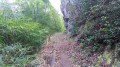
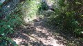
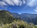
(7) It runs alongside a few fields but quickly turns into a footpath. It is slippery at the start and has a few ruts. The forage reeds try in vain to block the path. The path soon enters a forest of colourful trees and winds its way round a few bends. It then joins the rampart, offering a first view of the Petit Serré. The cliff face is bare for a few metres. A little further up, at a railing, there is a magnificent view of the Chaîne du Bois de Nèfles and the Etang-Salé in the distance. The numerous ridges of the range are clearly visible. It is also worth noting that this range shares the same geological origin as the Dimitile.
The climb is steady but never strenuous on this lovely path, which winds along the ridge through the Branles and the Bois de Noël. You can stop at any time to enjoy the panoramic views.
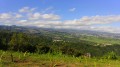
Reaching the Bute Fougère signals that the climb is nearly over. The view over the south of the island is magnificent! You can even see how far you’ve come from the Gol les Hauts water reservoir.
Take a few minutes to enjoy the view, then continue along the path. Some sections are protected by guardrails. Although most of the views are of the Cirque de Cilaos and the peaks of Les Makes, there are a few vantage points overlooking Grand Fond, La Rivière and Saint-Louis.
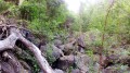
(8) As you pass a wayside shrine, it’s a sign that the climb is over and the descent towards Les Canaux is near. Take in one last view of the Cirque de Cilaos and plunge into the darkness of the cryptomeria forest. The trees are so close together that it feels like night in broad daylight!
(9) At the next junction, leave the Piton Cabris path on your right and carry straight on to quickly leave the cryptomeria forest behind.
(10) Keep left at the next junction and begin the descent to Les Canaux. Enjoy the lovely view of the Chaîne du Bois de Nèfles as you arrive at the plain of the same name. A few families still live there and have created a sort of village completely cut off from the rest of the world! The place is pleasant, peaceful and, above all, timeless. Follow the white arrows and the signs for ‘Les Canaux’ to cross this peaceful little hamlet.
Once you’ve left the houses behind, don’t miss the first path on the right! It starts just before the first ravine. It’s slippery but clearly visible. Cross a stream and rejoin the path on the left bank to reach a tunnel. This is actually an underground ravine. You can walk through it, but you’ll need a torch – and you mustn’t be claustrophobic!
Then return to the previous junction and keep to the right. The path is well-maintained but slippery and damp. Focus on the magnificent fanjans rather than the disheartening spread of weeds. The path passes houses and a few geranium beds once more. It is beautifully lined with hydrangeas. After a muddy stretch through the fodder reeds, you’ll pass close to a scree slope offering a view of the other side of Bras Patate. You’ll then begin a very slippery but short descent along a series of hairpin bends.
At the first junction, ignore the faint path on the right and turn left. Some sections are muddy and the roots are slippery. A short, zigzagging stretch then begins, which may seem endless.
(11) Keep left again at the next junction. Descend slightly, then climb a little before continuing on level ground through the fanjans. It takes just a few minutes to reach the final descent to Les Canaux. It is sometimes steep, but nothing insurmountable. The entire descent takes place through undergrowth of parrot trees, rampart trees and jamrosades.
As you run downhill, ignore a faint path on the left and keep to the right to reach an old picnic area: you’ll need to cross it. This marks the end of the descent. The path widens after the picnic area and offers views of Les Canaux. It leads onto the Chemin de la Forêt.
(12) Turn left at the next junction and walk past the church. There is a drinking fountain to the right of the church. There is even a small shop for those wishing to stock up on supplies.
Take the first path on the left. It crosses a stream.
(13) Follow the first lane on the right (Chemin de la Boutique). It turns into a narrow, very charming lane. Some sections can be slippery in wet weather! Although very short, it adds a little something extra to the walk.
(14) It leads onto Chemin Bras de Roc at a flat area. Follow the road to the right.
(15) Carry on to the left at the stop sign, then take the path that starts straight ahead at the next junction. It begins with a few steps and descends towards the Ravine des Merles. It crosses this ravine at an old water intake and climbs back up towards Chemin Richard.
(16) Keep to the right at the road. After a descent, ignore the first path on the right and keep to the left to pass close to an abandoned picnic area. Cross two ravines and take the first path on the right (Chemin Benjoins). Look out for the houses on the right-hand side of the road: follow it until you reach the last one.
(17) Turn right onto a track that runs alongside the wall. Follow the inconspicuous path to the right to reach a completely derelict picnic area, though it is still used by locals. There is a small pond here. It is well known to local youngsters and is fed by a small waterfall from an old water intake. Descend into the ravine and follow it to the left.
After about a hundred metres, don’t miss the spillway for the Gol les Hauts water reservoir on your left. The volume of water varies depending on when the reservoir is being drained, but it’s quite a sight when there’s a lot of water! Do take great care, however, during these drainage operations! Take a few minutes to admire the waterfall, then head back down the ravine for a few metres and turn left onto the track – which is quite overgrown – leading to a small path. Follow this, keeping to the left at the next junction, then take the first path on the right, which will lead you back to your car (S/E)

 Visorando Member

 Easy

 Moderate