


 Country:
 City:



Directions: Head towards Étang-Salé-les-Hauts via the N1 and exit at the Sables junction. At the roundabout, take the second exit then turn left immediately. After crossing the first ravine (Ravine Sèche), carry on straight ahead at the next junction (you can’t miss it – a sign points the way to Croc-Parc). At the first junction, take the second track on the right (impossible to miss – a sign points the way to Croc-Parc). Carry on to the first speed bump, then park in the next car park on the left.
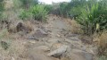
(S/E) Follow the track which continues straight on after the barrier. Immediately afterwards, ignore the track branching off to the right and carry on straight ahead. You will then cross a wide, completely open plain. You’ll have a view of Piton Rouge directly in front of you and Piton Reinette to the right. A few sandy sections will slow you down, but this is nothing compared to what lies ahead! Carry on straight ahead at the next junction, then take the path on the left at the following junction. The slope becomes steeper. Large boulders come into view, adding an extra challenge to the route. The trail, which is at times like a rollercoaster, winds through low, dry vegetation, offering sweeping panoramic views of the Étang-Salé region. The ascent of Piton Rouge along this trail does, however, include a few technical sections. After a few bends, you’ll reach a junction. Turn right, then right again immediately afterwards.
(1) You are now at the summit of Piton Rouge (35 metres!). After taking in the 360-degree panorama, you begin the descent along a wider but slippery path that runs very close to the old Piton Rouge quarry. At the next junction, turn left, then take the path immediately on the right. The slope levels out. Carry on straight ahead at each junction until you reach the next track.
(2) Turn left. Piton Reinette is now in sight, and we begin to climb it. At the next junction, keep to the left. The slope becomes steeper as we approach Piton Reinette. One last look back reveals the path we’ve covered. Stay on the same track until you reach the summit of the piton, from where you can see the entire route.
After a short break to admire the view, begin the descent from Piton Reinette, continuing along the same track. The sandy sections reappear here, a sign that we will soon be heading straight into the Étang-Salé forest. Stay on the same track until you reach the next signpost: Les Boucles Pédestre Forestière.
Carry on straight ahead at the sign. The sandy sections will become increasingly frequent, slowing your progress and making the going quite tough. At the next junction, turn left onto the downhill track, which is completely covered in sand! The gradient is quite steep, but there’s so much sand that you’ll have to pedal just to move forward! Stay on the same track until you reach the next sign: ‘Circular Pedestrian Trail’.
Take the path branching off to the right of the sign. This path is straight but still has a lot of sand (though there will be less of it). Continue to the end of the path, marked by a track.
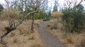
(3) Turn right. You’ll leave the sandy sections behind for a while, making progress easier. The track then runs alongside the RN1. At the next junction, carry on straight ahead. You’ll then begin a gentle descent before joining the cycle path.
(4) At the junction, turn right onto the cycle path. Keep to the right immediately afterwards. This marks the start of the climb up to Gros Piton. After a few bends and some concrete sections, at the first junction take the second path on the left. Carry straight on at the next two junctions, then turn right at the third. The numerous stones may cause some people to slip. At the next junction, turn left. Here we go for the final stretch of the climb up Gros Piton!
Then carry on straight ahead until you reach the next ONF sign on the right, which warns of a dangerous area. The constant din of traffic suggests we are very close to the RN1.
(5) Make a round trip to the Gros Piton mast by continuing straight on. Through the vegetation, you can see Étang-Salé-les-Bains, as well as Piton Reinette and Piton Rouge. From up there, you look out over the whole of the Étang-Salé Forest! This is the highest point in the forest (97 metres). Then head back down to the ONF sign indicating a dangerous area.
(5) Take the path on the left. Begin the descent to the quarries. This section does, however, include a few technical sections! You will then find yourself between the two Gros Piton quarries. At the first junction, turn right to visit the first quarry. Unlike the second one, the descent into this one is easy. The slope is gentle and the path is wide. On the way back up, however, there will be a short technical section. On the way back, turn right at the same junction. At the next junction, carry on straight ahead. To the left, you can just make out the second quarry through the vegetation. Turn left, then immediately turn right to visit the second quarry. The descent will be short but technical! The second quarry is also larger than the first! Back at the same junction, carry on straight ahead until you reach the road, which you’ll reach quickly.
(6) At the road, take the track that starts to the right of the path. This climbs gently, offering a final view of the Étang-Salé Forest.
(7) Take the second path which starts to the left of the track. You’ll head back into the Étang-Salé Forest once more. This section of the path will be short but technical!
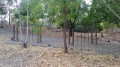
At the end of the track, turn right, then immediately left onto a track. The gradient eases off but there is a risk of slipping due to the slag. After a few hairpin bends – where the gradient is so gentle you hardly notice it – you’ll reach a junction. Turn right, then left at the next junction, then right again at the following one, and left once more at the one after that. You’ll then cross a sandy stretch before reaching the road. Turn right.
(8) Turn left onto the dirt track that starts at the far end of a car park. At the first junction, turn right. After that, at every junction, carry on straight ahead.
(9) At the end of the track, turn right. The track then winds up and down a few times whilst running alongside the fitness trail. At every junction, carry on straight ahead until you reach the road!
(10) Cross the road and take the path on the left which runs alongside it. The sandy sections reappear. Then stay on the same path until you reach the starting point (S/E)

 Visorando Member


 Easy

