Walk at Le Tampon

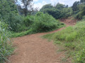
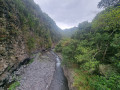
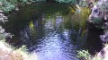
A short family walk there and back with a few variations, either along the Rivière d’Abord or alongside the sugarcane fields. On the riverside path, you can admire the pools carved into the rock.

Details

93576038
Creation:
Last update:
Last review:
  • Walking
    Activity: Walking
  • ↔
    Distance: 3.38 mi
  • ◔
    Average duration: 2h 05 
  • ▲
    Difficulty: Easy

  • ⚐
    Back to start: Yes
  • ↗
    Ascent: + 587 ft
  • ↘
    Descent: - 587 ft

  • ▲
    Highest point: 2,552 ft
  • ▼
    Lowest point: 1,946 ft

Photos

Description of the walk

If you’re coming by car, you can park near the roundabout, close to Monette’s, on Rue Marius et Ary Leblond.

(S/E) Turn right onto Rue de la République. Walk down the street and cross over the Rivière d’Abord. Walk back up for about a hundred metres to the recycling centre.

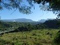
(1) Just opposite the gate, the path starts on the left alongside a field of sugar cane. Follow this well-maintained path along the edge of the field until you reach the Rivière d'Abord and a crossroads of paths.

(2) Take the path on the left, follow the left bank of the river, pass the Cascade Mouton waterfall and rejoin a tarmac road.

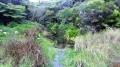
(3) Follow it to the left for a few metres, then turn right onto a path. Continue along the Rivière d'Abord. Cross it at a ford. Continue along this river until it joins the Bras Creux.

(4) Retrace your steps along the same route back to the junction you passed earlier.

(2) Turn left and, following the small paths near the river, return to the original crossroads.

(1) From here, follow the same route as on the way out to reach the car park near the roundabout (S/E).

Waypoints

  1. S/E : mi 0 - alt. 1,978 ft - Car park near the roundabout
  2. 1 : mi 0.15 - alt. 1,969 ft - Recycling centre
  3. 2 : mi 0.64 - alt. 2,123 ft - River junction
  4. 3 : mi 0.9 - alt. 2,251 ft - Tarmac road
  5. 4 : mi 1.68 - alt. 2,539 ft - Confluence of the Rivière d'Abord and Bras Creux
  6. S/E : mi 3.38 - alt. 1,978 ft - Car park near the roundabout

Notes

The route is mostly shaded.

Worth a visit

When you are on the path near the river, you may come across pools carved into the rock. Depending on the season, these pools may be filled with clear water. Please note that they are not very easy to access.

Reviews and comments

5 / 5
Based on 1 review

Reliability of the description
5 / 5
Ease of following the route
5 / 5
Route interest
5 / 5
Chesenau
Chesenau

Overall rating : 5 / 5

Date of your route : Aug 17, 2026
Reliability of the description : ★★★★★ Very good
Ease of following the route : ★★★★★ Very good
Route interest : ★★★★★ Very good
Very busy route : No

1) Don’t hesitate to take the paths that branch off to the left right from the start

2) This walk can be extended.
After point 4, head down into the bed of the Rivière d’Abord.
On the left, take a round trip to the confluence with the Bras Creux.
Head back up the opposite bank.
Join a sugarcane track.
Follow it to the left as far as the ford.
Turn right onto a small path that follows the riverbed and then its right bank.
Head back down into the riverbed: a black electricity or telephone cable helps you along the way.
Head back up the opposite side.
Via a series of ascents and descents along the left bank, you’ll arrive… I don’t know where, but in the direction of Notre Dame de la Paix. Which is certainly in need of support and prayers.

Machine-translated

Other walks in the area

For more walks, use our search engine .

The GPS track and description are the property of this route's author. Please do not copy them without permission.