Bassin Dix-Huit and the Terre Rouge circular loop

Bassin Dix-Huit (or Bassin 18) is one of the best-known pools in the south. Several legends circulate about it. The approach is very short but quite technical: best avoided with children, which explains its ‘medium’ difficulty rating. The pool is deep and the water is beautifully clear! To extend the walk, this route suggests completing a circular route at Pointe du Bois de Buis. This section, which follows the coast and offers some lovely views, presents no difficulty whatsoever.

Details

1190248
Creation:
Last update:
Last review:
  • Walking
    Activity: Walking
  • ↔
    Distance: 2.69 mi
  • ◔
    Average duration: 1h 30 
  • ▲
    Difficulty: Moderate

  • ⚐
    Back to start: Yes
  • ↗
    Ascent: + 299 ft
  • ↘
    Descent: - 289 ft

  • ▲
    Highest point: 187 ft
  • ▼
    Lowest point: 16 ft

Description of the walk

How to get there:
- From Saint-Pierre: head towards Grand Bois via the N2. Cross the Rivière d’Abord, then take the second exit. Go straight on at the roundabout, take the third exit at the next one, then the second at the following one. Then park in the first car park on the right.
- From Saint-Joseph: head towards Saint-Pierre via the N2. Drive past the village of Grand Bois and take the first exit. Park in the car park on the left.

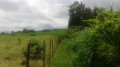
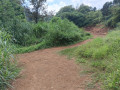
(S/E) Take the path which starts in the right-hand corner of the car park. You’ll come to a sign indicating the entrance to the Terre Rouge nature reserve. Keep left here, then left again at the next junction. The path passes close to some recent plantations as it approaches the sea. Turn left at the next junction and go down a few steps. The wide, well-used path winds through the brown cassava plants. It is often exposed and runs close to Pointe du Bois de Buis. Some of the casuarina trees are particularly striking. Ignore all the small paths branching off to the left towards the cliff.

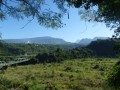
(1) You’ll reach a major junction with what remains of an old wooden sign in the middle. Turn left at this junction. If you look back, you can see the Piton de Grande Anse in the distance. There’s a short descent as you cross the Ravine des Roches.

(2) For the return journey, ignore the faint path on the right and turn left. The path approaches the RSMA (Adapted Military Service Regiment) before running alongside a wall. You’ll reach a track; turn right. Turn right again onto the path. After passing the houses, the path veers slightly to the left. You’ll need to keep a sharp eye out, as the grass can hide this path. However, the grass is short and the markings on the ground are easy to follow once you’ve spotted them.

(2) Follow the path back along the same route as on the way there.

(1) Turn left. The path climbs slightly.

(3) You’ll come to a junction with what remains of an old wooden sign in the middle. Take the path on the right, which is slightly less exposed and quickly leads back to the car park at the starting point.

(S/E) You’ll then reach the road; turn right. Next, take the first path on the right to avoid a dangerous junction. This turns into a narrow track that joins the old main road, which you should follow to the right. You can see the Piton de Mont-Vert a few metres further on. The road then passes a picnic area.

(4) You’ll then pass a grave and take the path on the right which starts just before the bridge. The Bassin Dix-Huit can already be seen from the bridge. The descent to the basin, however, is technically challenging and is only suitable for experienced walkers as it is not secured. The path is very pleasant at first and heads towards the sea. Then look out for an arrow on the left: it indicates the correct route to the basin. You’ll need to climb down a rocky outcrop. There are handholds, but the slightest misstep could be painful. The descent is steep all the way down!

(5) You’ll reach the Bassin Dix-Huit quite quickly, though. There are several legends surrounding it. It’s very popular! It’s one of the best-known pools in the South. Its magnificent blue water is well worth a short stop. You can swim there, but be careful: it’s very deep and can be dangerous if it’s rained further up the valley or when the sea is rough. This is because the sea is very close by and the pool is often fed by the waves when the sea is rough.
Then head back to the car park where you started (S/E).

Waypoints

  1. S/E : mi 0 - alt. 151 ft - Car park
  2. 1 : mi 0.36 - alt. 95 ft - Old wooden sign, on the left
  3. 2 : mi 0.45 - alt. 102 ft - Keep to the left
  4. 3 : mi 0.93 - alt. 118 ft - Old wooden sign, on the right
  5. 4 : mi 1.83 - alt. 115 ft - Take the path on the right
  6. 5 : mi 1.97 - alt. 16 ft - Bassin Dix-Huit
  7. S/E : mi 2.7 - alt. 151 ft - Car park

Notes

Take some water and a cap with you.
Swimming is possible at Bassin Dix-Huit (or Bassin 18) but with great caution: swimming is strongly advised against if it is raining or in heavy swells. It is also very deep.

Worth a visit

Places to see:

-Bassin Dix-Huit: its former name is said to have been ‘Bassin des Huitres’. However, the Creole language is thought to have altered the name, changing it to ‘Bassin Dix-Huit’. Another theory suggests it is so named because it is 18 metres deep.

Things to do:

-Visit the town of Saint-Pierre

Enjoy the various panoramic views.

Reviews and comments

4.1 / 5
Based on 3 reviews

Reliability of the description
5 / 5
Ease of following the route
4 / 5
Route interest
3.3 / 5
jle-douarain
jle-douarain

Overall rating : 4 / 5

Date of your route : Jun 10, 2025
Reliability of the description : ★★★★★ Very good
Ease of following the route : ★★★★★ Very good
Route interest : ★★☆☆☆ Disappointing
Very busy route : No

The first third was very pleasant, but the rest was located along a busy road. We quickly turned back. What a shame!

Machine-translated

danielfr40
danielfr40

Overall rating : 4 / 5

Date of your route : Feb 15, 2022
Reliability of the description : ★★★★★ Very good
Ease of following the route : ★★★☆☆ Average
Route interest : ★★★★☆ Good
Very busy route : Yes

The Red Lands circular route offers superb views of the waves crashing against the rocks right up to the military base
— turn back there.
In fact, if you follow the route alongside the military wall and then turn right to walk past some houses, you won’t find the path that completes the circular route – one of the houses must have blocked it off
As we’re not too keen on walking along roads, we drove to Basin 18, where we enjoyed the view of the waves from Point 5 even more than the basin itself
Thank you for this route

Machine-translated

mouscaz
mouscaz

Overall rating : 4.3 / 5

Date of your route : Jun 06, 2020
Reliability of the description : ★★★★★ Very good
Ease of following the route : ★★★★☆ Good
Route interest : ★★★★☆ Good
Very busy route : No

A peaceful spot, ideal for a short family walk, easily accessible with car parking at the starting point
Well-maintained and clean
The Visorando listing is clear and precise: there’s no risk of getting lost
Thanks to Visorando for introducing me to this spot

Machine-translated

Other walks in the area

For more walks, use our search engine .

The GPS track and description are the property of this route's author. Please do not copy them without permission.