Piton de Mont-Vert

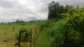
Rising to an altitude of 636 metres, the Piton de Mont Vert is an iconic peak in the south of the island. It is an ancient crater dating back 30,000 years! Visible for kilometres around, it is criss-crossed by several kilometres of footpaths. Winding through a beautiful forest, these paths are the best way to discover the flora and fauna of this piton. The climb is sometimes steep but only for short stretches.

Details

n°1185643
Creation:
Last update:
Last review:
  • Walking
    Activity: Walking
  • ↔
    Distance: 1.07 mi
  • ◔
    Average duration: 0h 50 
  • ▲
    Difficulty: Average

  • ⚐
    Back to start: Yes
  • ↗
    Ascent: + 351 ft
  • ↘
    Descent: - 351 ft

  • ▲
    Highest point: 2,080 ft
  • ▼
    Lowest point: 1,729 ft

Description of the walk

How to get there: head towards Grand Bois via the N2 and take the D29 towards Mont-Vert les Bas. Follow the road until you reach the sign for Piton de Mont-Vert. Then turn right onto the D29 towards Anse les Hauts. Continue until you reach the sign for Piton de Mont-Vert. Then turn left onto the Chemin du Cimetière and follow it again until you reach the next sign for Piton de Mont-Vert. Turn right at the junction. Then pass a track on your right and keep to the left.

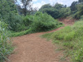
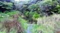
(S/E) Take the path that branches off to the left next to the kiosk. It is situated right at the back of the crater, the southern part of which opens out onto the ocean. The path plunges straight into the ferns and through undergrowth containing some endemic plants. However, some sections have been severely damaged by recent cyclones. The path alternates rapidly between ascents and descents. A few rare clearings offer views of the ocean and Piton de Grande Anse in the distance. After a series of ascents and descents, the path climbs quite steeply to reach the summit of the piton. The steps are sometimes high. The vacoas are becoming increasingly numerous! Some are bearing fruit. Reaching the steps made of rocks marks the end of the climb. The path narrows and slopes gently downwards. It winds along the ridge of the piton (shaped like an inverted U).

(1) Then ignore the small path on the right which descends steeply towards the starting kiosk. The path then climbs slightly but remains narrow. It passes close to some beautiful trees.

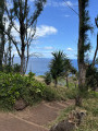
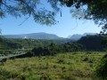
(2) You’ll reach a viewpoint offering views of Piton de Grande Anse, Piton du Calvaire and Anse les Hauts. There’s a bench where you can rest and enjoy the view. Then begin a short descent. The slope is less steep than on the way up. There’s a final view of Saint-Pierre and its surroundings. The path then runs alongside a sugarcane field before returning to the starting point’s kiosk (S/E).

Waypoints

  1. S/E : mi 0 - alt. 1,729 ft - Kiosk
  2. 1 : mi 0.56 - alt. 1,959 ft - Keep to the left
  3. 2 : mi 0.82 - alt. 1,923 ft - Viewpoint
  4. S/E : mi 1.07 - alt. 1,729 ft - Kiosk

Notes

A shelter (without a table and adapted for people with reduced mobility) is available at the starting point (S/E).

Worth a visit

Places of interest:

-Piton de Mont Vert.
-The viewpoint at (2).

Reviews and comments

4.3 / 5
Based on 2 reviews

Reliability of the description
5 / 5
Ease of following the route
5 / 5
Route interest
3 / 5
Thiech
Thiech
• Edited:

Overall rating : 4.3 / 5

Date of your route : Sep 26, 2022
Reliability of the description : ★★★★★ Very good
Ease of following the route : ★★★★★ Very good
Route interest : ★★★☆☆ Average
Very busy route : Yes

The site is the collapsed crater of an ancient volcano and is a popular spot for walkers and fitness enthusiasts. The main attractions are the short but very steep climb to the summit, the dense vegetation (we were lucky enough to spot a chameleon – it was dozing) and the view of the sea as you head back down to the right. The left-hand side offers nothing more, apart from the physical exertion required to get back to the summit ;-)

Machine-translated

danielfr40
danielfr40

Overall rating : 4.3 / 5

Date of your route : Feb 15, 2022
Reliability of the description : ★★★★★ Very good
Ease of following the route : ★★★★★ Very good
Route interest : ★★★☆☆ Average
Very busy route : Yes

A very well-marked path with steep steps leading up to the rock outcrop
views obscured by vegetation, except on the descent to the viewpoint, which has a lovely guava-wood bench

Machine-translated

Other walks in the area

For more walks, use our search engine .

The GPS track and description are the property of this route's author. Please do not copy them without permission.