


Pierrot

 Association / Club / Walk leader
 VIP
VIP Premium user
 - 73700 Bourg Saint Maurice
- Tel:0660727092
- Website: https://www.dansloeildupierrot.com
About
Hi! I'm a hiking mountain guide based in Bourg Saint Maurice (French Alps, near Les Arcs, Val d'Isère and Sainte Foy area).
I offer full day and half day guided walks, nights in refuges, wildlife observation, snowshoeing, igloo building, and much more!
Feel free to visit my Facebook page at https://www.facebook.com/pierrotsguidedw...
Sign up:
Published route(s)
 The Vernettes Chapel

 2.96 mi
 +617 ft
 -614 ft
 1h 55
1h 55
 Easy
Easy
 Departure from Peisey-Nancroix (Savoie)
The Chapelle des Vernettes is a highlight of Baroque religious art in the Tarentaise region and a must-see hike in the Peisey Valley.
Its main advantage is its accessibility, which can become a problem in the height of summer when many cars make the trip.
The Lac de la Plagne
 8.24 mi
+2,192 ft
-2,172 ft
5h 40
8.24 mi
+2,192 ft
-2,172 ft
5h 40
 Moderate
Departure from Peisey-Nancroix (Savoie)
Moderate
Departure from Peisey-Nancroix (Savoie)
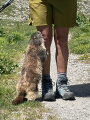
Lac de la Plagne is a classic day hike in the Peisey Valley. It takes you right into the heart of the Vanoise National Park in a very mountainous setting.
The normal route can be done without a map, as it is entirely on theGR®5, which is why I am suggesting a wilder route here, but also more challenging due to numerous stream crossings and some off-trail sections.
Lake Etroit
 4.29 mi
+2,661 ft
-2,661 ft
4h 15
Moderate
Departure from Peisey-Nancroix (Savoie)
4.29 mi
+2,661 ft
-2,661 ft
4h 15
Moderate
Departure from Peisey-Nancroix (Savoie)
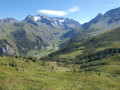
Another classic in the Peisey valley, with a bird's eye view of the village and a beautiful panorama of Mont Pourri. The route is steep and somewhat exposed, but it is possible to make a round trip via the descent route.
The Aiguille Rousse
 6.78 mi
+3,281 ft
-3,281 ft
6h 00
6.78 mi
+3,281 ft
-3,281 ft
6h 00
 Difficult
Departure from Peisey-Nancroix (Savoie)
Difficult
Departure from Peisey-Nancroix (Savoie)
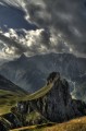
Whether seen from Nancroix or Les Vernettes, where it displays its impressive red cliff face, or from Le Rosuel, where it resembles a castle tower, the Aiguille Rousse is always impressive! However, it is only the chance of the relief that gives it this appearance of a watchtower over the valley. Its neighbour, the Aiguille Grive, is significantly higher, but also easier to access. Indeed, it is better not to be afraid of heights at the top of the Rousse!
The Wind Rock
 5.46 mi
+1,975 ft
-1,991 ft
4h 15
Moderate
Departure from Beaufort (Savoie) (Savoie)
5.46 mi
+1,975 ft
-1,991 ft
4h 15
Moderate
Departure from Beaufort (Savoie) (Savoie)
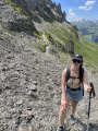
The Rocher du Vent is an impressive rock formation offering a bird's eye view of Lake Roselend, near the Cormet de Roselend. The route described here is unusual as it goes through a tunnel and then along a balcony path, so it is only suitable for walkers who are not afraid of heights or claustrophobia! Others can still discover the site by cutting across to the Lauze chalet.
The Pontet Lake
 2.34 mi
+778 ft
-778 ft
1h 45
Easy
Departure from Villar-d'Arêne (Hautes-Alpes)
2.34 mi
+778 ft
-778 ft
1h 45
Easy
Departure from Villar-d'Arêne (Hautes-Alpes)
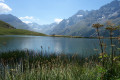
Le Pontet is a magnificent turquoise lake above the hamlet of Les Cours, near Villar d'Arêne. You can get close to it by car, but the walk from Les Cours is very pleasant and, depending on the season, you may see edelweiss and marmots.
The Col de la Vanoise
 7.34 mi
+2,828 ft
-2,828 ft
5h 50
Difficult
Departure from Pralognan-la-Vanoise (Savoie)
7.34 mi
+2,828 ft
-2,828 ft
5h 50
Difficult
Departure from Pralognan-la-Vanoise (Savoie)
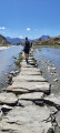
Located in the heart of the Vanoise massif, this route is a good introduction to France's first national park and goes around the Aiguille de la Vanoise. In early summer (June), you'll easily spot ibex, marmots and maybe even chamois.
It is best to park at the Fontanettes car park above Pralognan-la-Vanoise, but you can also start from Pralognan.
Moderator's addition on 04/08/2021: Please note! For safety reasons, it is strongly recommended that you do this route in the opposite direction to the one suggested here. See the reviews at the bottom of this page.
Lac de la Portette
 7.02 mi
+2,539 ft
-2,513 ft
5h 25
Moderate
Departure from La Côte-d'Aime (Savoie)
7.02 mi
+2,539 ft
-2,513 ft
5h 25
Moderate
Departure from La Côte-d'Aime (Savoie)
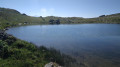
Lac de la Portette is a beautiful hiking destination in the Beaufortain, at the foot of the Grande Pareï cliff. And as I've always preferred loops to round trips, the Col du Mont Rosset and the return via the Balme refuge offer a nice bonus with views of the Pierra Menta, an iconic peak if ever there was one.
The Refuge de Bramanette
 2.24 mi
+1,575 ft
-138 ft
2h 25
Moderate
Departure from Bramans (Savoie)
2.24 mi
+1,575 ft
-138 ft
2h 25
Moderate
Departure from Bramans (Savoie)
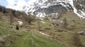
This short hike is the starting point for a magnificent three-day trek between Haute Maurienne and Val de Suze (Italy), with beautiful lakes and numerous small glaciers.But the setting and the welcome at the Refuge de Bramanette are such that they alone justify spending the night there and descending back down to the valley the next day!
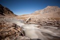
From the Bramanette Refuge to the Ambin Refuge
 8.50 mi
+4,186 ft
-3,665 ft
7h 35
Difficult
Departure from Bramans (Savoie)
8.50 mi
+4,186 ft
-3,665 ft
7h 35
Difficult
Departure from Bramans (Savoie)
A beautiful route, sometimes off the beaten track or on poorly marked paths. From the top of the passes, you can see both the peaks of the Vanoise (the Dent Parachée) and the Barre des Ecrins.This hike follows on from the "Le refuge de Bramanette" route.
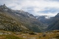
From the Ambin Refuge to Le Planey
 11.65 mi
+3,363 ft
-5,233 ft
8h 15
Difficult
Departure from Bramans (Savoie)
11.65 mi
+3,363 ft
-5,233 ft
8h 15
Difficult
Departure from Bramans (Savoie)
A very beautiful route amongst glaciers and lakes, which crosses the Italian border (beautiful view of the Val di Suza) and returns to France via the Col Clapier, which Hannibal and his elephants probably passed through.
This route follows on from the hike “From the Bramanette Refuge to the Ambin Refuge”, but can easily be done starting from the Ambin Refuge alone.
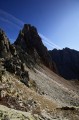
Le Passeur de Gargan
 8.47 mi
+3,543 ft
-3,553 ft
7 hrs
8.47 mi
+3,543 ft
-3,553 ft
7 hrs
 Very difficult
Departure from La Côte-d'Aime (Savoie)
Very difficult
Departure from La Côte-d'Aime (Savoie)
A challenging, steep and exposed route, but magnificent. The view upon reaching the ‘Passeur’ – a gap between the Pointe de Gargan and the Aiguille de la Nova – is breathtaking.
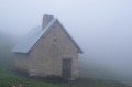
From Corrençon-en-Vercors to the Jasse du Play
 10.84 mi
+2,224 ft
-682 ft
6h 55
Moderate
Departure from Corrençon-en-Vercors (Isère)
10.84 mi
+2,224 ft
-682 ft
6h 55
Moderate
Departure from Corrençon-en-Vercors (Isère)
First stage of a 4-day crossing of the Vercors. It’s a long trek but the elevation gain isn’t excessive.
From the Jasse du Play to the Baraque du Pison
 9.47 mi
+735 ft
-928 ft
5h 00
Moderate
Departure from Gresse-en-Vercors (Isère)
9.47 mi
+735 ft
-928 ft
5h 00
Moderate
Departure from Gresse-en-Vercors (Isère)
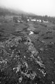
The second stage of the Vercors crossing. Less elevation gain than the previous day, but still a good distance. However, we’re now properly entering the Vercors plateau, and a map, a compass and a good sense of direction are essential, especially when it’s foggy!
From the Baraque du Pison to the Cabane de l’Essaure
 6.53 mi
+1,234 ft
-889 ft
4h 05
Moderate
Departure from Romeyer (Drôme)
6.53 mi
+1,234 ft
-889 ft
4h 05
Moderate
Departure from Romeyer (Drôme)
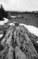
This is the third stage of this Vercors traverse. We’re now reaching the southern part of the Vercors plateau, where the terrain and vegetation make navigation very tricky, but the scenery becomes absolutely stunning!
From the Cabane de l’Essaure to Clelles station
 5.54 mi
+174 ft
-2,858 ft
2h 40
Easy
Departure from Treschenu-Creyers (Drôme)
5.54 mi
+174 ft
-2,858 ft
2h 40
Easy
Departure from Treschenu-Creyers (Drôme)
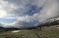
The fourth and final stage of the Vercors crossing. We leave the plateau to descend via Chichilianne to the foot of Mont Aiguille. Choosing Clelles station as the end point for this crossing means you can do the whole thing from Grenoble, but it’s of course possible to arrange for a car to be waiting in Chichilianne before setting off.
Le Lac du Retour
 5.16 mi
+2,297 ft
-2,287 ft
4h 20
Difficult
Departure from Sainte-Foy-Tarentaise (Savoie)
5.16 mi
+2,297 ft
-2,287 ft
4h 20
Difficult
Departure from Sainte-Foy-Tarentaise (Savoie)
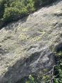
Une très belle randonnée dans le vallon sauvage de la Louïe Blanche, avec comme objectif le Lac du Retour, miroir du Mont Pourri.
The Bellacomba Lakes
 8.59 mi
+3,829 ft
-3,809 ft
8 hrs
Very difficult
Departure from Sainte-Foy-Tarentaise (Savoie)
8.59 mi
+3,829 ft
-3,809 ft
8 hrs
Very difficult
Departure from Sainte-Foy-Tarentaise (Savoie)
Certainly one of the most beautiful hikes in Haute-Tarentaise! A long but very beautiful route passing through the still wild valley of the Louïe Blanche, a short detour into Italy to the magnificent Bellacomba Lakes and the return via the Col du Tachuy and Lac du Petit, all dominated by the Pointes des Assaly with a breathtaking view of the Ruitor, Mont Pourri and the Aosta Valley side of the Mont Blanc massif.
Crossing the Vercors Plateau
32.40 mi
+4,354 ft
-5,358 ft
4 days
Difficult
Departure from Corrençon-en-Vercors (Isère)
This route describes a four-stage crossing of the Vercors Plateau, from Corrençon to Clelles station.
The hidden side of the Maurienne
22.39 mi
+9,124 ft
-9,035 ft
3 days
Difficult
Departure from Bramans (Savoie)
The lower part of the Maurienne Valley is better known for its motorway – which people drive along without stopping – than for its wild high-mountain landscapes.
This route, starting from St Pierre d’Extravache and winding through rocky landscapes, deep blue lakes and ever-present glaciers, disproves the reputation that the valley may have been given. You’ll be walking for three days amongst mountain pastures and high peaks, whilst remaining in mid-mountain terrain.