From the Jasse du Play to the Baraque du Pison

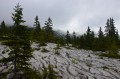
The second stage of the Vercors crossing. Less elevation gain than the previous day, but still a good distance. However, we’re now properly entering the Vercors plateau, and a map, a compass and a good sense of direction are essential, especially when it’s foggy!

This walk is part of a multi-day hike: Crossing the Vercors Plateau

Details

70
Creation:
Last update:
Last review:
  • Walking
    Activity: Walking
  • ↔
    Distance: 9.47 mi
  • ◔
    Average duration: 5h 00 
  • ▲
    Difficulty: Moderate

  • ⚐
    Back to start: No
  • ↗
    Ascent: + 735 ft
  • ↘
    Descent: - 928 ft

  • ▲
    Highest point: 5,548 ft
  • ▼
    Lowest point: 5,075 ft

Photos

Description of the walk

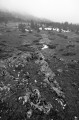
From the Jasse du Play, continue southwards on theGR®91; the path is sometimes less clearly marked, particularly in the Plaine de la Chau clearing.

(1). Continue along theGR® at the end of this clearing, and cross the forest at the foot of the Grand Veymont (you can take an alternative route by crossing the Grand Veymont). TheGR® veers south-west to reach the Bergerie de la Grande Cabane.

(2) Further south, you’ll come to a fork in the path.

(3) Turn right to reach the Cabane de Pré Peyret.
You could stop there for the night, but it’s a popular spot and fills up quickly!

(3) Turn back to the previous fork.

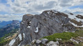
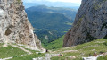
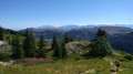
(3) Head right, due south, for about 3 km. You’ll be walking along the western cliff face of the Vercors plateau. Then you’ll descend about a hundred metres below the plateau to the Baraque du Pison (S/E).
The view here is less unobstructed (forest in a small valley) but you’re more likely to find space, and it offers better shelter from the wind.

Waypoints

  1. S : mi 0 - alt. 5,285 ft - Cabane Jasse du Play
  2. 1 : mi 1.34 - alt. 5,243 ft - Plaine de la Chau
  3. 2 : mi 5.01 - alt. 5,125 ft - Bergerie de la Grande Cabane
  4. 3 : mi 7.07 - alt. 5,302 ft - Turn-off towards the hut.
  5. 4 : mi 7.26 - alt. 5,249 ft - Cabane de Pré Peyret
  6. E : mi 9.47 - alt. 5,075 ft - Pison Hut

Notes

For all information on mountain huts and water sources: Refuges.info

Please note: as the Vercors huts are unstaffed, and backpacking is quite common in the area, it is advisable to bring everything you need for wild camping! Similarly, make sure you bring plenty of water – it’s better to carry 2 litres too much than to run out.
The Vercors plateau is also renowned for being difficult to navigate. Don’t forget your maps (3236OT and 3237OT) and your compass – and perhaps an altimeter – and avoid straying from the existing paths. And if you’re unsure, it’s better to turn back before you get properly lost!

As a reminder, the regulations for the Hauts-Plateaux du Vercors Nature Reserve impose the following main restrictions:
- Dogs are not permitted, even on a lead
- Flying at an altitude of less than 300 m is prohibited (therefore, drones and paragliders are prohibited)
- Fires are prohibited
- Deliberately disturbing wildlife is prohibited (be careful not to disturb marmots and ibex, amongst others!)
- Picking plants is prohibited
- Camping is prohibited, but bivouacking is permitted between 5.00 pm and 9.00 am
- Littering is prohibited (including in the shelters open to all!)
These strict regulations are necessary to protect the species and habitats found in this wild and unspoilt area!

This route passes through a protected area, which may be subject to special regulations:

Always be cautious and plan ahead when you're outdoors. Visorando and the author of this route cannot be held responsible for any accidents occurring on this route.

The GR® and PR® markings are the intellectual property of the Fédération Française de Randonnée Pédestre.

Other walks in the area

For more walks, use our search engine .

The GPS track and description are the property of this route's author. Please do not copy them without permission.