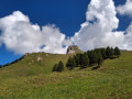
Mont Saint Jacques

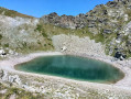
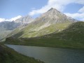
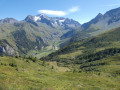
Mont Saint-Jacques overlooks the resort of La Plagne, but above all offers a magnificent view of numerous peaks in the Vanoise and Beaufortain ranges. You can even catch a glimpse of the Aiguilles d’Arves.
The Vanoise Express cable car also allows you to reach the summit from Peisey-Vallandry.

Details

n°67
Creation:
Last update:
Last review:
  • Walking
    Activity: Walking
  • ↔
    Distance: 7.94 mi
  • ◔
    Average duration: 6h 20 
  • ▲
    Difficulty: Difficult

  • ⚐
    Back to start: Yes
  • ↗
    Ascent: + 3,097 ft
  • ↘
    Descent: - 3,100 ft

  • ▲
    Highest point: 7,867 ft
  • ▼
    Lowest point: 5,075 ft

Photos

Description of the walk

(S/E) From Le Chanton, the Vanoise Express terminus, take the path that climbs straight up and then immediately turns right. Cross the road and follow the flat ski run. Further on, it joins another run which you must follow uphill to reach the foot of the Pierres Blanches chairlift. Continue until you reach the junction beneath the Lac Noir cable car.

(1) From there, take the path on the left above the road which climbs behind the houses. Pass under the ski lifts again until you reach the Plan Bois clearing.

(2) Follow the tarmac road to the left for a few metres; this soon becomes a stony track on the other side of the clearing. Enter the forest.

(3) Follow the signposted path which climbs to the left; it is well signposted all the way to the summit. It climbs steeply through the Swiss stone pine forest. As you emerge from this pine forest, you’ll catch sight of Mont Saint-Jacques. Continue the ascent to reach the Col du Seuchet with ease.

(4) Continue due west to reach the summit of Mont-St-Jacques with ease.
At the summit there is a small chapel and an orientation board – a must, given the view!

(5) Head back down the same route to the pass.

(4) Turn left onto a narrow path that winds its way between the rocky outcrops, to join the Frasses path in the scree slope below.
Follow this path to reach the Frasses chalets.

(6) Turn right onto the road, then right again onto the correct path which joins the outward route at the crossroads in the forest.

(3) Turn left back onto the route you took on the way there to reach the Plan Bois crossroads.

(2) Turn left onto the road and head down to the original junction of the cable car at Le Sauget.

(1) Follow the outward route back to Chanton, the Vanoise Express station.

Waypoints

  1. S/E : mi 0 - alt. 5,079 ft - Le Chanton, Vanoise Express station
  2. 1 : mi 0.7 - alt. 5,600 ft - Cable car junction
  3. 2 : mi 1.52 - alt. 5,984 ft - Map of Bois
  4. 3 : mi 1.75 - alt. 6,083 ft - Forest junction
  5. 4 : mi 3.25 - alt. 7,451 ft - Col du Seuchet (2286m)
  6. 5 : mi 3.64 - alt. 7,818 ft - Mont Saint-Jacques (2407m)
  7. 6 : mi 5.12 - alt. 6,037 ft - Les Frasses
  8. S/E : mi 7.94 - alt. 5,075 ft - Le Chanton, Vanoise Express station

Notes

The Vanoise Express is only open during the winter season and in July and August. Check with the Montchavin and Peisey Tourist Offices for exact dates and opening times.

Reviews and comments

4.2 / 5
Based on 2 reviews

Reliability of the description
3.5 / 5
Ease of following the route
4.5 / 5
Route interest
4.5 / 5
irslo
irslo

Overall rating : 4 / 5

Date of your route : Jul 19, 2022
Reliability of the description : ★★★☆☆ Average
Ease of following the route : ★★★★☆ Good
Route interest : ★★★★★ Very good
Very busy route : Yes

A really lovely route with stunning views, but when it comes to distances, there’s quite a difference between my Garmin, my phone and what was advertised.
Otherwise, it’s a hike you should do with plenty of water to hand 😁

Machine-translated

laurent59mp62
laurent59mp62

Overall rating : 4.3 / 5

Date of your route : Aug 03, 2017
Reliability of the description : ★★★★☆ Good
Ease of following the route : ★★★★★ Very good
Route interest : ★★★★☆ Good

A lovely walk, with marmots close by in the mountain pastures at the foot of the final climb; a superb view from the top of Mont St Jacques: the La Plagne valley, Mont Blanc .......

Machine-translated

Other walks in the area

For more walks, use our search engine .

The GPS track and description are the property of this route's author. Please do not copy them without permission.