Country:

 City:





Park at the Peisey-Vallandry (Peisey-Nancroix) resort, where there are plenty of car parks; the Plan Peisey car park is the closest to the start of the walk.
(S/E) Take the road leading to the hamlet of Vieux Plan Peisey; a sign already points towards the chapel. You’ll soon leave behind the ‘cubic’ buildings of the 1970s and pass through the resort’s last few chalets. A brief stop at Vieux Plan is well worth it, as this hamlet is a remnant of the region’s traditional pastoral practices: it is an intermediate mountain pasture between the winter settlements (the villages of Peisey, Moulin, Nancroix and Villaret) and the much higher summer pastures.
From there, take a fairly steep shortcut that starts behind the first house in the hamlet to rejoin the main path at the second bend. The path then passes through a larch wood, before forming a three-way junction.
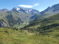
(1) Take the left-hand fork (the steeper one). You’ll soon reach the foot of the Combe ski lift, where a picnic table below offers a lovely spot for a break with views of the north face of Bellecôte and the stunning cliff face of the Aiguille Rousse, behind which the triangular summit of Mont Pourri (3,779 m) – the second-highest peak in the Vanoise – comes into view.
The path heads across the meadow towards the Aiguille Rousse, but be careful – it crosses a small wetland area! In this meadow, you can easily spot vanilla orchids (Orchis vanillé). At a junction at a high point in the meadow, the path joins the Col de l’Entreporte trail (visible to the left of the Aiguille Rousse).
(3) From here you can make out the chapel; continue straight ahead to the end of the walk.
(3) The chapel may be open. If not, you’ll find some consolation in the oratory situated below (follow the Stations of the Cross), which houses a pretty altarpiece, though nowhere near as impressive as those in the chapel. However, at this oratory you’ll find the ‘miraculous’ spring that has made the site famous; if you have any skin problems, do give it a go – the water is cold but excellent!
(3) Turn back.
(2) Turn left onto the track and head back to the first fork.
(1) Follow the route back along the same path you took on the way there to reach the Plan Peisey car park (S/E).


 Association / Club / Walk leader

 Difficult

 Visorando Member
 Moderate