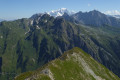
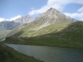
Le Passeur de Gargan

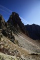
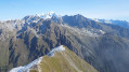
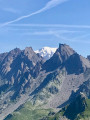
A challenging, steep and exposed route, but magnificent. The view upon reaching the ‘Passeur’ – a gap between the Pointe de Gargan and the Aiguille de la Nova – is breathtaking.

Details

68
Creation:
Last update:
Last review:
  • Walking
    Activity: Walking
  • ↔
    Distance: 8.47 mi
  • ◔
    Duration according to the author: 7 hrs 
  • ▲
    Difficulty: Very difficult

  • ⚐
    Back to start: Yes
  • ↗
    Ascent: + 3,543 ft
  • ↘
    Descent: - 3,553 ft

  • ▲
    Highest point: 8,747 ft
  • ▼
    Lowest point: 5,210 ft

Photos

Description of the walk

Park in the car park at St Guérin Forand, north of Aime-la-Plagne.

(S/E) Walk up the valley along the right bank of the Ornente torrent. You’ll reach theGR®5junction after crossing the torrent.

(1) Turn left onto theGR®, continuing along the left bank of the stream. You’ll reach the junction at the Refuge de la Balme.

(2) Leave theGR® and head straight ahead to tackle the very steep moraine that climbs towards the Col de la Nova. When you are directly below the Pointe de Gargan, you will reach a junction with two paths.

(3) Take the left-hand path to reach the top of the moraine, where there is no longer a path.
Head for a small pass at the foot of the Aiguille de la Nova at an altitude of around 2,660 metres. The pass is not very obvious, but once there, the descent route is just as steep, though fairly clear.
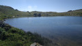
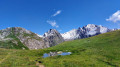
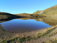
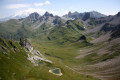
From the Passeur de Gargan, you look down on Lake Presset and the refuge of the same name, and the view of the Pierra Menta is magnificent.

(4) First head down towards the Col du Grand Fond, then join the path leading left to the refuge.

(5) Take the path that leads back down to the Refuge de la Balme.

(6) Turn left to return to the junction you passed earlier on the way up.

(2) Follow the route you took on the way there, reaching the first junction where you cross the Ornente stream.

(1) Keep to the left bank of the Ornente to return to the car park where you started (S/E).

Waypoints

  1. S/E : mi 0 - alt. 5,236 ft - St Guérin Forand car park
  2. 1 : mi 1.1 - alt. 5,574 ft - Crossing the Ornente
  3. 2 : mi 2.19 - alt. 6,296 ft - Moraine junction
  4. 3 : mi 3 - alt. 7,674 ft - Crossroads below the Pointe de Gargan
  5. 4 : mi 3.51 - alt. 8,747 ft - Gargan Pass
  6. 5 : mi 4.15 - alt. 8,232 ft - Refuge de Presset
  7. 6 : mi 5.75 - alt. 6,598 ft - Refuge de la Balme
  8. S/E : mi 8.47 - alt. 5,233 ft - St Guérin Forand car park

Notes

Presset Mountain Hut
La Balme Mountain Hut (please note, there are several mountain huts with this name in Savoie / Haute-Savoie!)

Always be cautious and plan ahead when you're outdoors. Visorando and the author of this route cannot be held responsible for any accidents occurring on this route.

The GR® and PR® markings are the intellectual property of the Fédération Française de Randonnée Pédestre.

Reviews and comments

3.8 / 5
Based on 4 reviews

Reliability of the description
3.3 / 5
Ease of following the route
3.5 / 5
Route interest
4.5 / 5
Denis Schmit
Denis Schmit

Overall rating : 4.7 / 5

Date of your route : Aug 15, 2026
Reliability of the description : ★★★★☆ Good
Ease of following the route : ★★★★★ Very good
Route interest : ★★★★★ Very good
Very busy route : No

It’s a lovely walk, though it does require sure-footedness, particularly at the start and on the descent towards the Presset refuge
The tranquillity of this route is a real bonus

Machine-translated

Pierrot
Pierrot ★

Thank you for this detailed comment!
The signposting has certainly changed since I described it 10 years ago!

Machine-translated

ecollain
ecollain
• Edited:

Overall rating : 3.7 / 5

Date of your route : Aug 24, 2023
Reliability of the description : ★★★☆☆ Average
Ease of following the route : ★★★☆☆ Average
Route interest : ★★★★★ Very good
Very busy route : No

A magnificent hike for those (like me) who love a challenge!
Leaving the moraine, after a few cairns, you climb up a grassy section (try not to stray too far onto the unstable, stony area) which takes you to a false pass at the foot of the Aiguille de Nova. You then descend into a large scree slope. The route description says to aim for a specific passage… but it’s not easy to know exactly what to aim for. Apparently, there are red dots marking the way. We didn’t spot them… You’ll need to either follow the GPX track or the blue line on the IGN map (ski-touring route). The passage is towards the centre of the small cirque beyond the false pass. The descent is much clearer. There are red dots and cairns at the start in a large scree slope, then a path emerges.
Great atmosphere, brilliant hike, magnificent view from the Passeur over the Pierra Manta and Lake Presset . Not a soul in sight… although we did come across two climbers tackling the Aiguille de la Nova .

Machine-translated

SebLau26
SebLau26
• Edited:

Overall rating : 2.3 / 5

Date of your route : Jul 31, 2023
Reliability of the description : ★★☆☆☆ Disappointing
Ease of following the route : ★★☆☆☆ Disappointing
Route interest : ★★★☆☆ Average
Very busy route : No

Route followed in July 2023...
A traverse up the scree slope was not straightforward (it might be better to take the grassy route further to the left of the suggested route from the start); this led to the base of the peak, where a steep, slippery and unstable climb followed to reach the saddle. As for the descent, unless you have to follow the ridge for a few metres to the right, we took the sheer drop – not life-threatening, but almost – to get down to the lake.
Clearly a navigational error on my part.
So, to clarify: when leaving the route towards the Col de la Nova, head sharp left, climbing along the grass at the edge of the scree for the first section, then over scree in the couloir. At the summit, look for the track on the right. I’d advise you to download the GPX file and check it on Google Earth before setting off.
The route is now marked with a red dot and arrow for the ascent, supplemented by a few cairns.
The road leading to the car park is easy to follow.
Otherwise, the site, the lake, the Pierra Menta, and the magnificent view from the Col du Grand-Fond are all worth seeing.
So be warned: the route is demanding, exposed and challenging – as stated, this is not your standard ‘visiorando’.

Machine-translated

Lore69
Lore69

Thanks so much

Machine-translated

brevetdo
brevetdo

A magnificent route.
Take care at the top of the moraine; follow the red and yellow markings carefully.

Access road to the chapel is fine: it has sharp bends

Machine-translated

Lore69
Lore69

Hello,
Could you please tell me how to get to St Guérin Chapel?
Thanks

Machine-translated

brevetdo
brevetdo

Overall rating : 4.3 / 5

Date of your route : Aug 10, 2021
Reliability of the description : ★★★★☆ Good
Ease of following the route : ★★★★☆ Good
Route interest : ★★★★★ Very good
Very busy route : No

A magnificent route.
Take care at the top of the moraine; make sure you follow the red and yellow markers carefully.

Machine-translated

Other walks in the area

For more walks, use our search engine .

The GPS track and description are the property of this route's author. Please do not copy them without permission.