From the Baraque du Pison to the Cabane de l’Essaure

This is the third stage of this Vercors traverse. We’re now reaching the southern part of the Vercors plateau, where the terrain and vegetation make navigation very tricky, but the scenery becomes absolutely stunning!

This walk is part of a multi-day hike: Crossing the Vercors Plateau

Details

71
Creation:
Last update:
Last review:
  • Walking
    Activity: Walking
  • ↔
    Distance: 6.53 mi
  • ◔
    Average duration: 4h 05 
  • ▲
    Difficulty: Moderate

  • ⚐
    Back to start: No
  • ↗
    Ascent: + 1,234 ft
  • ↘
    Descent: - 889 ft

  • ▲
    Highest point: 6,047 ft
  • ▼
    Lowest point: 5,069 ft

Photos

Description of the walk

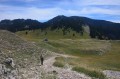
(S) From the Baraque du Pison, head up onto the plateau and rejoin theGR®91heading south. You’ll soon reach the Col du Pison. Lovely view.

(1) Continue south, then a little further on you’ll reach the Quatre Chemins du Jasneuf crossroads.

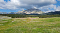
(2). This is where you leave theGR® and head north-east towards Mont Aiguille. The path is fairly well marked. You’ll pass close to the Bergerie du Jas Neuf before arriving at the Refuge de Chaumailloux.
This is also a very popular refuge, as it offers magnificent views of Mont Aiguille. You can make use of the nearby spring to top up your water supplies.

(3) Instead of leaving the plateau via the Pas de l’Aiguille, head south-east to go round the Tête des Baumiers. You’ll pass the Bergerie de Chamousset.

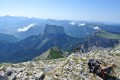
(4) We carry on, cross the Col du Creuson and descend to the Cabane de l’Essaure (E).
The view of the Montagnette cliffs is magnificent.

Waypoints

  1. S : mi 0 - alt. 5,069 ft - Baraque du Pison
  2. 1 : mi 0.67 - alt. 5,413 ft - Col du Pison (1655m)
  3. 2 : mi 1.36 - alt. 5,210 ft - Carrefour des Quatre Chemins
  4. 3 : mi 3.29 - alt. 5,348 ft - Chamailloux Hut
  5. 4 : mi 4.92 - alt. 6,043 ft - Bergerie de Chamousset
  6. E : mi 6.53 - alt. 5,413 ft - Cabane de l'Essaure (1653m)

Notes

For all information on mountain huts and water sources: Refuges.info

Please note: as the Vercors huts are unstaffed, and backpacking is quite common in the area, it’s advisable to bring everything you need for a bivouac! Similarly, make sure you take plenty of water – it’s better to carry 2 litres too much than to run out.
The Vercors plateau is also renowned for being difficult to navigate. Don’t forget your map and compass, and perhaps an altimeter, and avoid straying from the existing paths. And if you’re unsure, it’s better to turn back before you get properly lost!

This route passes through a protected area, which may be subject to special regulations:

Always be cautious and plan ahead when you're outdoors. Visorando and the author of this route cannot be held responsible for any accidents occurring on this route.

The GR® and PR® markings are the intellectual property of the Fédération Française de Randonnée Pédestre.

Other walks in the area

For more walks, use our search engine .

The GPS track and description are the property of this route's author. Please do not copy them without permission.