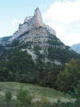
From the Cabane de l’Essaure to Clelles station

The fourth and final stage of the Vercors crossing. We leave the plateau to descend via Chichilianne to the foot of Mont Aiguille. Choosing Clelles station as the end point for this crossing means you can do the whole thing from Grenoble, but it’s of course possible to arrange for a car to be waiting in Chichilianne before setting off.

This walk is part of a multi-day hike: Crossing the Vercors Plateau

Details

72
Creation:
Last update:
Last review:
  • Walking
    Activity: Walking
  • ↔
    Distance: 5.54 mi
  • ◔
    Average duration: 2h 40 
  • ▲
    Difficulty: Easy

  • ⚐
    Back to start: No
  • ↗
    Ascent: + 174 ft
  • ↘
    Descent: - 2,858 ft

  • ▲
    Highest point: 5,472 ft
  • ▼
    Lowest point: 2,723 ft

Photos

Description of the walk

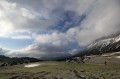
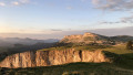
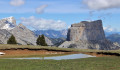
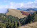
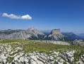
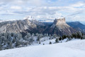
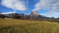
(S) From the Essaure hut, head northwards; you’ll soon reach the edge of the plateau, where the view of Mont Aiguille is superb.

(1) Cross the Pas de l’Essaure via the path that descends steeply towards Chichilianne, and you’ll soon reach the forest. It joins a good track; continue northwards to reach Chichilianne.

(2) Walk through the village and head up to Château-Vieux.

(3) Take the path leading to Clelles (signposted). At the main road, follow it for about 500 metres, then take the path below on the left; you’ll arrive at the hamlet of Gare de Clelles (S/E).
Trains run regularly between Clelles and Grenoble.

Waypoints

  1. S : mi 0 - alt. 5,417 ft - Cabane de l'Essaure (1653m)
  2. 1 : mi 0.45 - alt. 5,427 ft - Essaure Pass
  3. 2 : mi 2.91 - alt. 3,235 ft - Chichilianne
  4. 3 : mi 3.47 - alt. 3,330 ft - Château Vieux
  5. E : mi 5.54 - alt. 2,723 ft - Gare de Clelles-Mens

Notes

For all information on mountain huts and water sources: Refuges.info

Please note: as the Vercors huts are unstaffed, and backpacking is quite common in the area, it’s advisable to bring everything you need for a bivouac! Similarly, make sure you take plenty of water – it’s better to carry 2 litres too much than to run out.
The Vercors plateau is also renowned for being difficult to navigate. Don’t forget your map and compass, and perhaps an altimeter, and avoid straying from the existing paths. And if you’re unsure of your direction, it’s better to turn back before you get properly lost!

This route passes through a protected area, which may be subject to special regulations:

Worth a visit

Clelles Cheese Shop, 400 metres from the station.

Other walks in the area

For more walks, use our search engine .

The GPS track and description are the property of this route's author. Please do not copy them without permission.