


pb07

 Visorando Member
 Premium user
 - Location: Saint-Privat (07200)
- Gender: man
Sign up:
Published route(s)
 Vogüé - Lanas - Vinobre
 10.79 mi
 +1,273 ft
 -1,276 ft
 6h 05
6h 05
 Moderate
 Departure from Vogüé (Ardèche)
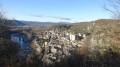
Hike starting from the village of Vogüé through typical "gras" landscapes. Beautiful views of the village, listed as one of the Most Beautiful Villages in France, and the Aubenas plain.
Champcueil - Beauvais - Malvoisine
 8.24 mi
+394 ft
-367 ft
4h 10
Moderate
Departure from Champcueil (Essonne)
8.24 mi
+394 ft
-367 ft
4h 10
Moderate
Departure from Champcueil (Essonne)
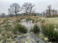
This hike will allow you to discover a wide variety of landscapes on a relatively short route, as well as some historical remains along the way.
Tour of the Jarjatte valley
 9.03 mi
+2,612 ft
-2,612 ft
6h 25
9.03 mi
+2,612 ft
-2,612 ft
6h 25
 Difficult
Departure from Lus-la-Croix-Haute (Drôme)
Difficult
Departure from Lus-la-Croix-Haute (Drôme)
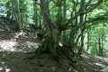
A medium-altitude hike, first on a cool, wooded north-facing slope, then on a south-facing slope through pastures.Please note that the Buëch ford may be impassable if the water is too high.
Balazuc - Estinettes Cave
 3.88 mi
+417 ft
-417 ft
2h 10
3.88 mi
+417 ft
-417 ft
2h 10
 Easy
Departure from Balazuc (Ardèche)
Easy
Departure from Balazuc (Ardèche)
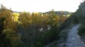
Family hike starting from the village of Balazuc.
For children, there is a small, safe cave to visit and a walk along the water's edge.
Easy route, mostly signposted but a little rocky in places.
The Plateau des Gras - Balazuc
 5.90 mi
+689 ft
-712 ft
3h 20
Moderate
Departure from Balazuc (Ardèche)
5.90 mi
+689 ft
-712 ft
3h 20
Moderate
Departure from Balazuc (Ardèche)
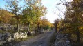
The Plateau des Gras is a limestone plateau crossed by rivers, situated between the Bois de Païolive woods in the southwest and the slopes of the Coiron in the northeast. The northwestern edge of the plateau overlooks a depression extending from Aubenas to Les Vans. The footpaths along this edge of the plateau offer unspoilt views of the Monts d'Ardèche hills at the eastern edge of the Massif Central. The walk also takes you along beautiful paths amid oak trees and to a viewpoint overlooking the village of Balazuc.
Gour de la Sompe - Pertus de Fabria
 5.55 mi
+820 ft
-830 ft
3h 15
Moderate
Departure from Lagorce (Ardèche)
5.55 mi
+820 ft
-830 ft
3h 15
Moderate
Departure from Lagorce (Ardèche)
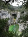
Walk in the Bois d'Ajude near Lagorce. The Gour de la Sompe is not well described in guidebooks and is not on a marked path, but the site is worth a visit for its green water and waterfall (when there is enough water). Beautiful view of the Ibie valley from the Pertus de Fabria.
Pradons - Les Bouchets - Serre Juillet.
6.58 mi
+1,119 ft
-1,099 ft
4h 00
Moderate
Departure from Pradons (Ardèche)
A hilly walk through green oaks between Pradons and Lagorce. Beautiful views of the Ardèche cliffs on the final descent.
The Louyre Canyon, from Échelette to Évent des Grenouillettes
 6.78 mi
+581 ft
-571 ft
3h 35
Difficult
Departure from Lussas (Ardèche)
6.78 mi
+581 ft
-571 ft
3h 35
Difficult
Departure from Lussas (Ardèche)
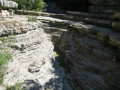
With its wild and exotic appearance, the Louyre Canyon is a classic destination for all hikers in the region. This circuit takes you from one end to the other, then back up the top with beautiful views. As a bonus, since this year, you can once again see traces of beaver activity.
The climb up the canyon is not very easy, and in one or two places you have to use your hands, but it is quite doable, even with children.
Vogüé - Serre Bastel - Les Chazes
 6.60 mi
+666 ft
-659 ft
3h 35
Moderate
Departure from Vogüé (Ardèche)
6.60 mi
+666 ft
-659 ft
3h 35
Moderate
Departure from Vogüé (Ardèche)
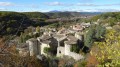
An easy hike on a limestone plateau with few trees. Beautiful views of the Ardèche valley and the surrounding mountains.
La Cham du Cros from the Col de la Croix de Millet
 6.81 mi
+1,594 ft
-1,598 ft
4h 30
Moderate
Departure from Prunet (Ardèche)
6.81 mi
+1,594 ft
-1,598 ft
4h 30
Moderate
Departure from Prunet (Ardèche)
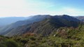
La Cham du Cros is the peak at the eastern end of the Tanargue massif. From there, the view stretches from the mountains of the south to the north of the Alps and, on a clear day, as far as Mont Blanc.
The Tower of Ville and the Dolmens of Serre Bastel
 4.19 mi
+469 ft
-479 ft
2h 20
Easy
Departure from Aubenas (Ardèche)
4.19 mi
+469 ft
-479 ft
2h 20
Easy
Departure from Aubenas (Ardèche)
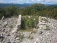
This short hike offers beautiful views of the Ardèche plain, from Saint-Sernin to Aubenas. As a bonus, you can search for the remains of dolmens on the Serre Bastel, a treasure hunt that will delight children. On the way back, the trail passes by the Tour de Ville, the remains of a ruined castle that has unfortunately been abandoned.
Louyre and the Col de Valaurie from Vesseaux
 7.97 mi
+1,634 ft
-1,611 ft
5h 05
Moderate
Departure from Vesseaux (Ardèche)
7.97 mi
+1,634 ft
-1,611 ft
5h 05
Moderate
Departure from Vesseaux (Ardèche)
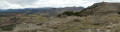
Hike through varied environments, bare hills, wooded valley bottoms and ridge trails with beautiful views.
The hamlet of Louyre, which was deserted in the middle of the last century, is once again inhabited and very much alive.
The ridges of Mont Champ
 4.73 mi
+1,037 ft
-1,030 ft
3h 05
Moderate
Departure from Saint-Privat (Ardèche)
4.73 mi
+1,037 ft
-1,030 ft
3h 05
Moderate
Departure from Saint-Privat (Ardèche)
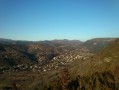
Although the highest point is not very high, this hike, mostly along ridges, offers beautiful views of the Ardèche and the Aubenas region.
The Jastres Plateau and its oppida
 3.94 mi
+285 ft
-299 ft
2h 05
Moderate
Departure from Lussas (Ardèche)
3.94 mi
+285 ft
-299 ft
2h 05
Moderate
Departure from Lussas (Ardèche)
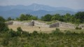
This hike will take you past the remains of oppida dating from the first century BC. The Jastres Sud oppidum, ‘Le Camp de César’, barely rises above the ground, but the Jastres Nord rampart is impressive.As an added bonus, and for those who aren’t particularly interested in historical remains, the path along the edge of the plateau offers magnificent views of the Ardèche.
Tour of Serre des Champs
 4.47 mi
+673 ft
-682 ft
2h 40
Easy
Departure from Vesseaux (Ardèche)
4.47 mi
+673 ft
-682 ft
2h 40
Easy
Departure from Vesseaux (Ardèche)
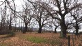
An easy hike in the hills above Vesseaux, where you will discover a few hamlets. Beautiful views of the mountains and surrounding villages. The route passes through beautiful chestnut groves and cherry orchards. Best seen in autumn when the chestnut trees change colour or in spring when the cherry trees are in bloom.
Between Oize and Sandron, the Moulin des Prés from Saint-Julien-du-Serre
 4.84 mi
+558 ft
-535 ft
2h 45
Easy
Departure from Saint-Julien-du-Serre (Ardèche)
4.84 mi
+558 ft
-535 ft
2h 45
Easy
Departure from Saint-Julien-du-Serre (Ardèche)
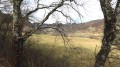
This is a short, easy hike with a wide variety of landscapes: meadows at the bottom of the Oize valley, more austere wooded slopes of the Sandron valley, pine forests and sandstone rocks towards Champestève or Fromenteyrol.
Roche Fort and Fenadou
 8.83 mi
+2,047 ft
-2,018 ft
5h 50
Moderate
Departure from Thueyts (Ardèche)
8.83 mi
+2,047 ft
-2,018 ft
5h 50
Moderate
Departure from Thueyts (Ardèche)
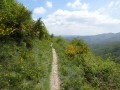
An "airy" hike which will yield fine views over the Ardèche Cévennes, the Ardèche valley to the south and the Fontaulière valley to the north. The route follows some of the paths maintained for the "Giants' Causeway Trail" and overall is thus very practicable and without difficulty. A large part of the walk is waymarked white and yellow.
Best done in May/June when the broom is in flower.
The Rocher de Cheylard from Ray-Pic
 4.58 mi
+1,168 ft
-1,168 ft
3h 05
Moderate
Departure from Péreyres (Ardèche)
4.58 mi
+1,168 ft
-1,168 ft
3h 05
Moderate
Departure from Péreyres (Ardèche)
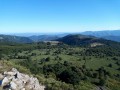
This is a fairly short climb that takes you to a summit offering a superb 360° panorama of the Ardèche mountains and the Alps. It is a simple round trip, most of which follows ridge paths with magnificent views.
On the way back, take the time to visit the Ray-Pic waterfall.
La Cham de Mars from Mézilhac
 7.07 mi
+873 ft
-863 ft
4h 00
Moderate
Departure from Mézilhac (Ardèche)
7.07 mi
+873 ft
-863 ft
4h 00
Moderate
Departure from Mézilhac (Ardèche)
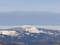
This hike on the Ardèche plateau is relatively flat and takes you to a summit with superb 360° views of the Massif Central and the Alps, and even Mont Blanc on a clear day.
Please note: the route on the way there has been designed to showcase the beauty of the paths and landscapes. The paths are not marked and can sometimes be difficult to find. A good knowledge of the area and maps is necessary. The return via theGR® de Pays is easier and more direct.
From Grand Tanargue to the summit of Méjean via Ron de Coucoulude
 10.25 mi
+1,411 ft
-1,394 ft
5h 55
Moderate
Departure from Ardèche
10.25 mi
+1,411 ft
-1,394 ft
5h 55
Moderate
Departure from Ardèche
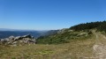
A hike on the highest part of the Tanargue ridge with magnificent panoramic views of the lower Ardèche, the Alps and the Ardèche plateau. The route has little elevation gain and is mostly on easy forest roads.
The Grospierres ridges from Le Rouret
 9.42 mi
+1,719 ft
-1,706 ft
5h 50
Moderate
Departure from Grospierres (Ardèche)
9.42 mi
+1,719 ft
-1,706 ft
5h 50
Moderate
Departure from Grospierres (Ardèche)
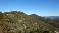
Following good paths through holm oak trees, this hike will take you to the ridges of the Grospierres hills with beautiful views, sometimes towards the Basse Ardèche on the south side, sometimes towards the mountains on the north side. On the way back, you can see the Notre-Dame des Songes chapel, the abandoned village of Chastelas and the Font Vive resurgence with its green water.
Rebord des Gras - Tour of the Chapias plateau
 8.52 mi
+269 ft
-282 ft
4h 10
Moderate
Departure from Labeaume (Ardèche)
8.52 mi
+269 ft
-282 ft
4h 10
Moderate
Departure from Labeaume (Ardèche)
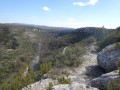
The Plateau des Gras is a limestone plateau, cut by rivers, which stretches from the Païolive woods in the south-west to the slopes of Coiron in the north-east. The path along the edge offers unobstructed views of the entire Monts d'Ardèche mountain range and leads to several viewpoints over the Ligne valley.
This route winds its way across a quasi-desert plateau dotted with numerous stone walls and piles of stones, evidence of a time when every square metre was exploited.
The Remène ravine from Chapias
 3.35 mi
+430 ft
-446 ft
1h 55
Difficult
Departure from Labeaume (Ardèche)
3.35 mi
+430 ft
-446 ft
1h 55
Difficult
Departure from Labeaume (Ardèche)
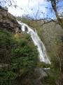
A short walk that will take you past many interesting sites around Chapias: the Notre-Dame Tower, the Maison Unal, the Remène waterfall and the Rocher des Curés site.Take care on certain tricky sections; please read the practical information carefully.
The summit of Blandine from Escrinet
 3.85 mi
+748 ft
-748 ft
2h 25
Moderate
Departure from Saint-Priest (Ardèche)
3.85 mi
+748 ft
-748 ft
2h 25
Moderate
Departure from Saint-Priest (Ardèche)
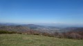
This is a short hike, but it will give you a magnificent view of the Coiron plateau and the entire Alpine range, from Ventoux to Mont Blanc on a clear day.
The summit of Méjean via the Grand Tanargue plateau
 9.63 mi
+1,132 ft
-1,122 ft
5h 25
Moderate
Departure from Ardèche
9.63 mi
+1,132 ft
-1,122 ft
5h 25
Moderate
Departure from Ardèche
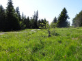
A hike on the highest part of the Tanargue ridge. With little elevation gain, you will enjoy magnificent views of the lower Ardèche, the Alps and the Ardèche plateau. In the height of summer, you will benefit from the coolness of the altitude and large shaded areas.
Circular on the Gras plateau, between Ville and Vogüé
 9.17 mi
+1,076 ft
-1,063 ft
5h 10
Moderate
Departure from Aubenas (Ardèche)
9.17 mi
+1,076 ft
-1,063 ft
5h 10
Moderate
Departure from Aubenas (Ardèche)
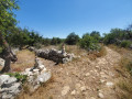
This walk takes place almost entirely on the Plateau des Gras, a limestone plateau pierced by karstic caves, rather arid on the western side and more wooded on the eastern side. It will also give you an original view of the village of Vogüé, an old quarry whose stones were exported as far as Paris and, if you look carefully, the remains of dolmens.
The Chauzon viewpoints
 8.63 mi
+866 ft
-853 ft
4h 45
Difficult
Departure from Chauzon (Ardèche)
8.63 mi
+866 ft
-853 ft
4h 45
Difficult
Departure from Chauzon (Ardèche)
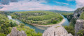
The village of Chauzon is located at the end of a plateau surrounded by the Ardèche, the Ligne and the Gournier stream. Following the edge of this plateau, this hike will reveal beautiful views of these three valleys.
These viewpoints are located on rocks at the top of cliffs. Access is not vertiginous, but please be careful with children.
Tour du Knoll de Chalembelle
 9.38 mi
+2,516 ft
-2,487 ft
6h 30
Moderate
Departure from Burzet (Ardèche)
9.38 mi
+2,516 ft
-2,487 ft
6h 30
Moderate
Departure from Burzet (Ardèche)
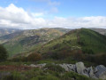
Hike with varied landscapes, the Bourges valley with its basalt flows, chestnut woods and blueberry fields, hamlets with old houses.
Superb view from the summit.
The ridges of Trappe Loup
 4.07 mi
+568 ft
-591 ft
2h 20
Easy
Departure from Ruoms (Ardèche)
4.07 mi
+568 ft
-591 ft
2h 20
Easy
Departure from Ruoms (Ardèche)
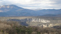
An easy walk on the ridges between Ruoms and Pradons. Beautiful views over the Ardèche valley and the cliffs of the cirque de Gens in the second part. Avoid hot weather, as shade is scarce and there's no water.
The ridges of the Grand Travers
 9.28 mi
+1,312 ft
-1,289 ft
5h 25
Moderate
Departure from Balazuc (Ardèche)
9.28 mi
+1,312 ft
-1,289 ft
5h 25
Moderate
Departure from Balazuc (Ardèche)
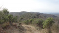
Hike along clear paths with beautiful views of the Ardèche valley and the Massif Central on one side, and the forests of Lagorce and the Dent de Rez massif on the other.
Les Valadous
 2.80 mi
+436 ft
-407 ft
1h 40
Moderate
Departure from Astet (Ardèche)
2.80 mi
+436 ft
-407 ft
1h 40
Moderate
Departure from Astet (Ardèche)
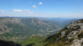
Although it is very flat, the summit of Les Valadous offers a 360° panorama of the Alps and the Massif Central.
The round trip from the Col du Pendu is a very easy family walk along wide, clearly marked tracks.
This route also features a balcony-like section along the edge of the plateau with an impressive bird’s-eye view of the upper Ardèche valley. This part of the route, on a poorly defined path, is more challenging and is reserved for more experienced hikers. It may also be temporarily inaccessible when this moorland is used for grazing (see practical information).
Menhirs and the hamlet of La Fage
 7.08 mi
+1,066 ft
-1,060 ft
4h 10
Moderate
Departure from Saint-Étienne-du-Valdonnez (Lozère)
7.08 mi
+1,066 ft
-1,060 ft
4h 10
Moderate
Departure from Saint-Étienne-du-Valdonnez (Lozère)
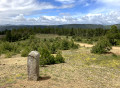
The first part of the hike follows the Balade au pays des Menhirs discovery trail. The rest of the route continues to the hamlet of La Fage. In addition to the Clocher des Tourmentes bell tower marked on the IGN map, you can admire beautiful granite houses covered with slate tiles. Unfortunately, while some have been restored, others are partly abandoned.
Cham Clause Viewpoint
 5.13 mi
+256 ft
-262 ft
2h 35
Easy
Departure from Burzet (Ardèche)
5.13 mi
+256 ft
-262 ft
2h 35
Easy
Departure from Burzet (Ardèche)
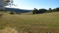
An easy walk that takes you to a stunning viewpoint overlooking Burzet and the Bourges valley.
Best undertaken in spring when the broom is in bloom.
Woods and vineyards around Rochecolombe
 10.24 mi
+1,263 ft
-1,266 ft
5h 50
Moderate
Departure from Rochecolombe (Ardèche)
10.24 mi
+1,263 ft
-1,266 ft
5h 50
Moderate
Departure from Rochecolombe (Ardèche)
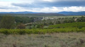
A hike offering varied scenery. The first section takes you through holm oak woods around the Route Royale, whilst the second section leads through vineyards with views of the Ardèche cliffs and the mountains of the Massif Central. Along the way, you’ll pass through the old village of Rochecolombe and, with a short detour, Saint-Maurice-d’Ardèche.
13/11/2023 - Please note: due to safety works, access through the old village is temporarily closed at the chapel. See the alternative route in the Practical Information section
Figeyrasse Cave
 4.28 mi
+472 ft
-469 ft
2h 25
Moderate
Departure from Vogüé (Ardèche)
4.28 mi
+472 ft
-469 ft
2h 25
Moderate
Departure from Vogüé (Ardèche)
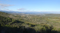
A short, unpretentious hike along little-used paths on the Gras de Lanas. The cave itself is nothing spectacular, but it is a good destination for a walk and the little valley that leads to it is very pleasant. The rest of the route is a more classic walk on the Gras, but partly on unmarked paths, which are sometimes prettier.
The Louyre ravine on the right bank
 8.88 mi
+1,690 ft
-1,663 ft
5h 35
Moderate
Departure from Vesseaux (Ardèche)
8.88 mi
+1,690 ft
-1,663 ft
5h 35
Moderate
Departure from Vesseaux (Ardèche)
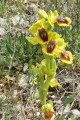
The route through the Louyre stream ravine along the valley floor and back via the left bank is a well-known walk (see ‘The Louyre Canyon, from L’Échelette to L’Évent des Grenouillettes’). The route suggested here takes you along paths overlooking the right bank, offering beautiful views of the cliffs at the Combasses climbing site.
From the Chaumasse Water Tower to Mézilhac via the Knoll of Ourseyre
 7.76 mi
+761 ft
-1,617 ft
4h 15
Moderate
Departure from Sagnes-et-Goudoulet (Ardèche)
7.76 mi
+761 ft
-1,617 ft
4h 15
Moderate
Departure from Sagnes-et-Goudoulet (Ardèche)
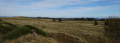
A one-way hike along the ridges of the Ardèche mountains. Best done on a fine, sunny day after rain to enjoy superb views of the Alps almost all the way, from Mont Blanc to Mont Ventoux.
From Saint-Alban to the Ranc des Biols, a walk on the Gras de Bourbouillet
 9.69 mi
+699 ft
-686 ft
5h 05
Moderate
Departure from Saint-Alban-Auriolles (Ardèche)
9.69 mi
+699 ft
-686 ft
5h 05
Moderate
Departure from Saint-Alban-Auriolles (Ardèche)
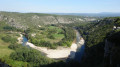
In this part of the Plateau des Gras, the Bourbouillet resurgence and the Aven du Reméjadou are among the classic routes often described. This hike will take you along some lesser-known and therefore less-frequented trails in the surrounding area. A word of advice, however: forget the IGN map, which is very incomplete in this area. Instead, use the OpenStreetMap hiking base map with the Visorando app; the built-in GPS may come in handy.
Le Serre des Bidaux and the Vallon de Fontenouille
 5.36 mi
+430 ft
-430 ft
2h 50
Moderate
Departure from Saint-Germain (Ardèche)
5.36 mi
+430 ft
-430 ft
2h 50
Moderate
Departure from Saint-Germain (Ardèche)
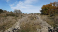
This hike, alternating between passages in the woods and wide open spaces, will take you to the highest point of Gras de Vogüé, where you can enjoy a 360° view of the entire plateau.
Many routes have already been described in this area. The chosen route takes less well-known paths, some of which are not marked on the IGN map (see practical information). This allows you to discover new paths, new viewpoints and encounter fewer people, especially in summer.
In search of a few curiosities in the woods around Remejadou
 4.37 mi
+141 ft
-151 ft
2h 10
Moderate
Departure from Lablachère (Ardèche)
4.37 mi
+141 ft
-151 ft
2h 10
Moderate
Departure from Lablachère (Ardèche)
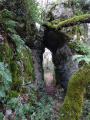
This hike is primarily a stroll along pretty trails in a relatively cool and humid area of the Plateau des Gras. The few points of interest marked on the map can be considered as a series of goals to achieve in what resembles an orienteering course. Avoid this route if you only hike on easy, well-marked routes. GPS and OpenStreetMap are recommended; see the practical information section.
The ridges of Villeneuve-de-Berg
 8.95 mi
+1,138 ft
-1,148 ft
5h 05
Moderate
Departure from Villeneuve-de-Berg (Ardèche)
8.95 mi
+1,138 ft
-1,148 ft
5h 05
Moderate
Departure from Villeneuve-de-Berg (Ardèche)
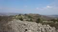
An easy hike with beautiful views of Villeneuve-de-Berg and the Ardèche mountains.
Much of the route is marked in white and yellow, but a few unmarked detours to the right or left allow you to enjoy the ridges even more.
In the sandstone hills and pine woods around Ailhon
 7.47 mi
+1,293 ft
-1,309 ft
4h 35
Moderate
Departure from Fons (Ardèche)
7.47 mi
+1,293 ft
-1,309 ft
4h 35
Moderate
Departure from Fons (Ardèche)
A walk of no great difficulty, despite a few stony and somewhat steep sections, which will allow you to discover the village of Ailhon and the Crouzet complex. Much of the route is shaded by pine trees, which is a welcome relief on summer days.
La Serre des Aiguilles, viewpoint overlooking Puilaurens Castle
 3.96 mi
+715 ft
-715 ft
2h 25
Easy
Departure from Puilaurens (Aude)
3.96 mi
+715 ft
-715 ft
2h 25
Easy
Departure from Puilaurens (Aude)
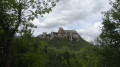
This short forest hike will take you to the top of a hill with a magnificent view of Puilaurens Castle. It is an interesting addition to a visit to the castle.
The hill of Chalancon from Mercuer
 4.08 mi
+902 ft
-889 ft
2h 40
Easy
Departure from Mercuer (Ardèche)
4.08 mi
+902 ft
-889 ft
2h 40
Easy
Departure from Mercuer (Ardèche)
Although its altitude barely exceeds 500 m, the Chalancon hill offers extensive views to the north over the Ardèche and Fontaulière valleys and to the south as far as Mont Ventoux.
Much of the hike follows shaded paths through pine woods.
The entire route is marked in yellow and white.
From Lentillères to Chalancon
 8.83 mi
+1,381 ft
-1,401 ft
5h 15
Moderate
Departure from Lentillères (Ardèche)
8.83 mi
+1,381 ft
-1,401 ft
5h 15
Moderate
Departure from Lentillères (Ardèche)
A hike through the hills, with not too much elevation gain. On the way there, along the ridges, you can enjoy superb views of the Ardèche, sometimes to the north, sometimes to the south. The return route takes you along a variety of paths through sandstone terrain and pine woods.
Around Vaudanoux
 2.40 mi
+482 ft
-472 ft
1h 30
Easy
Departure from Rochecolombe (Ardèche)
2.40 mi
+482 ft
-472 ft
1h 30
Easy
Departure from Rochecolombe (Ardèche)
A short, unpretentious walk above the hamlet of Vaudanoux with lovely views over the ridge.Please note: for those who prefer well-marked routes, this route is not signposted and some paths are difficult to follow.A map and GPS app are recommended.
The Rocher du Midi
 6.04 mi
+2,051 ft
-2,041 ft
4h 35
Moderate
Departure from La Souche (Ardèche)
6.04 mi
+2,051 ft
-2,041 ft
4h 35
Moderate
Departure from La Souche (Ardèche)
A somewhat steep climb up an old paved slanting street, but once at the top, your efforts are rewarded with a superb view of the upper Ardèche valley at the Col de Fontfreyde, followed by a 360° view from the summit of the Rocher du Midi. After a beautiful stretch along the ridge, the less steep descent zigzags between the various hamlets of La Souche.
Amidst sandstone and olive trees, the church of Payzac and the Chapel of Sainte-Appolonie
 6.99 mi
+1,001 ft
-1,004 ft
4h 05
Moderate
Departure from Les Assions (Ardèche)
6.99 mi
+1,001 ft
-1,004 ft
4h 05
Moderate
Departure from Les Assions (Ardèche)
An easy walk through woods, vineyards and olive groves at the foot of the Ardèche Cévennes. Beautiful views at both ends of the route.
The Dent de Rez from Saint-Vincent
 5.94 mi
+1,368 ft
-1,355 ft
3h 55
Moderate
Departure from Gras (Ardèche)
5.94 mi
+1,368 ft
-1,355 ft
3h 55
Moderate
Departure from Gras (Ardèche)
The view from the summit of the Dent de Rez is one of the must-see sights in the southern Ardèche. This hike, which is shorter and easier than the classic route, can be completed in half a day.
Pic dels Moros from Égat
 6.99 mi
+1,680 ft
-1,660 ft
4h 40
Moderate
Departure from Égat (Pyrénées-Orientales)
6.99 mi
+1,680 ft
-1,660 ft
4h 40
Moderate
Departure from Égat (Pyrénées-Orientales)
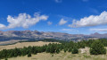
Located in the heart of Cerdagne, Pic dels Moros offers a magnificent 360° view. As a bonus, in good weather, you will be treated to the ballet of paragliders, whose launch area is located just below.
This hike is inspired by the PR®69 and PR®71 routes of the Pyrénées-Cerdagne Tourist Office, with a few modifications.