From Lentillères to Chalancon

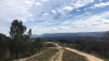
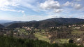
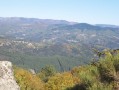
A hike through the hills, with not too much elevation gain. On the way there, along the ridges, you can enjoy superb views of the Ardèche, sometimes to the north, sometimes to the south. The return route takes you along a variety of paths through sandstone terrain and pine woods.

Details

29137842
Creation:
Last update:
Last review:
  • Walking
    Activity: Walking
  • ↔
    Distance: 8.83 mi
  • ◔
    Average duration: 5h 15 
  • ▲
    Difficulty: Moderate

  • ⚐
    Back to start: Yes
  • ↗
    Ascent: + 1,381 ft
  • ↘
    Descent: - 1,401 ft

  • ▲
    Highest point: 1,932 ft
  • ▼
    Lowest point: 1,352 ft

Photos

Description of the walk

Parking is available south of the D335 in the square next to the cemetery and the ‘Hiking Information’ sign.

White-and-yellow markings

(S/E) Cross the D335 and head north up a footpath. Pass the ‘Le Village’ sign and arrive at a small, level road at the ‘Le Village Haut’ sign.

(1) Take this road to the right. At the first bend, turn left onto a dirt track and continue until you reach the ‘Montferou’ sign.

Unmarked section

(2) Ignore the signposted paths to the right and left and continue straight on along a clearly marked path. Follow this path for approximately 2.5 km. At the first T-junction, turn left. At the next junction, join a white-and-yellow signposted path, which you take to the left until you reach the ‘Col de Farges’ sign.

White-and-yellow markings

(3) Take the road on the left for about twenty metres, then turn right onto a track. Continue until you reach the dirt track leading to the hamlet of Chalancon. Follow this for 500 m.

(4) Leave the road on the right and head towards a fire hydrant. Pass to the left of it, continue along a narrow path and then along a track running alongside a meadow. Follow the edge of the meadow until you reach a junction of several tracks just before the houses.

Unmarked

(5) Leave the signposted path, which continues to the right at a right angle, and take a wide track on the far right, heading due south-west.

(6) Before a hairpin bend, look out for an overhanging rock on the right-hand side of the track. A few small steps below it mark the start of a path. Climb up to the left of this rock, using the roots for support, to emerge just above it onto a good, level path. This is the only slightly tricky section of the route.
After fording a small stream, continue climbing along a path that widens, ignoring a few overgrown side tracks on the left, until you reach a forest track.

(7) Take this track to the right, then immediately turn left onto another forest track. After about six hundred metres, look out for a signposted path on the left, ascending from Mercuer and continuing to the right across a rocky outcrop.

White-and-yellow markings

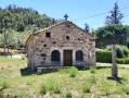
(8) Turn right onto this path. At the top of the climb, cross a large meadow. Make sure you close the gates properly and follow the path carefully to avoid trampling the grass. You’ll reach the ‘Turc’ sign next to a small chapel.

(9) Turn left onto the small road (towards La Faugère). After a left-hand bend, take a small path on the left. Continue downhill, cross a stream and come out onto a small road. Carry on straight ahead along this road until you reach a hairpin bend.

(10) Leave the road to the right onto a driveway leading to a property, then, just before the gate, turn left onto a small path.

(11) At the sign for La Faugère, turn right towards Lentillères. Pass a path on your right leading up towards Burac. Cross the stream and you’ll reach the D223.

(12) Turn right. Following the signposting, you would normally continue along this road to the junction and then turn left onto the Route de Lentillères (D335). To avoid this rather dangerous stretch of road, it is better to look out for the start of a small path on the left-hand embankment, which leads directly to the same point. Continue towards the fire-fighting water reservoir.

(13) Take the track on the left, then, 100 m further on, a path on the right that follows the ridge. Continue to the Daüs sign.

(14) Head down the track towards Lentillères, then turn left onto a path. Cross the Ruisseau d’Ayguenère and head back up to a wide track.

(15) After catching a glimpse of the Rocher des Croix, continue along the path opposite and arrive at Lentillères at the sign: L’École. Turn right to return to the start (S/E).

Waypoints

  1. S/E : mi 0 - alt. 1,637 ft - Car park next to the cemetery
  2. 1 : mi 0.33 - alt. 1,913 ft - Le Village Haut, road on the right
  3. 2 : mi 1.36 - alt. 1,831 ft - Montferou, straight on off the marked trail
  4. 3 : mi 2.43 - alt. 1,699 ft - Col de Farges (517m)
  5. 4 : mi 3.34 - alt. 1,614 ft - Fire tank
  6. 5 : mi 3.56 - alt. 1,476 ft - Track on the far right
  7. 6 : mi 3.7 - alt. 1,424 ft - Path to the right over the rocks
  8. 7 : mi 4.18 - alt. 1,421 ft - Turn right, then left
  9. 8 : mi 4.63 - alt. 1,460 ft - Marked path to the right on a rock slab
  10. 9 : mi 5 - alt. 1,621 ft - Turc Chapel
  11. 10 : mi 5.77 - alt. 1,417 ft - Path junction
  12. 11 : mi 6.02 - alt. 1,385 ft - La Faugère, on the right
  13. 12 : mi 6.68 - alt. 1,611 ft - There’s a shortcut on the opposite side to avoid the road, after the - Auzon (rivière) - Affluent droit de l'Ardèche
  14. 13 : mi 6.76 - alt. 1,650 ft - Fire tank
  15. 14 : mi 7.61 - alt. 1,611 ft - Daüs, on the right
  16. 15 : mi 8.28 - alt. 1,447 ft - Rocher des Croix, straight ahead
  17. S/E : mi 8.83 - alt. 1,634 ft - Car park next to the cemetery

Notes

The entire route, including the unmarked sections, follows well-defined paths or tracks that are not too steep.
Just after point (2), the unmarked path is clearly visible but poorly maintained. A pair of secateurs may come in handy to clear away some brambles. A little further on, as soon as you enter the woods, there are no further problems.
The only tricky bit is (6), where you’ll need to use your hands for about ten metres. Please note that on the IGN map, the start of the path is marked a little too close to the hairpin bend. It’s better to follow the GPS track or the OpenStreetMap.

Alternative route
For a shorter route, you can also park at Clos de la Bernarde (13), near the fire tank, and head straight up to Monferou (2) via a signposted path. The route is then just under 10 km.

Reviews and comments

4.2 / 5
Based on 3 reviews

Reliability of the description
4 / 5
Ease of following the route
3.7 / 5
Route interest
5 / 5
cathy du teil
cathy du teil

Overall rating : 4 / 5

Date of your route : Jun 23, 2024
Reliability of the description : ★★★★☆ Good
Ease of following the route : ★★★☆☆ Average
Route interest : ★★★★★ Very good
Very busy route : No

A really lovely, varied route – but be careful, the grass is quite tall at the moment, so bring some secateurs to clear and maintain the path

Machine-translated

Mich0726
Mich0726

Overall rating : 3.7 / 5

Date of your route : Jun 10, 2024
Reliability of the description : ★★★☆☆ Average
Ease of following the route : ★★★☆☆ Average
Route interest : ★★★★★ Very good
Very busy route : No

Hi, a really lovely walk – just a few points to clarify.
Be careful: from point (2) onwards, nature takes over – the vegetation is growing thick and fast, and so are the brambles! Lol.
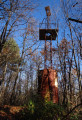
The path doesn’t go to the right of the mast as shown on the map, but to the left – it doesn’t matter though, as you’ll end up back on the main path.
At point (6), if you can’t find the ‘staircase’, carry on for about twenty metres and head up into Les Faïsses; you’ll find the path there, which is clearly marked.
From point (13) onwards, there’s been a lot of forestry work, so it’s difficult to find the path 100 metres after the Fork in the road; instead, keep going completely to the left until you reach a water reservoir, then head back up the steep path towards the peatland – you’ll rejoin the path at that point.
After that, it’s plain sailing – you’ll see some typically Ardèche signposts, the ‘rocher des croix’ and the ‘fouloir’.
Enjoy the walk.

Machine-translated

Béatrice Raoux
Béatrice Raoux
• Edited:

Overall rating : 5 / 5

Date of your route : Mar 18, 2023
Reliability of the description : ★★★★★ Very good
Ease of following the route : ★★★★★ Very good
Route interest : ★★★★★ Very good
Very busy route : No

A brilliant hike, with just 200 metres of tarmac over 14 km – and that’s brilliant!
The signposting is very clear, provided you make the effort to read the description properly – and a word of advice: do make that effort!
We completed it in 4 hours and 15 minutes, including a quarter of an hour’s lunch break, without walking particularly fast, but as it wasn’t very hot, we didn’t stop too often.
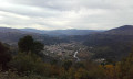
There are beautiful 3D views of the surrounding villages from the heights above Chalencon.

Machine-translated

Other walks in the area

For more walks, use our search engine .

The GPS track and description are the property of this route's author. Please do not copy them without permission.