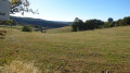
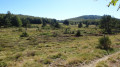
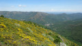
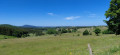
Cham Clause Viewpoint

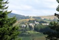
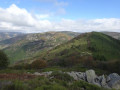
An easy walk that takes you to a stunning viewpoint overlooking Burzet and the Bourges valley.
Best undertaken in spring when the broom is in bloom.

Details

4085078
Creation:
Last update:
Last review:
  • Walking
    Activity: Walking
  • ↔
    Distance: 5.13 mi
  • ◔
    Average duration: 2h 35 
  • ▲
    Difficulty: Easy

  • ⚐
    Back to start: Yes
  • ↗
    Ascent: + 256 ft
  • ↘
    Descent: - 262 ft

  • ▲
    Highest point: 4,216 ft
  • ▼
    Lowest point: 4,032 ft

Photos

Description of the walk

Parking is available on the D289 between Burzet and Sagnes-et-Goudoulet, right on the edge of the plateau, next to a ruined hut.

Red and whiteGR® markings

(S/E) Take the path which climbs over a hillock heading south (open and close the electric fence, of course). After a second fence, rejoin the road and continue southwards, then westwards. Pass the start ofthe yellow and white-markedPR® path on your left and arrive at the information sign at the entrance to the hamlet of La Brousse.

(1) Leave the road and take the path on the left.

(2) At theGR® junction, take the path leading uphill to the left. Pass several paths on both the right and left and carry on straight ahead.

(3) At anotherGR® junction, pass theGR®7on your right and carry straight on for about 200 m until you reach a three-way junction.

Unmarked section

(4) Take the path on the left. Pass two paths on the left, symbolically blocked by a tree trunk. After leaving the woods, continue for about a hundred metres until the end of the climb.

(5) Leave the main path and turn left onto a track through the broom.

(6) At a three-way junction, take the path on the left, which is less visible than the other.
Carry on to a hilltop surrounded by broom. To enjoy the view, go beyond this hilltop by taking a track leading down to the right to a viewpoint on the rocks below.

(7) Turn back, then, a few dozen metres further on, leave the main path and take a track on the left. Pass a path on both the right and left, wade across the small stream and arrive at a three-way junction.

(8) Take this path to the left, pass a track on your right that is blocked by a fence, and join theGR®73.

Red and whiteGR® markings

(9) Turn right to return to the fork you previously passed.

(4) Follow the route you took on the way out in the opposite direction. After La Brousse, you can also continue along the road – which is very pleasant and quiet – to return to the starting point (S/E).


Waypoints

  1. S/E : mi 0 - alt. 4,045 ft - La Barricaude – Ruined hut
  2. 1 : mi 0.36 - alt. 4,045 ft - La Brousse – Signpost on the Montagne Ardéchoise
  3. 2 : mi 0.7 - alt. 4,131 ft - GR junction
  4. 3 : mi 1.33 - alt. 4,180 ft - GR junction
  5. 4 : mi 1.4 - alt. 4,167 ft - Crossroads of the circular loop
  6. 5 : mi 1.97 - alt. 4,216 ft - Path on the left through the broom.
  7. 6 : mi 2.15 - alt. 4,150 ft - Left-hand track (hard to see)
  8. 7 : mi 2.34 - alt. 4,150 ft - Viewpoint
  9. 8 : mi 2.75 - alt. 4,121 ft - Three-way junction
  10. 9 : mi 2.99 - alt. 4,091 ft - GR junction. Path running alongside the - Prat Sauvage (cours d'eau) - Affluent de la Loire
  11. S/E : mi 5.13 - alt. 4,045 ft - La Barricaude, a ruined hut

Worth a visit

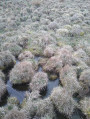
Before and after the (9), the path runs alongside the Font de l’Aigle and La Verrerie peat bogs, sensitive wetlands currently being restored by the Conservatoire d’Espaces Naturels Rhône-Alpes. See ‘La Verrerie peat bog (Ardèche) in the spotlight’.
It is worth noting that the Font de l’Aigle peat bog lies on the Atlantic–Mediterranean watershed.

Always be cautious and plan ahead when you're outdoors. Visorando and the author of this route cannot be held responsible for any accidents occurring on this route.

The GR® and PR® markings are the intellectual property of the Fédération Française de Randonnée Pédestre.

Reviews and comments

4 / 5
Based on 3 reviews

Reliability of the description
4.3 / 5
Ease of following the route
4 / 5
Route interest
3.7 / 5
RAMOND BERNARD
RAMOND BERNARD

Overall rating : 3.3 / 5

Date of your route : Sep 18, 2025
Reliability of the description : ★★★★☆ Good
Ease of following the route : ★★★★☆ Good
Route interest : ★★☆☆☆ Disappointing
Very busy route : No

Disappointed because there is no visibility along the route, forest trails, it's just walking for the sake of walking, arriving at the viewpoint is the only point of interest, but it doesn't last because the hike continues through the broom, so still no view... when you read "viewpoint", you expect a magnificent walk, especially as it is located at 1,200 metres. You expect to enjoy a beautiful view, but no!

Machine-translated

almati07
almati07

Overall rating : 4.7 / 5

Date of your route : Nov 18, 2024
Reliability of the description : ★★★★★ Very good
Ease of following the route : ★★★★★ Very good
Route interest : ★★★★☆ Good
Very busy route : No

The multitude of secondary tracks created for livestock and hunters, along with the cycle, cross-country skiing and snowshoe markings that had just been put in place, make GPS navigation very useful, as the IGN map does not show half of the drovers' roads encountered.

Machine-translated

besnardeau jean-pierre

Overall rating : 4 / 5

Date of your route : Aug 14, 2023
Reliability of the description : ★★★★☆ Good
Ease of following the route : ★★★☆☆ Average
Route interest : ★★★★★ Very good
Very busy route : No

A very pleasant walk with little elevation gain, offering a stunning view of the village of Burzet from the Cham Clause viewpoint. A very interesting peat bog area with an information board. One minor drawback: as the path is probably rarely used, very tall grass obscures the markers indicating changes in direction. Not recommended the day after rain, as there are very deep ruts caused by farm machinery.

Machine-translated

Other walks in the area

For more walks, use our search engine .

The GPS track and description are the property of this route's author. Please do not copy them without permission.