


Mogette

 Visorando Member
 Premium user
 - Gender: man
Sign up:
Published route(s)
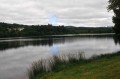
 From Lake Séchemaille to Mont Bessou via the Vézère springs.
 14.85 mi
 +1,601 ft
 -1,624 ft
 8h 15
8h 15
 Difficult
 Departure from Ambrugeat (Corrèze)
Near Meymac, Mont Bessou (976 m) is the highest point of the Millevaches Plateau. From the top of its observation tower at just under 1,000 metres, the view is simply magnificent. This hike takes you there via the Vézère springs through the Longéroux peat bogs at the foot of Puy Pendu.
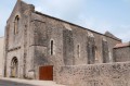
Towards Saint-Jean d'Orbestier Abbey
 8.15 mi
+164 ft
-138 ft
3h 55
8.15 mi
+164 ft
-138 ft
3h 55
 Average
Departure from Talmont-Saint-Hilaire (Vendée)
Average
Departure from Talmont-Saint-Hilaire (Vendée)
An easy and pleasant circular route from the port of Bourgenay via Orbestier Abbey. You will discover pleasant and peaceful paths in the first part after crossing Bourgenay following the mixed trail.
The return journey is along the seafront, taking you past the Bois de Saint-Jean before diving down to Cayola Bay and its footbridge, then following the coastline to the car park at the end of the route.
Important: see practical information.
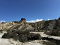
Tabernas Desert
 5.91 mi
+381 ft
-413 ft
3h 05
Average
Departure from Tabernas (Almeria)
5.91 mi
+381 ft
-413 ft
3h 05
Average
Departure from Tabernas (Almeria)
A hike of just 10km in the middle of the desert and in a western setting. It takes place in the Tabernas Desert Natural Park, north of Almeria in Spain, a desert area in an arid landscape. The American West and its canyons.
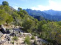
From the Moorish village of Frigiliana to the Nerja Caves
 8.00 mi
+2,093 ft
-2,595 ft
5h 30
Difficult
Departure from Frigiliana (Malaga)
8.00 mi
+2,093 ft
-2,595 ft
5h 30
Difficult
Departure from Frigiliana (Malaga)
From the coast, the Sierra de Tejeda in the park of the same name draws visitors like a magnet. This hike, lasting over 5 hours, takes you through the foothills.
Le Mont Del Fraile (Cerro del Fraile)
 4.38 mi
+1,496 ft
-1,493 ft
3h 20
Average
Departure from Níjar (Almeria)
4.38 mi
+1,496 ft
-1,493 ft
3h 20
Average
Departure from Níjar (Almeria)
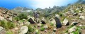
A 360° panorama of the Cabo de Gata - Nijar natural park, from the top of this peak, the highest point in the region at 493 meters above sea level. The park is of volcanic origin, and is the first maritime and terrestrial park in Andalusia. The view from the summit is magnificent, whether from the sea or the land.
Caldera de la Majada Redonda
 7.83 mi
+673 ft
-673 ft
4h 10
Average
Departure from Níjar (Almeria)
7.83 mi
+673 ft
-673 ft
4h 10
Average
Departure from Níjar (Almeria)
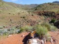
The volcano has been extinct for a long time, so you can safely explore this immense circular depression of the region’s most famous volcano. The access path naturally follows the course of a dry stream bed (rambla). We are in the Cabo de Gata-Níjar Natural Park, one of Spain’s most arid regions with its steppe-like vegetation.
Discovering the Mervent State Forest
 10.23 mi
+883 ft
-883 ft
5h 30
Average
Departure from Pissotte (Vendée)
10.23 mi
+883 ft
-883 ft
5h 30
Average
Departure from Pissotte (Vendée)
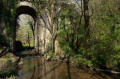
A superb hike through the largest forest in the Vendée. The terrain is varied but not particularly difficult, making it a hiker's paradise. Beautiful paths, a dam lake, a climbing site, a leisure park, a hidden cave, remarkable bridges and trees, and a forest that has been explored for many years: this is what I invite you to discover.
In the Mervent forest along the Vendée
 9.89 mi
+643 ft
-617 ft
5h 05
Average
Departure from Pissotte (Vendée)
9.89 mi
+643 ft
-617 ft
5h 05
Average
Departure from Pissotte (Vendée)
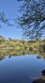
After exploring the Mervent National Forest, a lesser-known but slightly wilder route along the Mervent dam reservoir. Let's set off to explore the banks of the Vendée, passing by the Fontaine à l'Ermite, the Balingue and the Sauvaget site. Quite a programme.
Ruins of the old village of Las Cases
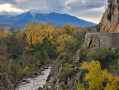 5.31 mi
+906 ft
-906 ft
3h 15
Average
Departure from Rodès (Pyrénées-Orientales)
5.31 mi
+906 ft
-906 ft
3h 15
Average
Departure from Rodès (Pyrénées-Orientales)
This is a hike that can be done even in winter and in the sunshine. We are in a region with a privileged climate. This easy circular hike of just over 8 km takes you through fragrant and colourful scrubland vegetation with the majestic Canigou massif as a backdrop.
Rocha da Pena (Rock of Pain)
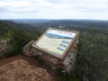 3.96 mi
+640 ft
-636 ft
2h 25
3.96 mi
+640 ft
-636 ft
2h 25
 Easy
Departure from Loulé (Faro District)
Easy
Departure from Loulé (Faro District)
All in all, an easy hike in a truly sublime, wild and rugged setting. It is a limestone plateau with scrub vegetation and magnificent views from the ridge.
Megalithic route in the Algarve
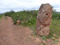 4.34 mi
+531 ft
-499 ft
2h 30
Easy
Departure from Silves (Faro District)
4.34 mi
+531 ft
-499 ft
2h 30
Easy
Departure from Silves (Faro District)
This easy, well-marked 7.5 km hike is suitable for families and takes you back to the Neolithic era through a landscape of rockroses. Discover the many menhirs and necropolises that dot this "Vale Fuzeiros" archaeological route, as indicated on the sign at the start.
Praia Grande discovery trail in the Algarve
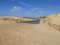 4.45 mi
+23 ft
-23 ft
2h 05
Easy
4.45 mi
+23 ft
-23 ft
2h 05
Easy
An easy walk to discover both the immense Praia Grande beach and a marshy area that is home to a large number of birds at the Salgados lagoon. All in all, a somewhat wild place.
The abandoned villages of Casesnoves and Las Cases
 10.19 mi
+2,136 ft
-2,146 ft
6h 35
Difficult
Departure from Rodès (Pyrénées-Orientales)
10.19 mi
+2,136 ft
-2,146 ft
6h 35
Difficult
Departure from Rodès (Pyrénées-Orientales)
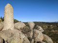
We are between the former kingdoms of Aragon and France, a superb circular hike of just over 17 km that will take you to two abandoned villages and up to Puig Pedros and its border marker. A region that is always sunny, with a splendid view of Mont Canigou through the fragrant maquis vegetation.
The sunken paths of Bourgenay
 10.12 mi
+259 ft
-256 ft
4h 55
Average
Departure from Talmont-Saint-Hilaire (Vendée)
10.12 mi
+259 ft
-256 ft
4h 55
Average
Departure from Talmont-Saint-Hilaire (Vendée)
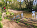
Although it’s close to the sea, I suggest you get off the beaten track, away from the crowds, and discover numerous paths on what is, all in all, an easy circular walk.
Pico Tiedu from Asiego
 6.28 mi
+2,776 ft
-2,753 ft
5h 20
Difficult
Departure from Cabrales (Asturias)
6.28 mi
+2,776 ft
-2,753 ft
5h 20
Difficult
Departure from Cabrales (Asturias)
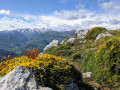
A superb view from this 1,180-metre summit in the Sierra de Cuera, which is well worth the effort. To the south, the panorama of the Picos de Europa is magnificent, whilst to the north you can see the sea. The walk starts in the pretty village of Asiego or Asiegu, which is well worth a visit.
The Seven Springs from Querença
 8.17 mi
+1,010 ft
-1,024 ft
4h 40
Average
8.17 mi
+1,010 ft
-1,024 ft
4h 40
Average
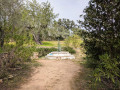
A circular route starting from Querença. Water is the central theme of this moderately difficult hike, with numerous springs and wells in this part of the Algarve.
La Table des Turcs
 6.98 mi
+249 ft
-240 ft
3h 25
Average
Departure from Méjannes-le-Clap (Gard)
6.98 mi
+249 ft
-240 ft
3h 25
Average
Departure from Méjannes-le-Clap (Gard)
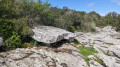
Méjannes-le-Clap, in a Natura 2000 area, is a real paradise for hikers with its well-marked trails. This easy circular route takes us to a place known as "la Table des Turcs" through the Combe de Ruph.
Covered walkways of Liscuis and Daoulas Gorges
 3.81 mi
+472 ft
-492 ft
2h 10
Easy
Departure from Laniscat (Côtes-d'Armor)
3.81 mi
+472 ft
-492 ft
2h 10
Easy
Departure from Laniscat (Côtes-d'Armor)
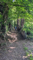
A short circular walk to discover the covered alleys listed as Historic Monuments, then the Daoulas Gorges in a somewhat wild rocky environment. A complete change of scenery guaranteed. As a bonus, and for a short 1 km detour, I suggest you visit the ruins of Notre-Dame de Bon Repos Abbey.
Roman road of Sao Bras de Alportel
3.37 mi
+778 ft
-600 ft
2h 15
Easy
Departure from Alcoutim (Faro District) (Faro District)
A circular loop of just over 5 km with no difficulty in a scrubland landscape. The first third follows an old Roman road (Calçadinha) which is well preserved and has probably been renovated in places. The rest of the route crosses scrubland where you will discover a huge, isolated rock, which is quite unusual in this landscape. The last third is on tarmac but mostly on small roads.
Le Barrocal, Chemin des Fontaines et de la Source
 5.31 mi
+518 ft
-535 ft
2h 55
Easy
Departure from Alcoutim (Faro District) (Faro District)
5.31 mi
+518 ft
-535 ft
2h 55
Easy
Departure from Alcoutim (Faro District) (Faro District)
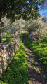
Near Sao Bras de Alportel, I invite you to discover the Barrocal, a region between the coast and the mountains of the Algarve. There are many cork oaks, whose bark is harvested, as well as many shrubs such as carob, almond and olive trees. On this easy 8.5 km hike, you will find fountains, a ford and a cave filled with spring water. The original name of this hike is "caminhos e encruzilhadas de ir à fonte", which can be found on the sign at the start, meaning "paths and crossroads leading to the spring".