Country:
 City:
City:


The car park known as La Croisée is located in Port Bourgenay in the municipality of Talmont-Saint-Hilaire.
- From Talmont-Saint-Hilaire, head towards Les Sables-d’Olonne, then after 1 km turn left towards Port Bourgenay and Querry Pigeon.
- From Les Sables-d’Olonne, head towards Talmont-Saint-Hilaire via the coastal road until you reach Port Bourgenay.
(S/E) Take the cycle path on the left, heading west towards Les Sables-d’Olonne; go round the first roundabout, pass the entrance to the Pierre & Vacances resort and cross the D129 via a tunnel at the exit of this roundabout. Turn left immediately after the tunnel and follow the golf course, which is enclosed by a high fence. The tarmac path turns at a right angle, still running alongside the golf course, then 50 m further on, take a small path on the left which leads onto a small road.
(1) Turn right onto this road for 50 metres, then immediately take the wide path opposite heading north; wooden posts are in place to prevent cars from using this path. Ignore the first turn-off on the left, which leads to the Haut du Golf housing estate; 200 metres from the start of the wide path, you’ll come to a narrow track in a slight bend.
(2) Turn left onto this path, lined with holm oaks on the left-hand side, which runs alongside a housing estate. You’ll come out onto a road leading to the Bois Marine housing estate on the right. Do not enter the housing estate but continue alongside it, then turn onto the first path on the right which crosses the hamlet of Beauregard and continue along a green corridor heading due north until you reach a wide path. Turn left and immediately take a narrow, very pleasant path on the right, lined with hedges. You’ll come out onto a wide track; follow it to the left for about a hundred metres, then turn right. Go round a sewage treatment plant and you’ll reach a crossroads.
(3) Carry on straight ahead along a wide gravel track until you reach the next crossroads. Turn left, walk past a campsite on your left, and arrive at the junction with Rue du Porteau.
Cross this road with care, then follow the tarmac dead-end track straight ahead towards La Petite Girardière for about 1 km.
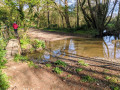
(4) Walk past this hamlet and the guesthouse, then continue straight ahead along a narrow sunken track that descends towards the Combe stream. You’ll reach thefirst ford.
(5) Do not take the path on the right, which disappears into the fields, but carry on to the left. A footbridge made of two large planks allows you to cross the ford on the left-hand side. Follow the path uphill, ignoring any tracks or paths to the left, but take the first one on the right.
(6) Follow this; it is one of the Olonnes cycle and footpaths, the ‘chemin de ronde’. At the first junction, head down to the right towards the Combe stream once more and reach thesecond ford.
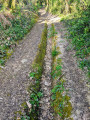
(7) Cross it or use the footbridge on the left. Follow this sunken – or even very sunken – track, which can be very wet depending on the time of year.
Alternative route here: if the path is impassable – which would be a real shame – head up alongside the field on the right-hand side as soon as you leave the ford, stay along the path without damaging the meadow, and come out at the first exit a little further up.
You will then come out onto a wide path. Continue along this lovely path until you reach a tarmac road with a holiday village on your right. After about 100 metres, turn left onto a green lane – this is the rampart walk.
(8) Walk through the hamlet of Petit Fradin until you reach the crossroads opposite the Malbrande racecourse. Turn left to reach a large roundabout on the D949.
(9) Cross this roundabout carefully at the pedestrian crossings, as this is a very busy road – the main route between Talmont, Saint-Hilaire and Les Sables-d’Olonne. Continue straight on along a small road for about 300 metres and, at the first left-hand bend in the road, take a wide track directly opposite. A little further on, leave the track on your left and carry on straight ahead along this track, which is unfortunately often rutted by farm machinery. Pass the first track on your right, carry on straight ahead; the track improves considerably until you reach a road, which you follow to the right for about 300 m. You’ll arrive at the junction with the D949.
(10) This is a very dangerous crossing; there is no protected crossing and the road is very busy. Carry on straight ahead and you will soon reach a wide track which initially descends through an area with damp ditches and a pond on the left. Ignore the tracks to the left or right. Towards the end, this long track turns into a sunken lane, leading to a road at a place called La Maroterie. Carry on along the road and turn left at the first junction. Head downhill and cross over the Ruisseau des Hautes Mer. After this bridge, you’ll reach a path that winds sharply to the right.
(11) Walk down across rocky slabs, which may be wet depending on the time of year. At the lowest point, head back up to the left. You’ll reach the road known as the ‘Route du Calvaire’ and then the roundabout of the same name.
(12) Cross the roundabout using the pedestrian crossings: Watch out for cars at this junction. Ignore the road on the right leading to Port Bourgenay or Le Querry Pigeon and take the road opposite La Clartière, which descends gently. Pass a path on the right to join the cycle path at the junction.
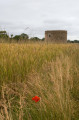
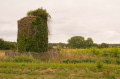
(13) Turn right onto the cycle path, then take the first path on the right. Pass in front of an old dovecote, then alongside a newly restored old pivot mill.
(14) Immediately after the post mill, carry on straight ahead along the road, pass a cul-de-sac on the left, continue along Rue de Germinal and enter the village of Les Hautes Mers. Ignore the road leading uphill to the left and continue downhill until you find yourself facing the marsh. Walk along the right-hand side of the marsh and the small Les Hautes Mers watercourse, crossing it via a small footbridge.
(15) Head up a small sunken path, then follow the road for about a hundred metres until you reach a dangerous junction which you’ll need to cross.
(16) The road you need to follow is opposite, but it is best to first take the road on the left for a few metres and cross at the pedestrian crossing in front of the bus stop. Then rejoin the main road known as the Route des Forges. Walk past the glassblower’s workshop at the old forges, then rejoin a stony path. A little further on, on the left, is the memorial to the airmen who died during theSecond World War. Turn left onto the path leading towards a large aerial.
Carry on straight ahead at the crossroads by the mast, walk alongside the golf course on the left and return to the original crossroads you passed on the way out.
(2) Follow the route in the opposite direction to the one taken on the way there to return to the car park known as La Croisée (S/E)

 Visorando Member

 Easy
Easy