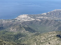
From the Moorish village of Frigiliana to the Nerja Caves

From the coast, the Sierra de Tejeda in the park of the same name draws visitors like a magnet. This hike, lasting over 5 hours, takes you through the foothills.

Details

1053517
Creation:
Last update:
Last review:
  • Walking
    Activity: Walking
  • ↔
    Distance: 8.00 mi
  • ◔
    Average duration: 5h 30 
  • ▲
    Difficulty: Difficult

  • ⚐
    Back to start: No
  • ↗
    Ascent: + 2,093 ft
  • ↘
    Descent: - 2,595 ft

  • ▲
    Highest point: 1,923 ft
  • ▼
    Lowest point: 472 ft
  • ⚐ Country: Spain
  • ⚐ City: Frigiliana 
  • ⚑
    Start: N 36.790814° / W 3.894537°
  • ⚑
    End: N 36.761715° / W 3.847705°
  • Hour-by-hour weather

Photos

Description of the walk

The start of this walk is just below the Tourist Office in the village of Frigiliana.

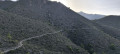
(S) Head down an alleyway due east (the Camino Boticario); there are signposts at the start:GR®242Nerja 14.6 km. You’ll soon reach the Rio Higueron; follow it northwards. The path isn’t always obvious, but it follows the riverbed as best it can, sometimes on one side, sometimes on the other. It also runs alongside the water pipe; you can’t go wrong as you simply need to follow the river.
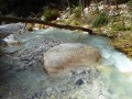
Important note: this walk was undertaken in March 2018 when the river’s flow was still relatively strong. You’ll pass a water reservoir called ‘Pozo Batan’.

(1) A few metres further on, cross the river and head eastwards up a well-marked red-and-white signposted path. It climbs steeply before reaching the ridge at an altitude of around 460 metres.

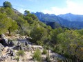
(2) Follow the ridge path due north. As you turn round, you can already enjoy some beautiful views of the sea in the distance. A little further on, you’ll reach a pass at an altitude of 485m.

(3) Take the path to the right; at this point, there are no red and white markings but there is a sign indicating the walking time to Nerja.
The path plunges down through the moorland, crosses a stream – the Arroyo de Los Garzos – before climbing back up to a second pass, not marked on maps, at an altitude of around 480m.

(4) Begin a gentle descent, passing a sign for Pozo de Cal (ruins of walls). Cross the stream bed again, then climb back up to 530m (another pass). Descend gradually to reach the Río Chillar.

(5) Cross the river to reach the opposite bank.
Note: due to the current, the crossing was made a few metres further downstream; a fallen tree allowed us to cross the torrent after taking off our shoes.
Continue the ascent south-eastwards, cutting across the contour lines before joining a wide path at around 550m.

(6) Follow this balcony-like path, which gradually heads south. Reach an unnamed pass, clearly marked and accessible to off-road vehicles.

(7) Continue eastwards following the red and whiteGR® markings, then, after a hairpin bend, head due south and arrive at a vast, level area. Here, you’ll cross a wide path.

(8) Follow it, descending gently for 1 hour until you reach the finish (E) near the Cueva de Nerja (cave).

Waypoints

  1. S : mi 0 - alt. 984 ft - The GR242 starts just below the Tourist Office
  2. 1 : mi 0.7 - alt. 925 ft - Pozo Batan
  3. 2 : mi 1.17 - alt. 1,470 ft - Ridge
  4. 3 : mi 1.42 - alt. 1,558 ft - Pass
  5. 4 : mi 1.93 - alt. 1,486 ft - 2nd pass
  6. 5 : mi 3.29 - alt. 1,165 ft - Rio Chillard
  7. 6 : mi 3.96 - alt. 1,775 ft - Wide path
  8. 7 : mi 4.51 - alt. 1,745 ft - Unnamed pass
  9. 8 : mi 5 - alt. 1,509 ft - Wide, flat area
  10. E : mi 8 - alt. 479 ft - Car park

Notes

(8) This is a picnic and barbecue area in the heart of El Pinarillo Natural Park. There are toilets.
Buses run a shuttle service between Nerja and Frigiliana in both directions; enquire either at the Tourist Office or at the Nerja bus stop. There are frequent services during the tourist season.
Hiking boots are recommended.
At the start of the season, the water flow is strong enough to make crossing the streams tricky.

Worth a visit

Don’t forget your camera – the scenery is superb.

Always be cautious and plan ahead when you're outdoors. Visorando and the author of this route cannot be held responsible for any accidents occurring on this route.

The GR® and PR® markings are the intellectual property of the Fédération Française de Randonnée Pédestre.

Reviews and comments

4.7 / 5
Based on 2 reviews

Reliability of the description
4.5 / 5
Ease of following the route
5 / 5
Route interest
4.5 / 5
CATBER
CATBER

Overall rating : 4.7 / 5

Date of your route : Jun 29, 2025
Reliability of the description : ★★★★☆ Good
Ease of following the route : ★★★★★ Very good
Route interest : ★★★★★ Very good
Very busy route : No

I did this route at the end of June as a trail run, leaving Nerja on the 7:20 bus and arriving 10 minutes later in Frigiliana. At that time of day, all the climbs were in the shade except for the end of the last one, which was very pleasant in the Andalusian heat... I couldn't find any water at picnic spot no. 8. A good kilometre after this point, on the advice of the previous comment, I took the path on the right (straight ahead in a left-hand bend). The descent to the stream is a little technical, but after that it's pure bliss, a short, very fast gravel single track, all in the shade and almost cool... With vegetation and bits of caves, you arrive a few hundred metres west of the Nerja caves, which you can visit or, like me, pass under the motorway to return to the town. A great holiday ride!

Machine-translated

olivier.matricon
olivier.matricon

Overall rating : 4.7 / 5

Date of your route : Feb 21, 2019
Reliability of the description : ★★★★★ Very good
Ease of following the route : ★★★★★ Very good
Route interest : ★★★★☆ Good

Park at the Nerja Caves (Cueva de Nerja); there’s a free, unpaved car park on the left just before the one for the caves. To get to Frigiliana, please note that you’ll need to take two buses: one from the caves to Nerja (€1.18) and one from Nerja to Frigiliana (€1.15). the timetables are almost identical, so you’ll need to plan ahead; the stops are a bit hidden, but you must get off at the terminus at the top of Frigiliana. Be sure to wander through the historic village – the narrow streets and the views are magnificent.
The start is right next to the bus stop (20 metres to the right before the bus terminus).
It’s impressive – you walk 100 metres beneath the village and you’re out in the countryside.
At point 3, there’s no sign showing the distance, but there’s no mistaking it – it’s definitely on the right. You walk through the heath – it’s lovely!
The only downside from the picnic/camping area… is the 4 km descent along a very wide path to reach the Nerja Caves – it’s a bit monotonous, though you might want to take the path through the canyon on the right. It took us 4½ hours as a pair, including breaks.

Machine-translated

For more walks, use our search engine .

The GPS track and description are the property of this route's author. Please do not copy them without permission.