Pico Tiedu from Asiego

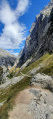
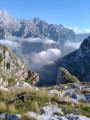
A superb view from this 1,180-metre summit in the Sierra de Cuera, which is well worth the effort. To the south, the panorama of the Picos de Europa is magnificent, whilst to the north you can see the sea. The walk starts in the pretty village of Asiego or Asiegu, which is well worth a visit.

Details

22346898
Creation:
Last update:
Last review:
  • Walking
    Activity: Walking
  • ↔
    Distance: 6.28 mi
  • ◔
    Average duration: 5h 20 
  • ▲
    Difficulty: Difficult

  • ⚐
    Back to start: Yes
  • ↗
    Ascent: + 2,776 ft
  • ↘
    Descent: - 2,753 ft

  • ▲
    Highest point: 3,904 ft
  • ▼
    Lowest point: 1,371 ft

Photos

Description of the walk

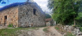
(S/E) Set off from the church, which offers a lovely view over the valley. Head due north towards the top of the village. At the first junction, turn left, then immediately right into the narrow lane that passes in front of the village’s only bar-restaurant (you can stop there on the way back!). At the end of the lane, turn left, then take a tiny lane on the right which climbs to reach, a little further up, a pretty decorated fountain (the top of the village).

(1) In front of the fountain, take the street on the right and then immediately turn left. Walk past a farmhouse, then take the path that climbs northwards. You’ll reach a road that circles the village.

(2) Cross the road and take the concrete path opposite, which is marked with zebra crossings to make it easier for vehicles (shepherds’ vehicles) to climb the hill. You’ll pass under three high-voltage power lines in succession. Go through a cattle grid as you cross a ridge and continue along this clearly marked path, which alternates between concrete and gravel sections depending on the steepness of the slopes. At an altitude of 787 m, you’ll reach the Tebrondi sheepfolds (named after the nearby peak).

(3) A few sheepfolds have clearly been restored; the spot is peaceful and idyllic, with a lovely view. From here, the path descends for about a hundred metres to a pass at 783 m and arrives in front of a corral-style livestock enclosure. During this short descent, you can clearly see the tracks leading up into the pastures slightly to the right, which you will take.

(4) At the entrance to the corral (livestock pen), do not take the path on the right which descends towards the east. You must cross the corral (which was open on both occasions we passed through) and head uphill to find a track that climbs to the right at first, then to the left, and so on, always heading north. The track is clearly visible. You will come to a metal gate.

(5) Go through the gate, taking care to close it behind you. You can see some buildings (old sheepfolds) through a copse of trees. Walk past a converted sheepfold on the right and head north-east, passing between rows of low stone walls. Follow the path which climbs steeply westwards along the ash trees.

(6) Once past the last trees (I made a cairn at this spot), continue along the clearly marked path heading north-east. In the distance, you can make out a metal cross which serves as a landmark.

(7) Climb up to the cross, where the view is already magnificent, just to get a sense of the ascent to the peak to the north amongst the rocky cliffs. There are no obvious paths amongst the numerous cattle tracks.
Leave the path you arrived on, which continues along the floor of a small valley dotted with numerous barns (Vega de Branes).

Make sure you spot the final grassy section leading towards the summit, as this is the route to reach the gap just before the summit. Here we go: from the cross, head back down the path and take the first track heading north-west for about 200 m, then climb towards the final grassy slope, either directly up the slope or zigzagging a few times to make the climb easier through the grass. You’ll approach the clearly visible gap.

(8) A steep but straightforward path crosses the gap and climbs to the summit along the ridge.

(9) Summit of Pico Tiedu at 1,180 m . 360° view. Right next to it, to the north, is the summit of Cabeza Ubena (1,187 m).
The return journey follows the same route back to El Compote.

(2) At the crossroads, this time take the road on the right to enjoy another view of the village and reach the Church of San Miguel (S/E).

Waypoints

  1. S/E : mi 0 - alt. 1,371 ft - San-Miguel Church
  2. 1 : mi 0.08 - alt. 1,404 ft - Fontaine
  3. 2 : mi 0.2 - alt. 1,496 ft - Route
  4. 3 : mi 1.86 - alt. 2,562 ft - Sheepfolds
  5. 4 : mi 1.97 - alt. 2,559 ft - Livestock enclosure
  6. 5 : mi 2.26 - alt. 2,979 ft - Metal gate
  7. 6 : mi 2.36 - alt. 3,094 ft - A cairn at the end of the last trees
  8. 7 : mi 2.52 - alt. 3,176 ft - Metal cross
  9. 8 : mi 3.01 - alt. 3,822 ft - Brèche
  10. 9 : mi 3.08 - alt. 3,898 ft - Pico Tiedu
  11. S/E : mi 6.28 - alt. 1,371 ft - San-Miguel Church

Notes

We did this walk in May 2022.
There are no signposts.
Do not attempt this walk in foggy conditions, as the final third of the route after the corral is either on narrow paths or even off-trail (we had to turn back once). It is easy to find your way in good weather.
The final ascent to the peak takes place across a steep meadow, with the summit serving as a visual landmark; this is reached via a grassy gap visible from the base.
The GPX tracks accurately follow our route without any alterations.
Make sure you take water with you.
There are herds of goats, sheep and cows (including bulls!).
When we did this walk, there were lots of calves and the cows were keeping a close eye on their young. As a precaution, it’s best to keep your distance.
There are three car parks in the village, including a three-space car park dedicated solely to motorhomes at the entrance to the village on the right-hand side as you arrive. There is another car park at the entrance to the village on the left-hand side and a further one on a plateau at the exit.
The walk is rated as difficult due to the lack of signposting and a final climb off the beaten track.

Worth a visit

There is a bar-restaurant in the centre of the village. It serves excellent food made with local produce; the cider is craft-brewed and the owner speaks a little French.
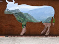
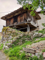
The village is set on a hillside with very steep alleyways; it still has the granaries typical of Asturias (horreos). At the top of the village there is a beautiful fountain and some lovely cut-outs in steel plates, perfect for taking original photos.
You’ll come across numerous sheepfolds during the walk, some of which have been superbly restored.
The view from the summit is spectacular. Don’t forget your camera and a pair of binoculars.
There is a lovely picnic area on the access road to the village, halfway between Carrena and Assiegu.

Reviews and comments

4.8 / 5
Based on 2 reviews

Reliability of the description
5 / 5
Ease of following the route
4.5 / 5
Route interest
5 / 5
User 27216776

Overall rating : 5 / 5

Date of your route : Aug 13, 2025
Reliability of the description : ★★★★★ Very good
Ease of following the route : ★★★★★ Very good
Route interest : ★★★★★ Very good
Very busy route : No

This hike is classified as difficult and really tough, with some steep climbs, especially at the start and end.
Difficult navigation at the end of the route but no problem with GPS tracking.
Lots of mist and fog, crossing semi-wild cows, incredible atmosphere!
You feel completely immersed in unspoilt nature.
Splendid view when the fog lifts. Temperatures always around 20 degrees. It took us 5 hours walking at a good pace with a short break for lunch.

Machine-translated

pagueri
pagueri

Overall rating : 4.7 / 5

Date of your route : Jun 16, 2024
Reliability of the description : ★★★★★ Very good
Ease of following the route : ★★★★☆ Good
Route interest : ★★★★★ Very good
Very busy route : No

A lovely walk, with no major difficulties apart from a very steep track at the start and a slightly tricky route through the pastures in the final third of the ascent, as the paths are poorly marked. But by eye (or by following the GPS track), you can make your way up without any trouble.
At the summit, the panoramic view is superb, with the ocean to the north and the Picos mountain range to the south (when the clouds allow ).
For the descent, just for a change, we carried on straight along the ‘ridge’ (heading north, in other words), then made our way down to the hollow below (with a few rocky sections to negotiate), where we picked up some intermittent paths leading back to the 783-metre pass. A lovely circular loop amongst the peaceful herds....
A well-deserved beer (or cider...) in the pretty village of Asiegu.
A big thank you to the author of this walk!

Machine-translated

Other walks in the area

For more walks, use our search engine .

The GPS track and description are the property of this route's author. Please do not copy them without permission.