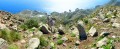
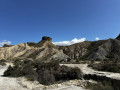
Caldera de la Majada Redonda

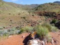
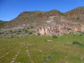
The volcano has been extinct for a long time, so you can safely explore this immense circular depression of the region’s most famous volcano. The access path naturally follows the course of a dry stream bed (rambla). We are in the Cabo de Gata-Níjar Natural Park, one of Spain’s most arid regions with its steppe-like vegetation.

Details

1070137
Creation:
Last update:
Last review:
  • Walking
    Activity: Walking
  • ↔
    Distance: 7.83 mi
  • ◔
    Average duration: 4h 10 
  • ▲
    Difficulty: Moderate

  • ⚐
    Back to start: Yes
  • ↗
    Ascent: + 673 ft
  • ↘
    Descent: - 673 ft

  • ▲
    Highest point: 745 ft
  • ▼
    Lowest point: 62 ft

Photos

Description of the walk

Take exit 479 off the A-7 (Nijar–San Isidro–San José), continue for 20 km and follow the signs to San José, then take the exit on the right towards Los Escullos–La Isleta–Rodalquiar. Continue for 3 minutes (3 km) then park in front of the Los Escullos campsite.

(S/E) Head south-east for a few metres and take the path on the left at the first junction, heading straight up north-west into the bed of the dry river, which is unfortunately being used as a rubbish tip. You’ll very quickly reach the access road to the campsite, which you’ll need to cross.

(1) Continue due west for a few hundred metres, then the path veers north and leads to a tunnel – or rather a very large culvert – which you must go through to cross the road.

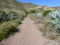
(2) After passing through the culvert, the sandy path heads north-west along the riverbed and becomes increasingly pleasant as it winds through the vegetation. Follow the path as it curves northwards and reaches a first junction. Ignore the private track on the right and continue straight ahead for about a hundred metres to reach a small car park with an information board.

(3) Take the path heading north-west, following the riverbed as it winds several times through lush vegetation. A few metres before a right-hand bend, you’ll spot some ruins on a hill to your left.

(4) To reach them, take a path on the left near an abandoned, fenced-off well. The path climbs to a ruined building about a hundred metres away. The site is notable for the stone paving on the terrace.

(5) Return to the previous junction.

(4) Continue left for a few metres, then leave the wide path heading due north to follow a track heading east through the dry stream bed. Carry on until you reach the entrance to the caldera. Signs, in Spanish, explain the site.

(6) Follow the well-marked path to better explore and appreciate this immense circular depression. Finish the walk at the 220-metre mark.

(7) Begin the return journey along the same route to the crossroads in the village of Presillas Bajas.

(3) Turn left onto the access road to the village of Presillas Bajas. Walk the length of the road that runs through this village with its white houses and blue shutters.

(8) Return to the previous crossroads.

(3) Follow the route you took on the way there until you reach the first crossroads.

(1) This time, take the road to the car park in front of the campsite (S/E).

Waypoints

  1. S/E : mi 0 - alt. 72 ft - Park in front of the Los Escullo campsite
  2. 1 : mi 0.4 - alt. 102 ft - Access route to the campsite
  3. 2 : mi 0.75 - alt. 148 ft - Tunnel
  4. 3 : mi 1.76 - alt. 302 ft - Car park
  5. 4 : mi 2.7 - alt. 456 ft - Junction, turn left
  6. 5 : mi 2.76 - alt. 479 ft - Ruins
  7. 6 : mi 3.44 - alt. 620 ft - Caldera
  8. 7 : mi 3.78 - alt. 745 ft - Elevation 220
  9. 8 : mi 5.91 - alt. 344 ft - Presillas Bajas
  10. S/E : mi 7.84 - alt. 72 ft - Park in front of the Los Escullo campsite.

Notes

Make sure you bring water; there are no water sources along the trail.
No difficulty; the terrain is flat but quite sandy.
You can drive to the village of Presillas Bajas; the walk from there takes 2 hours there and back.

Worth a visit

Enjoy the 360° panoramic view in the centre of the caldera.
Walk along the rambla, this dry riverbed.
Exceptional steppe-like vegetation.

Reviews and comments

4.3 / 5
Based on 4 reviews

Reliability of the description
4.5 / 5
Ease of following the route
4.5 / 5
Route interest
3.8 / 5
gogo57
gogo57

Overall rating : 4 / 5

Date of your route : May 09, 2026
Reliability of the description : ★★★★☆ Good
Ease of following the route : ★★★★☆ Good
Route interest : ★★★★☆ Good
Very busy route : No

To avoid the first section, half of which runs along the dry riverbed (as mentioned in the previous review), we wanted to start from Presillas Bajas. We’re travelling in a motorhome and, unfortunately, the only car park in Presillas Bajas expressly prohibits motorhomes. So we parked on the road leading to Presillas Bajas and walked the last 300 metres to the start of the route.
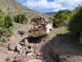
We really enjoyed this section of the walk (8.8 km in 2 hours 40 minutes) and came across this old, battered Simca 1000 (see photo) that seemed to have appeared out of nowhere.

Machine-translated

Pierlo
Pierlo

Overall rating : 4.3 / 5

Date of your route : Sep 25, 2024
Reliability of the description : ★★★★★ Very good
Ease of following the route : ★★★★★ Very good
Route interest : ★★★☆☆ Average
Very busy route : No

Mixed feelings about this walk, half of which takes place in the dry riverbed. As a result, you walk for a long time without any views or open spaces. Furthermore, the riverbed consists of sand and small pebbles, which makes progress difficult. The view upon reaching the Caldera is stunning and, indeed, one feels very small in the face of the tectonic upheavals that have taken place here. Thank you for sharing.

Machine-translated

Pep 64
Pep 64

Overall rating : 3.7 / 5

Date of your route : Sep 07, 2024
Reliability of the description : ★★★★☆ Good
Ease of following the route : ★★★★☆ Good
Route interest : ★★★☆☆ Average
Very busy route : No

I think this route is mainly used by mountain bikers – there are lots of tyre tracks on the path. As for the scenery, though, there isn’t much variety along the way.

Machine-translated

Mogette
Mogette

Hello
Thank you for your comment. I read that you’ve done both hikes in the area, including the one to the summit of Mount Del Fraile. Well done.
Joël

Machine-translated

titibof
titibof

Overall rating : 5 / 5

Date of your route : Jun 25, 2023
Reliability of the description : ★★★★★ Very good
Ease of following the route : ★★★★★ Very good
Route interest : ★★★★★ Very good
Very busy route : No

There weren’t any reviews yet for this walk, which we thought was brilliant. The start is a bit monotonous along the riverbed with its sandy ground, but after the village of Presillas, there’s a lovely little, well-signposted path that winds its way around the river’s bends. It’s actually hard to get lost, as you follow the (dry) river practically all the way to the end. The ruins are well worth a look, and at the end of the walk you feel very small in this immense ‘caldera’. It was a little longer than advertised, but the walk is easy with a gentle, steady climb.

Machine-translated

For more walks, use our search engine .

The GPS track and description are the property of this route's author. Please do not copy them without permission.