


Christian Billiard

 Visorando Member
 Premium user
 - Location: Gruissan (11430)
- Gender: man
Sign up:
Published route(s)
 Circular walk starting from L’Abeuradou
 9.42 mi
 +2,231 ft
 -2,218 ft
 6h 15
6h 15
 Difficult
 Departure from Félines-Minervois (Hérault)
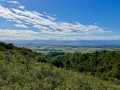
A lovely walk in this area, well known for its two PR® trails in Caunes-Minervois and Félines-Minervois: the Marble Quarries Route. To create this circular route, off the beaten track, we spent several days ‘working’ to find the best route, clearing certain sections overgrown with vegetation and marking the paths we created with Yellow Circles. In the marble quarries, you can really appreciate the titanic effort put in by the workers at the start of the 20th century. Information boards explain how the various quarries we come across used to operate.
In the vicinity of Saint-Félix-de-l'Héras
 9.86 mi
+791 ft
-791 ft
5h 15
9.86 mi
+791 ft
-791 ft
5h 15
 Moderate
Departure from Saint-Félix-de-l'Héras (Hérault)
Moderate
Departure from Saint-Félix-de-l'Héras (Hérault)
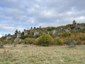
A pleasant hike in three stages. The first part crosses vast areas of pastureland, the second allows you to wander through a "lunar" landscape amid dolomitic rocks, and the third, in the undergrowth, runs alongside streams that you have to cross. This diversity of landscapes makes this hike easy and interesting.
Citou circular loop
 6.42 mi
+2,300 ft
-2,310 ft
4h 55
Moderate
Departure from Citou (Aude)
6.42 mi
+2,300 ft
-2,310 ft
4h 55
Moderate
Departure from Citou (Aude)
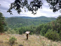
A beautiful circular route starting from the village of Citou. Almost the entire hike takes place in the woods, so it is feasible in hot weather. A passage along the ridge at the highest points of the route offers beautiful views of the surrounding area, particularly the village of Lespinassière.
Summit of La Bourrasse
 9.57 mi
+3,091 ft
-3,081 ft
7h 05
Difficult
Departure from Citou (Aude)
9.57 mi
+3,091 ft
-3,081 ft
7h 05
Difficult
Departure from Citou (Aude)
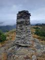
Starting from Citou, this circular route takes you on a route that winds along the western slopes of the massif, including the ascent to the summit of La Bourasse. Sections along the ridge offer interesting views over the Montagne Noire as far as the Minervois plain.
The Gorges de Colombières via the Col de la Buffe
 5.84 mi
+2,510 ft
-2,503 ft
4h 50
Difficult
Departure from Colombières-sur-Orb (Hérault)
5.84 mi
+2,510 ft
-2,503 ft
4h 50
Difficult
Departure from Colombières-sur-Orb (Hérault)
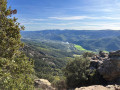
A different kind of hike in the Gorges de Colombières. The ascent along the left bank of the Ruisseau d’Arles offers a more challenging hike than the PR® route, which lies further to the east and leads to the same spot. Almost uninterrupted views of the gorge throughout the climb allow you to see the western slope of the Gorges. Another way to explore them.
La Clape off the beaten track
 7.41 mi
+1,017 ft
-988 ft
4h 20
7.41 mi
+1,017 ft
-988 ft
4h 20
 Easy
Departure from Narbonne (Aude)
Easy
Departure from Narbonne (Aude)
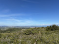
Circular route on the Montagne de la Clape passing close to the Chapel of Notre-Dame des Auzills.
The Las Aygos and Coudel passes
 10.20 mi
+2,382 ft
-2,369 ft
6h 45
Moderate
Departure from Cabrespine (Aude)
10.20 mi
+2,382 ft
-2,369 ft
6h 45
Moderate
Departure from Cabrespine (Aude)
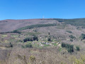
In good weather, the view of the Pyrenees is incredible. On that day, following heavy snowfall – exceptional for the season – the snow-capped peaks were visible from the Canigou Massif all the way to the Maladetta Massif, taking in the highest peaks of Cerdagne, the 3,000-metre peaks of Ariège, and the peaks over 3,000 metres in the Luchon region. Closer by and all around, the entire Montagne Noire, with the Pic de Nore transmission mast standing at its highest point.
Canyon du Diable
 3.69 mi
+476 ft
-476 ft
2h 05
Easy
Departure from Saint-Jean-de-la-Blaquière (Hérault)
3.69 mi
+476 ft
-476 ft
2h 05
Easy
Departure from Saint-Jean-de-la-Blaquière (Hérault)
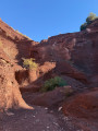
During the walk entitled ‘The Devil’s Canyon and Gibret’s Cross’, we discovered the extraordinary part of the canyon. The walk described today, which offers a striking contrast in scenery, covers only the canyon section. It is an exceptional geological site that we wanted to show our friends without having to repeat the long hike we’d done previously. It lies within a very distinctive geological formation known as ‘ruffe’ (a term used in the Hérault to describe the red soils formed from pelites). The hike is a round trip and presents no particular difficulties.
The Moulin de Biot and the marble quarries via Ventajou
 8.25 mi
+1,660 ft
-1,657 ft
5h 15
Moderate
Departure from Félines-Minervois (Hérault)
8.25 mi
+1,660 ft
-1,657 ft
5h 15
Moderate
Departure from Félines-Minervois (Hérault)
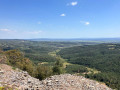
This hike, partly off the marked trails, allows you to see the hamlet of Biot, its quarry and its mill. As you pass the marble quarries (you will cross four during the hike), you will understand the titanic work carried out by our ancestors during the last century. The hike ends with a long, safe cliff-top path offering spectacular views of the Minervois plain and, beyond, the Corbières massif. In good weather, you can see the Pyrenees in the distance.
The Ilhes circular route
 14.03 mi
+3,432 ft
-3,432 ft
9h 25
Difficult
Departure from Les Ilhes (Aude)
14.03 mi
+3,432 ft
-3,432 ft
9h 25
Difficult
Departure from Les Ilhes (Aude)
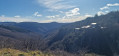
Starting from the small village of Les Ilhes-Cabardès, this circular walk takes you past two villages in the Cabardès region, each boasting churches as striking as the next – the main attractions of these small communities, somewhat tucked away in the corners of the Montagne Noire.
Towards the Ruisseau du Cros and Font dal Rainard
 8.42 mi
+1,703 ft
-1,667 ft
5h 20
Moderate
Departure from Félines-Minervois (Hérault)
8.42 mi
+1,703 ft
-1,667 ft
5h 20
Moderate
Departure from Félines-Minervois (Hérault)
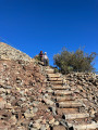
This hike offers a variety of landscapes and trails in the Félines-Minervois marble quarry area. The passage along trails that we have recently opened up allows you to discover places that are little known or unknown.
An unusual discovery of an area of the Montagne Noire starting from Les Ilhes.
 14.23 mi
+3,809 ft
-3,789 ft
9h 50
14.23 mi
+3,809 ft
-3,789 ft
9h 50
 Very difficult
Departure from Les Ilhes (Aude)
Very difficult
Departure from Les Ilhes (Aude)
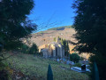
This challenging hike involves four successive ascents and descents in the foothills of the Montagne Noire. It offers a wide variety of places and views throughout the day.
To complete this loop, we have cleared a path through broom and holm oak trees. The GPX track is essential for following this section, which is approximately 400 m long, from the point (10). The rest of the hike is on well-marked trails. Note the crossing of the Ruisseau de La Grave (at an altitude of 397 m), which can be tricky if the flow is strong.
Pont de Daniel and Pont du Moulin via Minerve
 4.91 mi
+1,109 ft
-1,135 ft
3h 15
Moderate
Departure from Minerve (Hérault)
4.91 mi
+1,109 ft
-1,135 ft
3h 15
Moderate
Departure from Minerve (Hérault)
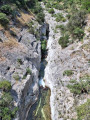
A short hike around the town of Minerve along trails that are rarely used. They offer magnificent views, but be careful if you are afraid of heights on the edges of the Brian Canyon.
From Roquo Négro to Montredon via the Ruisseau de la Grave
 5.76 mi
+1,283 ft
-1,283 ft
3h 45
Moderate
Departure from Fournes-Cabardès (Aude)
5.76 mi
+1,283 ft
-1,283 ft
3h 45
Moderate
Departure from Fournes-Cabardès (Aude)
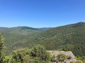
To complete a loop in the Montagne Noire on unmarked, poorly marked and rarely used paths, we have opened up a few sections of trail that allowed us to enjoy an unusual experience in a little-known area. If you like adventure, don't forget to take the GPX track with you!
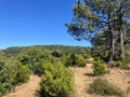
Steep ridges in the Soulanes de Nore Forest south of the Montagne Noire.
 7.60 mi
+2,172 ft
-2,178 ft
5h 25
Difficult
Departure from Fournes-Cabardès (Aude)
7.60 mi
+2,172 ft
-2,178 ft
5h 25
Difficult
Departure from Fournes-Cabardès (Aude)
Loop, on little-known trails or ones we create, reserved for experienced walkers who are willing to follow the GPX track and are not afraid to take poorly marked trails, most of which are unmarked.
Loop starting from Le Pin
 7.66 mi
+2,454 ft
-2,451 ft
5h 40
Moderate
Departure from Vieussan (Hérault)
7.66 mi
+2,454 ft
-2,451 ft
5h 40
Moderate
Departure from Vieussan (Hérault)
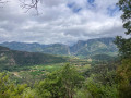
This hike offers beautiful views of the foothills of the Massif Central and the plain to the south, with the Orb valley winding at the foot of the slope, and to the north, facing the Carroux massif and the Gorges d'Héric.
Cosprons, Banyuls and Paulilles from Cap Béar
 10.10 mi
+1,749 ft
-1,759 ft
6h 10
Moderate
Departure from Port-Vendres (Pyrénées-Orientales)
10.10 mi
+1,749 ft
-1,759 ft
6h 10
Moderate
Departure from Port-Vendres (Pyrénées-Orientales)
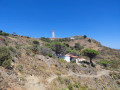
A walk between land and sea. From Cap Béar, the path leading to Port-Vendres offers a beautiful panoramic view of the harbour and the town. The route then winds its way through vineyards and pine forests to Banyuls-sur-Mer. From there, the coastal path follows the rugged coastline with its small sandy beaches and rocky coves known as ‘calas’ in Catalan. This walk reveals a striking contrast, combining an insight into vineyard work with seaside resort life.
⚠️ This is an open-air route, so in the event of strong winds or intense heat, it is best to avoid it.
⚠️ Check whether the coastal path linking Argelès-sur-Mer to Cerbère is open or closed here before setting off on this walk.
Batère Tower via the Col de Formentera
 8.90 mi
+2,907 ft
-2,933 ft
6h 40
Moderate
Departure from Taulis (Pyrénées-Orientales)
8.90 mi
+2,907 ft
-2,933 ft
6h 40
Moderate
Departure from Taulis (Pyrénées-Orientales)
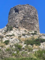
This is a beautiful round-trip hike that can be done in summer as it takes place mostly in the woods and on the northern slope for the most part. The trail markings, which were recently redone (PR® Yellow), make it easy to follow the path from Taulis to the Col de Formentera. The Tour de Batère, at the end of the hike, crowns the outing with beautiful 360° views.
Los Masos loop via three refuges
 12.06 mi
+3,917 ft
-3,904 ft
8h 55
Difficult
Departure from Valmanya (Pyrénées-Orientales)
12.06 mi
+3,917 ft
-3,904 ft
8h 55
Difficult
Departure from Valmanya (Pyrénées-Orientales)
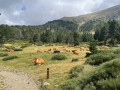
This loop takes you to the Refuge des Cortalets (manned) at the foot of Canigou, passing by the Abri du Pinatell on the way there and the Refuge de Prat-Cabrera on the way back. This less frequented route is longer but gentler. The magnificent landscapes along the way are full of charm. The return, which is steeper, offers fewer views of the Canigou massif. We really enjoyed this version. From the Refuge des Cortalets, you can make a round trip to the summit of Canigou.
Short loop around Mont Marcou
 6.85 mi
+2,510 ft
-2,510 ft
5h 20
Moderate
Departure from Saint-Geniès-de-Varensal (Hérault)
6.85 mi
+2,510 ft
-2,510 ft
5h 20
Moderate
Departure from Saint-Geniès-de-Varensal (Hérault)
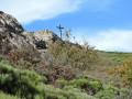
This hike forms a loop with a 360° view at the highest point, offering a magnificent panorama of the sea, the Carroux plateau and all the mountains to the north and east of this remarkable dome: Mont Marcou. The climb is quite demanding with steep slopes where you sometimes have to use your hands to climb rocky passages. The descent also has some fairly steep sections. This hike may therefore be difficult for some. However, the first 45 minutes allow you to warm up before tackling the tough climb to the antennas. A beautiful route.
From Thuir-d'Évol to the Mouline refuge
 8.60 mi
+2,487 ft
-2,493 ft
6h 05
Moderate
Departure from Olette (Pyrénées-Orientales)
8.60 mi
+2,487 ft
-2,493 ft
6h 05
Moderate
Departure from Olette (Pyrénées-Orientales)
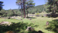
This is a very pleasant round trip hike in hot weather. Inspired by the Visorando publication of the loop entitled "Le Camì Ramader, le Refuge de la Mouline depuis Évol", it has the advantage of following the course of the Evol stream, allowing you to cool off regularly. Much of the route is through woodland, and the shade provided by the various trees, which change species as you climb, offers welcome respite from the heat.
The Caroux Plateau via the Saut de l'Âne and the Roc de Boutou
 5.25 mi
+2,956 ft
-2,949 ft
5h 00
Difficult
Departure from Saint-Martin-de-l'Arçon (Hérault)
5.25 mi
+2,956 ft
-2,949 ft
5h 00
Difficult
Departure from Saint-Martin-de-l'Arçon (Hérault)
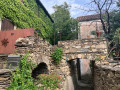
Climb up a little-used path to reach the Caroux plateau. Challenging due to its configuration, the ascent in this part of the massif is wilder than the usual access routes. This hike is for experienced walkers, as the route is not always easy to find and some passages are a little difficult or exposed, but not dangerous.
Tour Madeloc loop with nine passes
 11.31 mi
+2,621 ft
-2,628 ft
7h 30
Difficult
Departure from Banyuls-sur-Mer (Pyrénées-Orientales)
11.31 mi
+2,621 ft
-2,628 ft
7h 30
Difficult
Departure from Banyuls-sur-Mer (Pyrénées-Orientales)
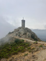
This hike offers beautiful views of the seaside resorts that we will overlook throughout the day as we pass through numerous mountain passes. From Argelès-sur-Mer to Banyuls-sur-Mer, and even beyond if the sky is clear, via Collioure and Port-Vendres, the entire Côte Vermeille stretches out before us. The final stretch in Banyuls-sur-Mer allows us to see the official GR®10 sign, the starting (or finishing) point of the Grande Randonnée trail that links this town to Hendaye (from Catalan Country to Basque Country) across the entire Pyrenees mountain range.
Pic Carlit and tour of the 12 lakes
 9.41 mi
+3,100 ft
-3,094 ft
7h 00
Difficult
Departure from Angoustrine-Villeneuve-des-Escaldes (Pyrénées-Orientales)
9.41 mi
+3,100 ft
-3,094 ft
7h 00
Difficult
Departure from Angoustrine-Villeneuve-des-Escaldes (Pyrénées-Orientales)
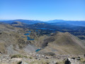
Inspired by the hike called "Puig Carlit" on Visorando, this new description takes into account the "one-way" system around the summit that was put in place two years ago. Major work carried out during this period has replaced the haphazard markings and created a well-marked path for the descent from the summit. It is essential to respect the one-way system (for the safety of walkers), which avoids difficult crossings in rocky, exposed passages where it is necessary to use your hands. The overcrowding in the area prompted us to look for an end to the route off the beaten track, so that we would no longer encounter hikers every 20 metres. What a crowd on 4 September! But we understand the enthusiasm for this wonderful mountain range, where there is something to see in every direction.
Cabrespine circular via Trassanel and the Pas de Monsarrat
 10.65 mi
+2,349 ft
-2,346 ft
6h 55
Moderate
Departure from Cabrespine (Aude)
10.65 mi
+2,349 ft
-2,346 ft
6h 55
Moderate
Departure from Cabrespine (Aude)
Between rocks, caves and passes, this hike starting from the Gouffre Géant de Cabrespine offers beautiful views of the Minervois plain, the Corbières massif and, weather permitting, the Pyrenees mountain range.
Thuir d'Evol circular via La Mouline and Llobadibes
 11.87 mi
+3,166 ft
-3,163 ft
8h 15
Difficult
Departure from Olette (Pyrénées-Orientales)
11.87 mi
+3,166 ft
-3,163 ft
8h 15
Difficult
Departure from Olette (Pyrénées-Orientales)
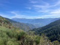
A beautiful hike with a steady climb to the Refuge de la Mouline along a well-marked trail that passes through increasingly beautiful scenery as you progress, often through woodland. After the refuge, the hike changes completely as you leave the pine forest, with a balcony walk offering impressive views of the Pyrenees mountain range, from Canigou to Cambre d'Aze. Although it does not present any technical difficulties, this hike is classified as difficult, partly because of its length but mainly because of the uncertainty in following the route after the Refuge de la Mouline, as the quality of the trail changes completely. It is essential to follow the Visorando trail to complete this circular hike off the beaten track, as it is well worth the effort. A GPS or the Visorando app is therefore strongly recommended.
Tour de Batère, Col de Formentera and Pla de les Eugues
 4.61 mi
+1,010 ft
-1,033 ft
3h 00
Moderate
Departure from Corsavy (Pyrénées-Orientales)
4.61 mi
+1,010 ft
-1,033 ft
3h 00
Moderate
Departure from Corsavy (Pyrénées-Orientales)
A short, easy walk offering beautiful views of the eastern face of the Canigou massif from the Tour de Batère. You can also see the seaside resorts of Argelès-sur-Mer and others as you head north along the coast.
From Roc du Caroux to Tour du Caroux via the orientation table
 7.56 mi
+1,713 ft
-1,696 ft
5h 00
Easy
Departure from Rosis (Hérault)
7.56 mi
+1,713 ft
-1,696 ft
5h 00
Easy
Departure from Rosis (Hérault)
This hike takes you across the Caroux plateau, from the Gorges d'Héric to the Gorges de Colombières, overlooking the area of small mountains south of the Balcon du Caroux towards the sea. On a clear day, this hike offers impressive views as far as the Pyrénées Orientales mountain range, from Cap Béar to Pic du Carlit via the Albères and Pic du Canigou.
Le Saut de l'Âne, Le Roc du Boutou and La Croix Saint-Martin
 7.55 mi
+3,471 ft
-3,442 ft
6h 30
Difficult
Departure from Saint-Martin-de-l'Arçon (Hérault)
7.55 mi
+3,471 ft
-3,442 ft
6h 30
Difficult
Departure from Saint-Martin-de-l'Arçon (Hérault)
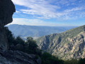
A hike in the Caroux massif that partly follows the GRP® du Haut Languedoc et des Vignobles trail, which crosses the southern face from west to east, winding its way through a rugged granite landscape. There are some beautiful views along the way, looking south towards the sea. This is a somewhat challenging hike given the fairly steep slopes to reach the plateau.
Le Pin circular via Estaussan and Vieussan
 8.37 mi
+2,195 ft
-2,188 ft
5h 45
Moderate
Departure from Vieussan (Hérault)
8.37 mi
+2,195 ft
-2,188 ft
5h 45
Moderate
Departure from Vieussan (Hérault)
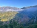
This hike uses part of each Visorando route entitled "La Tour du Pin - Vieussan" and "circular at Le Pin". They are done in reverse, allowing you to do most of the trail at the beginning. Large sections of the route offer interesting views.
Pic de Rossilló and Pla de l'Arca Dolmen
 10.06 mi
+2,408 ft
-2,395 ft
6h 45
Difficult
Departure from Molitg-les-Bains (Pyrénées-Orientales)
10.06 mi
+2,408 ft
-2,395 ft
6h 45
Difficult
Departure from Molitg-les-Bains (Pyrénées-Orientales)
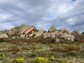
A beautiful hike facing the Canigou massif. It takes you up to Pic del Rosselló, from where you enter a spectacular mineral area. Cross a plateau dotted with rounded rock mounds that look as if they were placed there by giants. A magnificent landscape used for grazing, facing the long Pyrenees massif to the south.
Pic de l'Estelle from Coll Palomeres via the Pinosa mining site
 8.90 mi
+2,802 ft
-2,799 ft
6h 30
Moderate
Departure from La Bastide (Pyrénées-Orientales)
8.90 mi
+2,802 ft
-2,799 ft
6h 30
Moderate
Departure from La Bastide (Pyrénées-Orientales)
A very beautiful hike with views of the eastern slope of the Canigou Massif and a visit to the Pinosa mining site (a listed historic monument) which bears witness to the work and living conditions of miners in the 19th and 20th centuries. A beautiful 360° panorama at the summit of Pic de l'Estelle over the Corbières to the north, the sea and the Albères to the east, Spain to the south and the slopes of Canigou to the west. The Batère Tower on the descent from the peak is reminiscent of the system of signal towers erected in the Middle Ages, which formed a communication network: at night using fires and during the day using smoke.
From Esquino d'Aze to Chemin des Fleisses via the hamlet of La Fage
 8.10 mi
+3,251 ft
-3,258 ft
6h 35
Difficult
Departure from Colombières-sur-Orb (Hérault)
8.10 mi
+3,251 ft
-3,258 ft
6h 35
Difficult
Departure from Colombières-sur-Orb (Hérault)
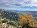
This is a demanding hike with a long, very steep section covering a significant elevation gain from Esquino d'Aze to Tour Verte, but that's par for the course when climbing the south face of Caroux! Beautiful views of this remarkable rocky landscape forming a vertical barrier between the hills of Saint-Chinianais and the Caroux plateau. However, you need to be experienced in walking on rough, unmarked trails.
The Castle, the Guillera Gorges and Pic Pedrous via Casesnoves
 9.77 mi
+2,211 ft
-2,205 ft
6h 25
Moderate
Departure from Rodès (Pyrénées-Orientales)
9.77 mi
+2,211 ft
-2,205 ft
6h 25
Moderate
Departure from Rodès (Pyrénées-Orientales)
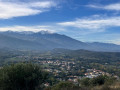
With Rodès Castle and the Guillera Gorges to start the hike, the diversity of the next section offers spectacular heath and rock landscapes in the midst of a unique mineral environment. It feels like wandering through a world of giants who have placed rounded blocks of rock, forming piles of monumental boulders scattered among the broom and rockroses that dot the area.
Pic des Maurous via Pic de Marbet and Roc de l'Agle
 8.85 mi
+3,425 ft
-3,399 ft
7h 05
Difficult
Departure from Finestret (Pyrénées-Orientales)
8.85 mi
+3,425 ft
-3,399 ft
7h 05
Difficult
Departure from Finestret (Pyrénées-Orientales)
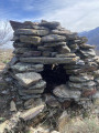
In the first part of the hike from Finestret to Pic des Maurous, the climb from the point (1) is quite demanding. The steep slope throughout this section requires a good level of fitness. It offers beautiful views of the north and east of the area, from the Madres Massif to the sea, passing through the plain and its villages, the Fenouillèdes and the Corbières in the distance.
The GPX track can be very useful.
El Borboner, Cortal Grau, Sant Féliu and La Cogulera from Rodès
 9.41 mi
+1,749 ft
-1,739 ft
5h 50
Difficult
Departure from Rodès (Pyrénées-Orientales)
9.41 mi
+1,749 ft
-1,739 ft
5h 50
Difficult
Departure from Rodès (Pyrénées-Orientales)
This hike in the north-western sector of Rodès mainly follows little-used paths. This circular route sometimes requires walking on poorly marked paths overgrown with vegetation (trousers recommended), and sometimes on well-marked paths or tracks (but as little as possible, as we prefer the paths). The "common thread" of the day is the almost constant view of Canigou. Some parts are not easy to walk, so they are reserved for walkers who are not afraid to "wear out their shoes".
Visorando app recommended.
Short circular loop of Roc d'Orque
 7.02 mi
+1,608 ft
-1,594 ft
4h 40
Moderate
Departure from Saint-Geniès-de-Varensal (Hérault)
7.02 mi
+1,608 ft
-1,594 ft
4h 40
Moderate
Departure from Saint-Geniès-de-Varensal (Hérault)
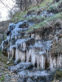
This walk in the Roc d’Orque massif takes place largely on the south-facing side, which is lovely at this time of year. It’s a lovely route at the foot of high limestone cliffs, passing close to a large waterfall that flows from the base of one of them. A resurgence causes the water to gush forth, having travelled through the mountain from the catchment area formed by the plateau above the cliffs. Well worth a visit.
Hikers who completed this circular route after Storm Nils reported difficulties in following it from the starting point. Extensive work has been carried out by a forestry company, enabling the route to be restored. See Practical Information.
 Below the Col de Jau, Sentier des 5 Sens
 4.19 mi
+1,332 ft
-1,332 ft
4h 39
Moderate
Departure from Mosset (Pyrénées-Orientales)
4.19 mi
+1,332 ft
-1,332 ft
4h 39
Moderate
Departure from Mosset (Pyrénées-Orientales)
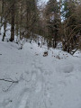
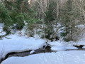
Inspired by a Visorandonneur hike called "Le Sentier des 5 Sens depuis la route du Col de Jau" (The 5 Senses Trail from the Col de Jau road), the idea of doing it on snowshoes was made possible by the exceptional snowfall of the previous days. There was enough good snow to avoid having to climb up and start from the Col de Jau as we did in other winters. Apart from the track leading from the road to the car park, the entire hike took place in virgin snow, allowing us to see animal tracks in all directions. It was a real treat!
Below the Col Jau, towards the old ski lift
 4.26 mi
+1,014 ft
-1,017 ft
4 hrs
Moderate
Departure from Mosset (Pyrénées-Orientales)
4.26 mi
+1,014 ft
-1,017 ft
4 hrs
Moderate
Departure from Mosset (Pyrénées-Orientales)
Circular hike starting below the Col de Jau at the start of the old ski resort. Except for the track leading from the road to the car park, we were able to complete the entire hike in virgin snow and discover areas marked only by animal tracks in all directions.
Pic Pédrous via a little-used path
 10.13 mi
+2,257 ft
-2,247 ft
6h 35
Moderate
Departure from Rodès (Pyrénées-Orientales)
10.13 mi
+2,257 ft
-2,247 ft
6h 35
Moderate
Departure from Rodès (Pyrénées-Orientales)
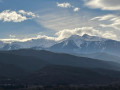
Puig Pedrós is a classic hike in Rodès. We wanted to climb it via a path that is no longer used. It runs around the Vallagra Ravine. As it was poorly marked, if at all, we reopened the middle section of the path, before and after crossing the Còrrec de Vallagra, on the right and left banks (lots of brambles and Mediterranean vegetation). We crossed the stream (elevation 319) using tree trunks deposited by the recent floods. This part of the route is a bit adventurous and is intended for adventurers. The rest of the circular route is uneventful.The GPX track is highly recommended.
Circular Douch route via the Tour du Caroux and the Font Salesse refuge
 5.68 mi
+764 ft
-781 ft
4 hrs
Easy
Departure from Rosis (Hérault)
5.68 mi
+764 ft
-781 ft
4 hrs
Easy
Departure from Rosis (Hérault)
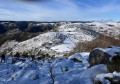
A snowshoe hike on the Caroux plateau, which is not often possible. Of course, you need to have your own snowshoes, as it is almost impossible to hire them on the way there. But it was very pleasant to be able to walk with snowshoes on that day. The slight incline allows people who are not used to this activity to discover the pleasure of hiking in the snow in areas that are, in part, untouched.
GPX track required in some places.
Callau Refuge Circular Walk
 6.36 mi
+892 ft
-892 ft
5 hrs
Moderate
Departure from Mosset (Pyrénées-Orientales)
6.36 mi
+892 ft
-892 ft
5 hrs
Moderate
Departure from Mosset (Pyrénées-Orientales)
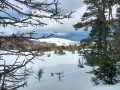
This year, with its exceptional snowfall, it is possible to tackle routes that were difficult to complete in previous years. There seems to be nearly a metre of snow, which is impressive. To climb up to the pass, we took advantage of a very clear road, with no snow or ice. A very beautiful circular route, a little challenging as you sink in a lot, but very interesting. For the less adventurous, a round trip on the flattest part of the route makes for an easy discovery hike (between the Col de Jau at 1,506 metres and the point (2) at 1,529 metres).
Pic Dourmidou
 4.77 mi
+1,332 ft
-1,316 ft
4 hrs
Moderate
Departure from Mosset (Pyrénées-Orientales)
4.77 mi
+1,332 ft
-1,316 ft
4 hrs
Moderate
Departure from Mosset (Pyrénées-Orientales)
This year, with its exceptional snowfall, allows you to do this route on snowshoes in good conditions. To climb up to the pass, we took advantage of a very clear road, with no snow or ice. A beautiful hike that takes you to the summit of Pic Dourmidou with heavy snowfall, just after 5 to 10 centimetres of fresh snow fell during the night, adding to the thick layer that had fallen in previous days. Beautiful 360° view from the summit before the fog rolled in.
Circular Pic de Bau starting from Eus
 10.82 mi
+2,507 ft
-2,507 ft
7h 10
Difficult
Departure from Eus (Pyrénées-Orientales)
10.82 mi
+2,507 ft
-2,507 ft
7h 10
Difficult
Departure from Eus (Pyrénées-Orientales)
This hike takes place on a south-facing slope, allowing you to spend a day in the sun, with the Canigou massif in your sights.
Pla Segalà
 5.62 mi
+1,864 ft
-1,860 ft
5 hrs
Moderate
Departure from Mantet (Pyrénées-Orientales)
5.62 mi
+1,864 ft
-1,860 ft
5 hrs
Moderate
Departure from Mantet (Pyrénées-Orientales)
We really enjoyed this round-trip snowshoe hike, made possible by exceptional snow cover and, above all, the fresh snow that had fallen the previous day. Starting via the track makes for an easier start to the hike, allowing you to warm up rather than immediately taking the GR® 177, which climbs quite steeply through the woods. Leaving the track, the path climbs a little further to join the GRP® and begins a slightly steeper ascent to reach Pla Segalà, the day’s destination.
Pla Segalà from Col de Mantet
 4.70 mi
+1,450 ft
-1,450 ft
6 hrs
Difficult
Departure from Mantet (Pyrénées-Orientales)
4.70 mi
+1,450 ft
-1,450 ft
6 hrs
Difficult
Departure from Mantet (Pyrénées-Orientales)
A lovely circular route starting from the Col de Mantet and passing through Pla Segalà. Apart from a few animal tracks, pristine white snow is guaranteed throughout the route.
Henri Barbusse memorial, Cogulló, then the Juell, Vell and Eusebi passes
 9.12 mi
+3,248 ft
-3,271 ft
7h 00
Difficult
Departure from Vernet-les-Bains (Pyrénées-Orientales)
9.12 mi
+3,248 ft
-3,271 ft
7h 00
Difficult
Departure from Vernet-les-Bains (Pyrénées-Orientales)
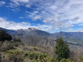
The only place in the region where there was no wind! We were able to walk all day without a breath of wind, whilst everywhere else, gusts of over 100 km/h were sweeping across the mountains. Incredible! On the other hand, there are quite a few trees blocking the paths, which sometimes makes progress difficult or tedious. Nevertheless, a lovely hike despite the final section being entirely on track.
Roc d'Orque Circular Route
 7.80 mi
+2,448 ft
-2,444 ft
5h 45
Difficult
Departure from Castanet-le-Haut (Hérault)
7.80 mi
+2,448 ft
-2,444 ft
5h 45
Difficult
Departure from Castanet-le-Haut (Hérault)
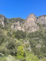
This marks the completion of this beautiful hike after several weeks of research to create the route described below. It’s a great achievement that will help people discover and get to know this small mountain range located east of the Caroux and Espinouse ranges. Some sections (fairly short) are a bit tricky to follow, but the Visorando GPX track is very useful.
Mont Tauch Circular Route
 10.24 mi
+2,493 ft
-2,510 ft
6h 55
Difficult
Departure from Maisons (Aude)
10.24 mi
+2,493 ft
-2,510 ft
6h 55
Difficult
Departure from Maisons (Aude)
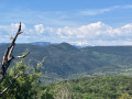
The distinctive shape of Mont Tauch makes it easily recognisable during hikes, whether from the Catalan Pyrenees, the Caroux or various peaks in the Corbières. It catches the eye to such an extent that it makes you want to explore it. From the village of Maisons, a gentle, steady climb takes you up the 555 metres to this plateau, which is interesting for its geographical position as it offers spectacular views of the Pyrenees, from the Albères to the Madrès massif, via the Corbières hills to the highest peaks of Capcir. Whilst the first part of this hike presents no difficulties, the descent on the other side of the plateau is best left to seasoned hikers capable of navigating using the Visorando GPX track.
From Puech Bouissou to the Cirque de l'Infernet via Saint-Guilhem-le-Désert
 14.90 mi
+3,153 ft
-3,166 ft
9h 35
Very difficult
Departure from Montpeyroux (Hérault) (Hérault)
14.90 mi
+3,153 ft
-3,166 ft
9h 35
Very difficult
Departure from Montpeyroux (Hérault) (Hérault)
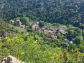
Visiting Saint-Guilhem-le-Désert and hiking through the beautiful limestone massif surrounding the village is well worth the effort. This circular route, with its varied landscapes, allows you to see the most picturesque spots in the area without having to rub shoulders with the crowds hiking in the massif.