Country:

 City:


Coming from Perpignan via the D66 (formerly the RN 116), drive along the right bank of the Vinça reservoir until you see the bridge spanning it on your right. Turn right onto the D13 towards Tarerach, cross the railway line, and park on the right, immediately after the bridge, in a space by the side of the road.
Red and white markings (GR® 36)
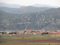
(S/E) Cross the road (very little traffic) and go round the back of the concrete wall to find the path, which starts with a few steps. The path climbs quite steeply up the mountainside, offering a beautiful view of the Canigou massif.
(1) At this junction of paths (elevation 430), take the one that continues to climb to the right. You’ll return via the path coming from the opposite direction. After the sewage treatment plant in the hamlet of Marcevol, go round the Priory on the left to reach a tarmac road, then follow it to the left for 50 metres until you reach a three-way junction.
(2) Turn right, following the red and white markings, to cross the village and see the stone buildings, as well as the building adjoining the Church of Notre-Dame des Escaliers or Sainte-Marie-des-Grades.
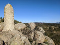
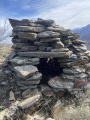
(3) Continue along the GR® 36, which regularly crosses a track but follows well-marked paths. Look out for the orri on the right-hand side of the path.
(4) Leave the marked path to follow a route signposted with signs bearing a stylised “M”, which probably refers to the Roc del Moro. These signs appear regularly along the route from the hamlet of Marcevol. The path winds upwards to reach a large notch in the rock, where a locked gate blocks the entrance to what is likely a mine. Go round this peak to the left; a faint but clearly visible path crosses the heath consisting of Montpellier rockroses and heather.
(5) At the first junction of paths, turn left and head north. At the next junction, head west to rejoin the GR® 36.
(6) Turn right onto the GR® 36 and, about 300 m further on, take a path on the left which shortens the route, rejoining the GR® as it continues along a track. A steep climb leads to a valley floor and a track junction.
(7) Ignore the track on the left that descends directly to the village of Arboussols; instead, head right onto the track that winds its way up to the Coll de Guers. This is a junction of several tracks.
No signposting
(8) Head left, towards the south, along a new descending track. Stay on the main track, ignoring all the more or less visible side paths. The view of the Pyrenees mountain range is as beautiful as ever. All along the way, you’ll be walking amongst butterfly lavender; the season is perfect for it.
(9) At the junction with a path on the right, there is a beautifully restored house. Take this path to reach a tarmac road, where you’ll find the first houses of the village of Arboussols.
(10) Turn left onto the Chemin des Mimosas, then take the Chemin de Sainte-Eulalie and the Rue de la Coopérative on the left to reach the D35C (Route de Marcevol),
(11) Turn left and continue along this road, where there is very little traffic. Walking along the tarmac can be a bit tedious in the sun.
(12) You can turn right onto the stony track, which avoids walking along the departmental road. Yellow signposts. Continue along the road for about 250 metres.
(13) You can turn right onto the path, which avoids walking along the county road.
(14) In a wide left-hand bend in the road, look for a track on the right.
(14) Head down the far right-hand side. After the second hairpin bend to the right, take the path marked in yellow on the left. Join the D35C.
(15) Follow it to Marcevol.
(16) On reaching the hamlet, before the junction you passed on the way out, take the path leading down to the right. At a large hairpin bend to the left, ignore the path heading towards Arboussols, and continue along the mountainside, climbing slightly to return to the original junction. Head down via the same path you took at the start of the walk.
(1) Carry on straight ahead, in the opposite direction to the outward journey, along the steep path which leads back to the car park (S/E).

 Visorando Member
 Easy

 Difficult
 Association / Club / Walk leader