Country:

 City:
City:


From Béziers, take the D909 towards Bédarieux, then the D909A. Pass through the village of Hérépian and take the D13 to Saint-Gervais-sur-Mare. Drive through the village and head towards Saint-Geniès-de-Varensal via the D922, then turn right at a place called Pont Vieux to reach Plaisance (in the commune of Saint-Geniès-de-Varensal) via the D22E14. There is a car park on the right after crossing the bridge over the Ruisseau du Bouissou (towards the town hall).
Yellow markings
(S/E) Take the tarmac road towards the town hall, walk past the bar and the tennis courts, following the yellow PR® markings. Cross the Ruisseau du Bouissou and continue along a narrow tarmac road, which quickly turns into a stony track.
(1) At the next track junction, turn right and continue climbing towards the Col de la Devèse (altitude 430m).
(2) Ignore the track on the right and start the descent on the left to reach a tarmac road.
(3) Turn right, ignore the first junction on the left, then the second on the right, continuing along the tarmac road (Route de Sals) on which we encountered no vehicles. After a slight bend to the left, look out for the start of a path on the left, built with log steps, which climbs steeply.
(4) Take this path, which marks the start of a sustained climb through the woodland, until you reach a junction of tracks and paths with signposts.
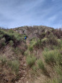
(5) First turn left then right. The well-marked path continues to climb steeply, alternating between sections of steep trail and rocky outcrops that you’ll need to climb, sometimes using your hands for support. During the climb, enjoy the many spectacular views. Reaching a handrail marks the end of the tough ascent leading to a series of antenna masts.
(6) The route now follows a grassy track, then a stony path that runs alongside the antennae (elevation 912m) and descends slightly towards the Chemin de Marcounet, a wide track.
No signposting
(7) Chemin de Marcounet. Continue along the track, ignoring the signposted path that continues northwards. Head towards the hamlet of Marcounet, which is inhabited. Pass quietly past the house (please respect the peace and quiet of the area). After the house, take the path that climbs to the right to reach the GRP® Haut Languedoc et Vignobles, signposted in yellow and red.
Yellow/Red and Yellow markings
(8) Turn right to climb towards the Croix de Marcou. Now head towards the summit, keeping the large cross in your sights, and reach it. The climb is quite steep.
No markings
(9) Mont Marcou, with its fantastic 360° view, is the reward for the effort made to get there. From the cross, head towards a bench, leaving the GRP® which descends southwards. Pass in front of the bench and continue south-south-west to reach a wide grassy track which begins to descend steeply towards the Roc de Marcou.
(10) Before reaching it, note a path branching off to the right (marked by a small cairn). This allows you to proceed along the flank of Mont Marcou, first following a curve then a straight line heading north. Reach a small ridge (elevation 931m).
(11) Continue westwards along the edge of a rocky slope on the left. The descent continues through pastures to reach the hamlet of Albès, which can be seen below.
(12) Before entering the hamlet, turn left onto a track that passes in front of a kennel. It climbs steadily, blocked by two gateways (please close them properly after passing through). The track levels out before reaching a small grassy clearing which marks the end, in front of a fence. Climb over the fence on the left, which you have been following since the start of the grassy area, and descend across the field to a passage marked by two posts. Cross the fence at this point (Yellow Circles on the rock visible from this passage). A pleasant path crosses a field of ferns and winds down towards the Grotte d’Orquette (there are still gate posts on this section; make sure to close them properly).
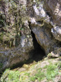
(13) Arrival at the Grotte d’Orquette. Two ruined buildings stand next to the cave. It is actually a resurgence where water collected on the plateau, which seeps into the limestone ground, re-emerges here. One of the two buildings was a mill; the millstone is still visible when you enter the lower building, through which the small stream flows. Continue the descent (sometimes a little steep) following the markings made with Yellow Circles. This leads to the Roc d'Orque path.Turn left towards the ruins of the hamlet of Orquette.
(14) Ruins. Pass to the left at the foot of the houses and take the path that descends, at times quite steeply, to the stream (you will find the stream that emerged further up from the resurgence seen earlier), a tributary of the Bouissou stream. The route continues along a grassy track, following the Bouissou on the left bank, until you reach a stony track.
(15) Turn right, cross a bridge and continue along the stream on the track, this time on the right bank. You’ll arrive at the Saint-Geniès fish farm and a large private car park. The route then follows the tarmac road into the village of Saint-Geniès-de-Varensal.
(16) At the bridge over the Bouissou, turn 90° to the right to take a long flight of steps that pass by the foot of the church and continue along a path heading south. It passes above the cemetery and continues alongside the tarmac road below. It joins the D22E14 at a wayside cross. Walk for about 150 metres along the tarmac road (there is little traffic, but please be careful).
(17) Note, on the left, the start of a path blocked by a large rock. Walk down to the bridge, turn right to rejoin the tarmac road (walking past the tennis courts) which you took at the start of the walk to reach the car park (S/E).
 Visorando Member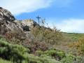
 Moderate