Country:

 City:
City:


From Béziers, head towards Bédarieux (D909) then take the D909A to Hérépian. Continue on the D13 to reach Saint-Gervais-sur-Mare. Enter the village and take the street on the left, then follow the one-way street on the right towards Saint-Geniès-de-Varensal. On leaving the village, continue on the D922, reach Andabre and turn right onto theD22E14, pass through Plaisance and continue along this road to Saint-Geniès-de-Varensal. There is no parking in the village; head towards Combals, cross the bridge over the Bouissou and park in a disused quarry on the left after the bridge.
Red/Yellow and Yellow markings
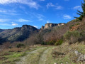
(S/E) Return to the tarmac road and take the marked path on the left which joins the track a little further up. On the stony track, turn right. This climbs and leads to a recently built building situated on the former route of the GRP®. Continue climbing the track until you reach, further up, the path branching off to the left (signposted). This fairly steep path leads back onto the track once more. Take the signposted route opposite, which continues with a steady climb. A few hundred metres further up, near Baussas, look out for a flat area on the left leading into the woods.
No official markings
(1) It is marked by a large cairn, followed by a second cairn a little further on. See Practical Information.
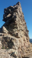
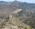
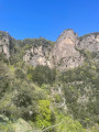
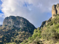
This section leads to a grassy track, which connects to the rest of the route. It leads onto a new, stony track. From here, you can see, opposite, the majestic cliffs of Orque, which mark the destination of the hike. Descend to the right until the first hairpin bend.
(2) Leave the track and take a path on the right that climbs slightly, then descends gently to cross a small stream via a footbridge. This well-marked path then climbs again to reach the small ruined hamlet of Orquette.
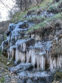
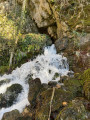
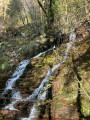
(3) Before reaching the ruins, take the path that continues to the right (cairns) and runs beneath imposing cliffs to reach a beautiful waterfall, whose waters emerge from the foot of the cliff.
(4) The waterfall marks the end of this short hike. A few metres before reaching the waterfall, it is worth climbing through the woods and scree to the resurgence. This allows you to see this geological curiosity. It results from the loss of water that runs off the plateau between Le Fau and Albès, two hamlets situated on the plateau above the great cliffs. After this ‘visit’, turn back to retrace the path in the opposite direction to the small ruined hamlet of Orquette.
(3) Head towards the ruins of the hamlet of Orquette, pass to the left at the foot of the houses and take the path that descends, sometimes quite steeply, to the stream you have already crossed further up via the footbridge, the confluence of the Bouissou stream.
(5) The route continues along a grassy track, following the left bank of the Bouissou, until you reach a stony track.
(6) Turn right and cross a bridge to continue following the stream along a track, on the right bank this time. You’ll arrive at the Saint-Geniès fish farm and a large private car park. The route then continues along the tarmac road to the car park (S/E).
 Visorando Member

 Difficult