Country:

 City:
City:


From Conques-sur-Orbiel, take the D101 northwards to the village of Les Ilhes-Cabardès. Park in the large car park on the left as you enter the village, directly opposite the road leading to the bridge over the Orbiel – this will be your return route at the end of the walk.
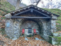
(S/E) From the car park, head west along the wide path that climbs and passes beneath a wooden house. Go round it on the right and follow the wide path marked with yellow and blue circles. The climb is quite steep at the start. Continue to a junction of paths.
(1) Take the path furthest to the left and continue climbing until you reach a grassy track.
(2) Follow it to the right, passing close to the ruins of the medieval Carrus mine, and continue along a stony track. Leave the track behind, turning left at elevation 522, and follow a narrow tarmac road until you emerge at a bend in another road at elevation 571. (We didn’t see a single vehicle on this road, which winds through a lovely wood; it’s really very quiet, if not deserted.)
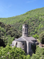
(3) Cross this road and continue straight ahead along the track for about 600 metres, then turn right at the next track, heading north, and soon north-west. Stay on this track, ignoring the paths branching off to the right and left, to reach La Tourette-Cabardès via Rue de la Baronnie. Pass under the remarkable porch of the church’s bell tower.
(4) Turn right, then left onto the D9. At the next hairpin bend, continue along the D9 to leave the village, pass a double hairpin bend (right-left) and, after the next bend, look for the path that climbs steeply to the left.
(5) Follow this path as it climbs steadily, ignoring all the offshoots on either side, then stay on a track heading east.
(6) At the junction of the track and a footpath, turn left onto the footpath which leads to the forecourt of the church at Miraval-Cabardès. Walk past the church door and go down the steps leading to the D101 road.
(7) Cross the bridge opposite over the Orbiel, and turn left onto the road that runs alongside the stream for about fifty metres. Go to the right between the houses to find a footpath heading south-east and follow it.
(8) At the junction with a wide path, head up to the left, through the woods.
(9) At the junction of tracks, turn left and continue the slightly steeper climb. Ignore the next two tracks branching off to the left to reach a stony track (elevation 734).
(10) Continue along this track heading east and, at the next three-way junction, veer to the right, passing a building (a gamekeepers’ lodge), then, at the next junction, turn right again to reach a crossroads of tracks (wayside cross).
(11) Take the track opposite signposted ‘La Bastide d’Esparbairenque’ (sign). At the next track junction, take the track on the left heading north-west for about 250 metres, then turn right towards the hamlet of Cubserviès. Tarmac road.
(12) Enter the village to admire the waterfall, then a viewpoint.
(13) Retrace your steps.
(12) Continue straight ahead along the Route du Moulin, which descends, crosses the Rieutort near a cluster of houses (Fontpeyrisse mill) and climbs up the other side.
(14) At the bend, take the path down to the right, cross the Ruisseau de la Conque, pass the ruins of Pellairol and continue along this signposted path. Cross the bridge over the Ruisseau de Prat to reach a bend in the tarmac road.
(15) Turn left to cross the village heading south-west and, on leaving the village, head towards the cemetery above the road. The path passes above the cemetery to join a track which you follow uphill to the Croix de Viallèle.
(16) First turn left then right to take the track which descends and quickly narrows into a path running alongside the three more or less renovated huts at Les Artigues.
(17) At the next junction, leave the path leading to Roquefère on your right and turn left towards the hamlet of Le Vigné. On the tarmac road that follows, walk past the houses and head down the road to enter the bed of the Ruisseau de la Grave. Very soon, cross the alluvial bed (marked with cairns).
(18) Climb up the opposite slope via a path that takes you through the woodland, crosses the Ruisseau de l’Abessenc (dry), continues westwards and then southwards until you reach a stony track. Turn left and carry on to the next track.
(19) Leave the track and take the path on the right which descends and leads into the village of Les Ilhes. In the centre of the village, turn right to cross the bridge over the Orbiel, thencarefully cross the D101 road to rejoin the (S/E).


 Visorando Member
 Very difficult
 Moderate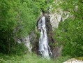

 Easy
Easy