


Pierre Marché

 Visorando Member
 Premium user
- Gender: man
Sign up:
Published route(s)
 Puy du Pariou circular walk, alternative route from the Goules car park
 4.03 mi
 +699 ft
 -699 ft
 2h 30
 Easy
 Departure from Orcines (Puy-de-Dôme)
This route is an alternative to the “Le Puy Pariou from the Goules car park” route. The return journey, after descending the 555 steps of the staircase,involves walking a circular route around Le Puy, passing at the foot of the Col des Goules. The return route begins by crossing a mountain pasture and continues along a forest track.Please note: it is forbidden to descend to the bottom of the crater or to walk all the way round the crater.
The Artists’ Trail and the Doctors’ Trail circular loop
4.49 mi
+1,122 ft
-1,099 ft
3h 00
 Moderate
Departure from Mont-Dore (Puy-de-Dôme)
The route follows the Chemins de Mille Gouttes, des Artistes, des Médecins and de Fond de Bois, with the option to park right next to the starting point. The circular route is almost entirely on forest paths. The short section between the Capucin Sylvatorium and Rigolet Haut is surfaced with (rustic) tarmac. However, there is virtually no traffic on this road. On the descent from the Chemin de Mille Gouttes, halfway between the Chemin des Artistes and the finish, turn left onto a pleasant path which leads to the start of the Route de la Tour d’Auvergne. You will then see the thermal baths building at the end of the Allée Georges Lagaye.
Col de la Croix Morand from Mont-Dore via two waterfalls
4.67 mi
+1,434 ft
-259 ft
3h 25
Moderate
Departure from Mont-Dore (Puy-de-Dôme)
The start is in front of the thermal baths, on Place du Panthéon. Initially, the route passes through the town to the Qeureuilh district where, after the landscape cemetery, you’ll find the paths leading to the Col de la Croix Morand, where Laurence and Christophe’s Buron welcomes you for an Auvergne meal or a snack featuring an excellent blueberry tart.For the return journey, you’ll need to leave a car at the Col de la Croix Morand or retrace your steps along the same route.
The Mont-Dore Artists’ Trail: a circular route via Rigolet Bas and Rigolet Haut
5.15 mi
+978 ft
-984 ft
3h 15
Moderate
Departure from Mont-Dore (Puy-de-Dôme)
This walk first takes us through the streets of Mont-Dore, from the thermal baths to the old railway station. After a short detour along the River Dordogne, you’ll need to cross the municipal workshops to take a footpath between the old railway line and the River Dordogne, before heading up towards Rigolet Bas and the golf course, then Rigolet Haut, and finally down again to join the Chemin des Artistes, followed by the Chemin des Mille Gouttes, before returning to the town near the Tourist Office.
Four Waterfalls Route from Mont-Dore
6.97 mi
+1,591 ft
-1,598 ft
4h 35
Moderate
Departure from Mont-Dore (Puy-de-Dôme)
The aim of this walk is to complete a route taking in the four main waterfalls of Mont-Dore: the Grande Cascade, Rossignolet, Queureuil and Saut du Loup.Three of the waterfalls are in roughly the same area. This leaves the option of visiting the Grande Cascade at a later date. In that case, simply take the Chemin de Chappes on the right as you set off from the town hall; this leads up to the Melchi-Roze path, and then continue the route to the left.
Circular route via Melchi-Roze, Monteyroux and Les Artistes, starting from Mont-Dore
 4.05 mi
+902 ft
-896 ft
2h 40
Easy
Departure from Mont-Dore (Puy-de-Dôme)
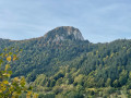
The suggested circular route is a route around the town of Le Mont-Dore. It takes us along the three paths mentioned in the title. The start and finish are on the Place du Panthéon, opposite the thermal baths, so that you can access the Chemin de Melchi-Roze via the Chemin de Chappes on the way out and via the Chemin de la Banne on the way back. In the area around the gendarmerie and the old railway station, there is no alternative but to take a few tarmac-surfaced streets.
The Mille Gouttes, Salon du Capucin and Rigolet circular loops, starting from Mont-Dore
 3.36 mi
+814 ft
-833 ft
2h 15
Moderate
Departure from Mont-Dore (Puy-de-Dôme)
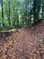
Le Mont-Dore is a tourist destination for three main reasons: hiking in the Sancy massif, the winter sports resort and the spa town. For all these good reasons, there are numerous hiking trails around Le Mont-Dore and the surrounding area. It would be a shame not to mention that this is a welcoming region where life is good. Who wouldn’t be tempted, whilst out on a hike, to stop for a snack of bread, cheese and cold meats, not forgetting to finish off with a slice of blueberry tart! It is against this backdrop that the suggested walk is a circular route starting from the thermal baths, running alongside the funicular railway, reaching the Salon du Capucin after working up quite a sweat, then winding gently back down through magnificent woodland and countryside, passing through Rigolet and Les Vergnes before returning to Mont-Dore and its thermal baths. The walk can also start from the Tourist Office in the town centre.
The cliff-top road from La Ravine à Jacques to Saint-Denis along the TiTrain
 7.72 mi
+49 ft
-49 ft
3h 35
Moderate
Departure from Saint-Denis (La Réunion) (Réunion)
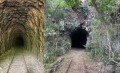
The title of this walk forms part of the route along the former TiTrain de la Réunion line: 126.2 km between Saint-Benoît and Saint-Pierre. This route runs parallel to the TiTrain route, which passes through a tunnel between Ravine à Jaques and Saint-Denis. Further on, the railway line passes through two other tunnels: one between Ravine à Jacques and La Grande Chaloupe, and another between La Grande Chaloupe and La Possession. The main attraction of this route is that it provides a continuous link along the railway route. The route is a return route that can be completed on foot or by bike along the old cliff-top road, which is now closed to motor vehicles.
This walk can be complemented by a visit to La Grande Chaloupe, the headquarters of the TiTrain association, which works to preserve and promote Réunion’s railway heritage.
Around Mehun-sur-Yèvre from the station
9.55 mi
+36 ft
-36 ft
4h 25
Moderate
Departure from Mehun-sur-Yèvre (Cher)
From Mehun-sur-Yèvre railway station, the suggested route is a circular route that takes you round the outer edge of the town. As the route passes close to the main sights, you can always veer off the route to visit a particular site. The historic sites are covered by a separate walking tour within the town of Mehun.
Route historique de Mehun-sur-Yèvre
4.26 mi
+26 ft
-26 ft
2h 00
Easy
Departure from Mehun-sur-Yèvre (Cher)
Mehun-sur-Yèvre boasts a rich historical heritage centred around the Château de Charles VII. This tour of the historic centre is a circular route starting and ending at the railway station, which is served by a line running from Lyon to Bourges, Mehun, Vierzon and Nantes. The proposed walk is designed to introduce visitors to the history and heritage of the area, from the Bituriges-Cubes to the people of Berry today, featuring numerous historic sites such as the Gardens of Duke Jean de Berry, the Château de Charles VII, the Hôtel de la Pucelle d’Orléans… and an insight into two centuries of trade along the main street, Rue Jeanne d’Arc.
The TiTrain railway line in Saint-Leu
3.15 mi
+56 ft
-52 ft
1h 30
Easy
Departure from Saint-Leu (La Réunion) (Réunion)
The town of Saint-Leu is bordered to the north by the Petite Ravine and to the south by the Ravine des Avirons. The main aim of the walk is to follow, where possible, the route taken by the TiTrain from the time of its inauguration on 12 February 1882. We will cross six bridges and viaducts, the old railway station and two railway halts.
Sainte-Suzanne – Cambuston
4.24 mi
+79 ft
-23 ft
2h 00
Moderate
Departure from Sainte-Suzanne (La Réunion) (Réunion)
Twelfth stage, running close to the railway line. This stage is flat, but crossing the Sainte-Suzanne and Saint-Jean rivers may pose a problem for beginners. It is the second-shortest stage of the trek. This stage is divided into three sections: the first is urban, the second rural, and the third is urban again. However, there are fewer railway remains on this section, and those that are present have been left to fall into disrepair.
Sainte-Marie – Sainte-Suzanne
4.65 mi
+105 ft
-112 ft
2h 15
Easy
Departure from Sainte-Marie (La Réunion) (Réunion)
The eleventh stage of the walk takes you right alongside the railway line. This stage is short and very easy. It is also the only section where you’ll follow the entire route of the railway line. This section is regularly used by joggers. The path runs fairly close to the coast and occasionally offers some lovely views of the sea. There are also numerous railway remains along this section.
La Possession – Grande Chaloupe
4.76 mi
+1,122 ft
-1,135 ft
3h 10
Moderate
Departure from Réunion
Eighth stage of the island tour, following the railway line as closely as possible. After the long flat stretch of the previous stages, this short stage sees a return to uphill terrain. As access to the tunnel is officially prohibited, you must go via the Chemin des Anglais, which includes sections with steep gradients. This is a very old paved path that is now a must-do hike on the island.
Saint-Gilles – Saint-Paul
6.73 mi
+673 ft
-679 ft
3h 40
Easy
Departure from Saint-Paul (La Réunion) (Réunion)
Fifth stage of the island tour, running close to the railway line. This stage is flat and relatively easy. The first section is urban and passes through the tourist towns of Saint-Gilles and Boucan Canot, renowned for their white sandy beaches. The second section is more rural, running along the cliffs of Cap la Houssaye. The final section is urban once again and takes you through the town of Saint-Paul. Along the way, you’ll come across around ten remnants of the railway line.
L’Étang-Salé les Bains – Saint-Leu
 8.39 mi
+141 ft
-138 ft
4h 00
Moderate
Departure from L'Étang-Salé (Réunion)
The third stage of the route runs closest to the railway line. It starts in the charming seaside village of Étang-Salé les Bains and ends in another seaside town: Saint-Leu. The terrain is flat throughout, but a few off-trail sections are tricky. There are numerous remains of the railway line on this stage, far more than on the previous one. This stage runs constantly along the coast and also offers some beautiful views of the ocean and the hills.
Saint-Louis – l’Étang-Salé les Bains
 11.19 mi
+102 ft
-285 ft
5h 15
Moderate
Departure from Saint-Louis (La Réunion) (Réunion)
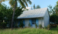
The second stage of the walk runs closest to the railway line; it begins in the multicultural town of Saint-Louis and takes you past two branch lines of the railway. It then winds through the Étang-Salé forest, following the main railway line as closely as possible, before arriving at the peaceful seaside village of Étang-Salé les Bains. Of course, you’ll come across a few remnants of the railway line.