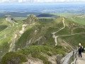
Col de la Croix Morand from Mont-Dore via two waterfalls

The start is in front of the thermal baths, on Place du Panthéon. Initially, the route passes through the town to the Qeureuilh district where, after the landscape cemetery, you’ll find the paths leading to the Col de la Croix Morand, where Laurence and Christophe’s Buron welcomes you for an Auvergne meal or a snack featuring an excellent blueberry tart.
For the return journey, you’ll need to leave a car at the Col de la Croix Morand or retrace your steps along the same route.

Details

n°109793732
Creation:
Last update:
Last review:
–
  • Walking
    Activity: Walking
  • ↔
    Distance: 4.67 mi
  • ◔
    Average duration: 3h 25 
  • ▲
    Difficulty: Moderate

  • ⚐
    Back to start: No
  • ↗
    Ascent: + 1,434 ft
  • ↘
    Descent: - 259 ft

  • ▲
    Highest point: 4,593 ft
  • ▼
    Lowest point: 3,271 ft

Description of the walk

Parking is available in the underground car park beneath the Place du Panthéon, which is open all year round. Another car park is located at 10 Rue de Rigny, near the bandstand.

(S) Turn right onto Rue Favart, continue along Avenue des Belges, then Avenue de la Bourboule until you reach the junction with Route des Cascades at Le Queureuilh.

(1) Turn right onto Route des Cascades towards the campsite and the landscaped cemetery, heading uphill. Shortly afterwards, the Chemin de Monteyroux, coming from the right and marked with the red and white signposts of the GR®4, will follow this route as far as the Route du Col de la Croix Morand. When you reach the junction with the Chemin des Gentianes,

(2) Carry straight on along Route de Prends-Toi-Garde and keep to the right until you reach the landscape cemetery.

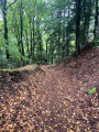
(3) Turn right at the cemetery; the GR® enters the forest. Continue along the GR® until you reach the Waterfall du Queureuilh.

(4) Go back a little way and take the path that descends alongside the Queureuilh Waterfall stream; once you reach the GR® 4, first turn left then right and follow the path down to the Rossignolet Waterfall.

(5) Walk in a circular fashion around the waterfall, skirting it via the steps on the left, then return to the GR®4 and follow it uphill to the left. As you approach the Route du Barbier, take the path on the right until you reach the D983.

(6) Cross it and continue along the Route de la Tâche until you reach the junction at the Ferme de la Tâche.

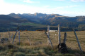
(7) Take the stony track on the right, turn left onto a path, cross a woodland, then a meadow, taking care to close the gates properly behind you, and continue until you reach the D996 on the right.

(8) Turn left and follow the road to the Col de la Croix Morand (E); see the ‘Practical Information’ section for the return journey.

Waypoints

  1. S : mi 0 - alt. 3,419 ft - Place du Panthéon - Thermes du Mont Dore
  2. 1 : mi 0.75 - alt. 3,271 ft - Queureuilh
  3. 2 : mi 0.92 - alt. 3,307 ft - Crossroads – Chemin des Gentianes
  4. 3 : mi 1.16 - alt. 3,350 ft - Landscaped cemetery
  5. 4 : mi 1.73 - alt. 3,497 ft - La Cascade du Queureuilh
  6. 5 : mi 2.09 - alt. 3,451 ft - Cascade du Rossignolet
  7. 6 : mi 3.04 - alt. 3,881 ft - Crossing the D983
  8. 7 : mi 3.37 - alt. 4,062 ft - Ferme de la Tâche
  9. 8 : mi 4.32 - alt. 4,478 ft - Junction with the D996
  10. E : mi 4.67 - alt. 4,593 ft - Col de la Croix Morand ou de Dyane (1403m)

Notes

Before leaving the town, don’t forget to pack the necessary provisions for the walk, unless you plan to have lunch at the Buron du Col de la Croix Morand.
Between (S) and (1): at the start of Avenue de la Bourboule, on the left, 100 metres along Avenue de la Gare, you’ll find the supermarket: Panier Sympa.
Between (2) and (3), on the left-hand side of the Route des Cascades, before the landscaped cemetery, you’ll pass the Camping de l’Esquiladou on your left.
(E) Before setting off on the walk, leave a car at the Col de la Croix Morand for the return journey.
Note: to return on foot, follow the outward route in the opposite direction: the distance will be 15 km and the elevation gain 535 m. Allow between 5½ and 6 hours’ walking in total.

Worth a visit

(4) The Queureuilh Waterfall.
(4) You can take a detour to visit the Saut du Loup Waterfall, or see the ‘4 Waterfalls’ walk.
(5) The Rossignolet Waterfall.
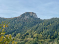
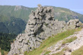
(E) Col de la Croix Morand or Col de Dyane (1,403 m); on reaching the pass, on the left is the Puy de la Croix Morand (1,520 m) and on the right is the Puy de la Tache (1,632 m).
(E) Meals available at the Croix Morand lodge

Always be cautious and plan ahead when you're outdoors. Visorando and the author of this route cannot be held responsible for any accidents occurring on this route.

The GR® and PR® markings are the intellectual property of the Fédération Française de Randonnée Pédestre.

Other walks in the area

For more walks, use our search engine .

The GPS track and description are the property of this route's author. Please do not copy them without permission.