Country:
 City:
City:


(S/E) The starting point is in front of the station, opposite the railway tracks. After crossing the small square in front of the passenger terminal, take Avenue Jean Vacher, heading away from the barriers.About halfway down the street, the large building on the left is the former gendarmerie barracks, which was moved to the start of the Route de Bourges and is now situated north of Mehun. At the end of this street, turn right onto Rue André Brému for a return walk towards the Pillivuyt porcelain factory. Halfway along, on the left, is the Saint-Syph chemist’s.
(1) This short detour to the Pillivuyt porcelain factory allows you to see, just on the right before the factory entrance, the Protestant church built on the initiative of Charles Pillivuyt, and the factory shop where you can buy, at attractive prices, most of the items manufactured in the factory, as well as kitchenware.
Turn round, walk past the chemist’s again before reaching Place du Saint-Syph, then turn right after the florist’s “Aux fleurs de toujours”.
The name “Saint-Syph” comes from “Saint-Symphorien”, who was the patron saint of the Chapel of Crécy. Following the Revolution of 1789, the parish of Crécy was merged with the parish of Mehun, which then became a separate commune. Note the statue of Saint-Symphorien above the café, next to the grocery shop.
In the past, where the flower shop now stands, there used to be a farrier’s workshop. Follow Rue Jeanne d’Arc (formerly known as Rue des Ponts), passing a bakery to reach the Café de France, then the Berry Canal, which runs parallel to the River Yèvre, with Bourges upstream and Vierzon downstream.
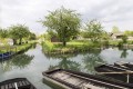
(2) Cross the canal and then follow it to the right, passing a lock and the old lock-keeper’s house.
(3) Then turn left and cross a small bridge over the Yèvre. Next, cross the Gardens of Duke Jean de Berry, skirting them to the right, and walk uphill along the Yèvre to the Place du Château.
(4) The castle of Charles VII was built on the site of the wooden fort erected by the Bituriges-Cubes. The leading expert on the castle’s history is Philippe Bon, the curator. You can visit the castle and climb to the top of the tower for a superb view of the town and its surroundings. A panoramic view reveals, in turn: the statue of Joan of Arc (1982) and the Collegiate Church of Notre-Dame (11th century), the former girls’ school (1701), Duke Jean’s Garden, Bourges in the distance, the Gandebert meadow, the château’s ‘ouche’ (former kitchen garden), the boys’ school (1823), the current post office and the vicarage (former ‘mestrize’).
Head next towards Notre-Dame Church. This Romanesque church marks the boundary of the first city wall, which could only be crossed via an underground passage, the entrance and exit of which can still be made out. Also worth noting is the Chapel of Regnault Thierry (1466), surgeon to Charles VII, who, after becoming a widower, became dean of the chapter and of the collegiate church. To the east of the collegiate church stood the houses of the prebendary canons. To the north, the car park now stands where the butter market once was, which in turn had replaced the old cemetery. A sculpture comprising three busts dating back to the Gallo-Roman period can be seen to the right of the south door.
(5) After passing to the west of the collegiate church, turn right onto Rue de la Gargouille, which continues as Rue Catherine Pateux, and you will reach the post office.
The post office has been relocated on numerous occasions. Thefirst post office opened in 1776; it was initially based at the homes of the first successive postmasters, before moving to the following locations: the site of the Saint-Joseph boarding school, Rue Charles VII (on the corner of Rue Émile Zola), 145 Rue Jeanne d’Arc, 18 Rue Agnès Sorel, and 3 Rue Catherine Pateux (current location). Catherine Pateux was the founder of the Rosière de Mehun tradition; her legacy was supplemented by those of Sophie Barrère and Victor Planchon.
Turn left onto Rue Sophie Barrère until you reach Rue Jeanne d’Arc, then turn right to pass under the Porte de l’Horloge (second city wall) and arrive at Place Charles Pillivuyt.
(6) Place Charles Pillivuyt is steeped in history, starting with the Porte de l’Horloge, which is the finest surviving remnant of the three fortified walls. It marks the boundary between the second and third walls. Beyond the gate, on the right, stood the pillory, followed by the Maison des Gassots (the ‘gassoterie’), the town butcher’s, the former town hall, a stable, a café, and La Samaritaine at the entrance to Rue Jeanne d’Arc. On the other side of the street, where the bank now stands, there used to be the Post Office and Telecommunications Office, which replaced a café (the third on the square, formerly known as ‘Caroir des flûtes’).
Here is the list of shops on the even-numbered side of Rue Jeanne d’Arc in the period 1900–1920: 124 La Samaritaine, 126 haberdashery, 128 cabaret, 130 chemist’s, 132 tailor’s, 134 bakery, 136 herbalist’s, 138 hatter’s, 142 bicycle shop, 144 tinsmith’s, 146 butcher’s, 148 printer’s, 150 cooper’s, 152 milliner’s, 154 gardener’s, 158 saddler’s, 160 delicatessen, 162 seed shop, 164 hotel, … on the left between Rue Jeanne d’Arc and Place du 14 Juillet: 175 farrier, 173 wigmaker, 171 baker.
Continue up Rue Jeanne d’Arc (formerly Rue de la White Cross).
(7) Before the Hôtel de la White Cross, turn right (Impasse de la White Cross) to reach the castle grounds, then continue on the left to reach the wash houses.
(8) After the two wash houses, on the right, Place de Gandebert is situated where the Chemin de Thinay-Barmont once ended. Its name is linked to two important elements in the town’s history. The first is a farm which, from the late14th century, was used to run the castle’s menagerie, established by Jean de Berry. The second is a former fortified house that belonged to two prominent families (the Sathenats and then the Servas). At the end ofthe 19th century, building on the foundations of a former manor house, Camille Méraut, a doctor and mayor, had a retirement home built, nicknamed ‘Le Petit-Pot’. The retirement home was subsequently moved to the start of Avenue du Général De Gaulle.
Turn left onto Rue Gilbert Demay, then right onto Rue de l’Abreuvoir, cross the Route de Bourges to reach Rue Marius Ameline.
(9) The Saint-Jean district is home to the chapel of the same name. It was in this area that various medical institutions were located, such as the Hôtel-Dieu and the leprosarium…
Turn left onto Rue Fernand Baudry. Just before reaching Place du 14 Juillet, you’ll see the former Hôtel des Postes.The main road, now the departmental road No. 2076 from Tours to Saint-Pierre-le-Moûtiers, was commissioned by the king as a bypass to avoid the congestion on what is now Rue Agnès Sorel. When the Sainte Reine district was re-developed, a large triangular square known as the “Promenade” or “mail” was created. Originally named Place Moÿret, it was renamed Place du 14 Juillet in 1891 and is now the venue for festive events.
Cross the Route de Bourges again to reach Rue Émile Burieau (the former Casino cinema) slightly to the right.Turn left onto Rue Agnès Sorel (the former post office at No. 18).
(10) Turn left after the CCAS and read the sign explaining “la Bouinotte”. Return to Place du 14 Juillet and turn right to rejoin Rue Jeanne d’Arc.
(7) Follow it to the right (on the odd-numbered side);the first house is a florist’s, formerly a tailor’s. Then turn right onto Rue Agnès Sorel.
(10) At the ‘Bouillotte’, turn left into Rue Augustin Guinard, passing the town hall on your right.Then turn left onto Rue des Marches, then right onto Rue Émile Zola. Next, turn left onto Rue Charles VII. Join Rue Jeanne d’Arc and follow it to the right, passing between the Hôtel de la Pucelle and Renault Thierry’s “Grande Maison”. Cross the bridge over the Yèvre and continue to the canal.
(2) Turn right towards the underpass beneath Rue Camille Mérault; after a few hundred metres, turn left into the Passage des Fabriques du Canal, then left again onto Rue du Gué Marin, which leads to the junction of Rue Camille Mérault and Rue Paul Besse. Follow the latter to the left until just before Place du Saint-Syph.
(11) Turn right onto Rue de l’Ouche Boyer, which leads to Boulevard de la Liberté; turn left here to reach Mehun station (S/E).
 Association / Club / Walk leader
 Visorando Member
 Moderate