Country:
 City:
City:


Along the railway line
(S) From the station, continue eastwards along Rue du 20 Décembre. At the first bend, carry straight on along a track. Just here you’ll find some old railway tracks. Follow this track to where it ends and carry straight on along a path. This path ends quite quickly: carry straight on off the beaten track until you reach the abutment of the Rivière Sainte-Suzanne, which is in poor condition.
Detour
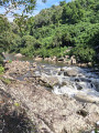
(1) From the abutment, head towards the ocean to wade across the Sainte-Suzanne River.Do not attempt to cross after heavy rain or when there is a swell; check the water level before crossing! The path on the other bank may prove tricky for beginners: you’ll need to walk over boulders and tetrapods. The gaps between the boulders are quite deep, so take care on this section.
(2) Once you have reached the opposite bank, take the first track leading up the right bank of the Sainte-Suzanne River.
Along the railway line
The track soon joins the railway line and leads to the La Marine neighbourhood.
(3) At the end of the track, turn left onto Rue des Pêcheurs, then immediately right onto Rue de l’Adour and again immediately left onto Rue des Barques. Right at this junction stood the old La Marine railway halt, which no longer exists.
Detour
(4) Turn left at the end of Rue des Barques, then left again at the next junction. Next, take the first track on the right, which leads to the sea. Then follow the coastline and cross the branches of the River Saint-Jean. Take care when crossing , as the bichique traps make it a tricky passage. After the river, take the first track on the right. Walk for about a hundred metres and turn right towards a wayside shrine marked on maps and visible from the track.
(5) Right next to it are the remains of the right-bank abutment of the Saint-Jean River railway bridge. You can see the abutment on the opposite bank from this spot. Continue along the track, which crosses the old railway line and bypasses the Bois Rouge factory to the south. There used to be a private track serving this mill.
Then take the first track on the right and turn left at the end of the road. Next, take the first right and follow this road until you reach the junction at the entrance to the Bois Rouge factory.
Along the railway line
(6) Continue straight ahead along the track. This track follows the railway line in its entirety. Where the reeds have been cut back, there are sweeping and very beautiful views of the region. But watch out for the sun! At the end of the track, continue straight ahead along Chemin de Bois Rouge, which is completely exposed.
Detour
Then turn right. The railway line continues to the left through the cane fields. Pass close to Cambuston College.
(7) After the college, take the second left onto Rue Martin and walk alongside the stadium. At the bend, turn left onto Rue Bois Dur.
On the railway line
Then take a sharp right-hand bend onto Rue du Lavoir. Follow this street to its end. This is where the old Cambuston station used to be. Today, there is a chemist’s in its place (E).
 Visorando Member
 Difficult
  Easy
Easy