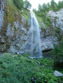
The Artists’ Trail and the Doctors’ Trail circular loop

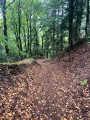
The route follows the Chemins de Mille Gouttes, des Artistes, des Médecins and de Fond de Bois, with the option to park right next to the starting point. The circular route is almost entirely on forest paths. The short section between the Capucin Sylvatorium and Rigolet Haut is surfaced with (rustic) tarmac. However, there is virtually no traffic on this road. On the descent from the Chemin de Mille Gouttes, halfway between the Chemin des Artistes and the finish, turn left onto a pleasant path which leads to the start of the Route de la Tour d’Auvergne. You will then see the thermal baths building at the end of the Allée Georges Lagaye.

Details

n°110024513
Creation:
Last update:
Last review:
–
  • Walking
    Activity: Walking
  • ↔
    Distance: 4.49 mi
  • ◔
    Average duration: 3h 00 
  • ▲
    Difficulty: Moderate

  • ⚐
    Back to start: Yes
  • ↗
    Ascent: + 1,122 ft
  • ↘
    Descent: - 1,099 ft

  • ▲
    Highest point: 4,114 ft
  • ▼
    Lowest point: 3,438 ft

Description of the walk

Park in one of the car parks on Avenue de la Libération, near the Tourist Office.

(S/E) As you leave the car park, turn left and walk alongside the Théâtre de Verdure. Continue to the pedestrian crossing, cross carefully, then turn left again to reach the start of the Chemin des Mille Gouttes, which is very well signposted.

(1) Turn right, walk past the hotel and leave the path on your right – you’ll take this on the way back. Continue to the junction with the Chemin des Artistes.

(2) Take this path on the left and head towards the funicular bridge.

(3) Carry on straight ahead, ignoring the path on the left which leads back down to the tennis courts, until you reach the junction with the Chemin des Médecins.

(4) Take the sharp right-hand bend to follow it, and carry on to the funicular’s upper station.

(5) Head straight on along the Sylvatorium du Capucin forest path. After the viewing points and rest areas, join the Route du Rigolet.

(6) Follow it to the right and continue downhill to the hamlet.

(7) At the entrance to the hamlet, turn right onto Rue Lucie Aubrac, then right again onto Place de la Fontaine. Once at the end of the street, turn right onto the Chemin de Fond de Bois: look out for a rustic sign indicating “Mont-Dore”. Continue to the junction with the Chemin des Artistes.

(8) Carry on to the right along this path until you rejoin the Chemin des Mille Gouttes, which descends from the Salon du Capucin on your right.

(9) Carry on to the left: the two paths run together for a short distance before separating again at the junction you passed on the way out.

(2) Stay on the Chemin des Mille Gouttes, heading in the opposite direction to the outward journey, which descends to the left; after 100 m, turn left again to follow the winding path which leads onto the Avenue de la Libération (D645). Head to the right and you will soon reach the car park (S/E).

Waypoints

  1. S/E : mi 0 - alt. 3,442 ft - Avenue de la Libération
  2. 1 : mi 0.08 - alt. 3,438 ft - Chemin des Mille Gouttes
  3. 2 : mi 0.29 - alt. 3,675 ft - Junction of Chemin des Artistes and Chemin des Mille Gouttes
  4. 3 : mi 0.48 - alt. 3,675 ft - Funicular bridge
  5. 4 : mi 1.77 - alt. 4,045 ft - Junction with Chemin des Médecins
  6. 5 : mi 2.81 - alt. 4,049 ft - Upper station of the funicular
  7. 6 : mi 3.21 - alt. 4,042 ft - Route du Rigolet
  8. 7 : mi 3.48 - alt. 3,862 ft - Rigolet Haut
  9. 8 : mi 3.89 - alt. 3,615 ft - Junction with Chemin des Artistes
  10. 9 : mi 4.12 - alt. 3,678 ft - Junction of Chemin des Artistes and Chemin des Mille Gouttes
  11. S/E : mi 4.49 - alt. 3,442 ft - Avenue de la Libération

Notes

As the walk mainly follows forest paths, please bring everything you need to be self-sufficient. The town centre has all sorts of shops. Information is available from the Tourist Office.

Worth a visit

(S/E) The start and finish of the walk are situated at a spot from which you can see: the lower funicular station, the Protestant church, the River Dordogne, the Tourist Office, the Parc des Thermes and numerous shops.

(3) From the funicular bridge, you can see: looking down, the lower station; and looking up, the climb towards the upper station. As well as the tracks, you’ll notice the traction cable and the staircase used for track maintenance. A little further on is a shelter where walkers caught in a heavy downpour can take refuge.

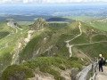
(5) As stated at the entrance to the Capucin Forestry Trail: “discover the benefits of trees … thanks to forest spas”. Several viewing platforms and vantage points offer panoramic views of the valley and the town of Mont-Dore.

Other walks in the area

For more walks, use our search engine .

The GPS track and description are the property of this route's author. Please do not copy them without permission.