Country:
 City:
City:


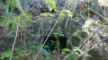
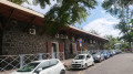
(S) Start the walk at the Étang-Salé Tourist Office and turn right onto the road running past it. This follows the old railway line before reaching a dead end. Continue along the path that joins on from here and reach the main road, then follow it to the left. You can just make out the embankment on the left where the railway used to run.
(1) Cross the Ravine Mila. The railway bridge was situated just to the right. Nothing remains of this bridge apart from a section of the retaining wall, visible from the bridge, which is situated in the ravine upstream of it.
(2) Next, cross the Ravine du Ruisseau. The abutments and piers of this railway bridge still exist and are used to support the main road. At the junction by the bridge, continue straight ahead.
(3) You will then come to a third ravine (Ravine des Avirons). The old railway bridge was situated just to the right and the abutments are still visible. Before the ravine, there is an old reservoir named after Adrien Cadet. It is on the right just as you reach the ravine.
Immediately take the track that starts straight ahead at the bend and runs alongside the A-road. This is the track where the railway line used to run. Then turn left onto the first track that joins the road and immediately keep to the right. Keep to the right again to continue along the track and reach Bois Blanc. From there, the railway line zigzags back and forth, constantly crossing from one side of the A-road to the other.
(4) Return to the road and cross the Ravine Bois Blanc via an old railway bridge in good condition, which can be seen as you descend towards the sea. Return to the road and continue to the left.
(5) Then cross another stream via a former railway culvert, which is also in good condition. To see it, you’ll also need to walk down towards the sea.
(6) Next, cross a third stream via a railway culvert, which is now used by the road. To see it, you’ll need to walk down the mountain-side this time.
(7) After these three streams, cross the Ravine du Trou. You can see the remains of the railway bridge abutments just to the right. Continue along the road and, at the bend, carry on straight ahead onto the old A-road. On your right, you can see the embankment over which the railway line ran. Cross the A-road and head down the ravine on the other side, completely off the beaten track: it’s best to wear long clothes to avoid getting scratched! Make your way to the right bank.
(8) Head west. On this bank, you’ll find the remains of a cut stone embankment from a railway bridge. You’ll need to keep a sharp eye out, however, and cross at the right spot, as it’s buried under vegetation and only its northern face is visible. Whatever happens, even if there are no paths, keep heading due west until you reach a track. It follows the old railway line exactly. Continue straight on, then ignore the next track coming from the right.
(9) Cross the Ravine des Sables via an old railway bridge. To see it, however, you’ll need to reach the A-road. The track soon ends in the undergrowth: you’ll then need to head north-west off the beaten track, which is quite overgrown.
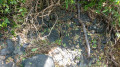
You’ll then come to a track at a bend; follow it to the left. Keep to the left and join the A-road to cross the Ravine de la Veuve via a former railway culvert. Carry straight on at the junction by the ravine. Just here, on the right, is a pile of cut stones: these were used to support the railway embankment.
Leave the A-road and follow this embankment before rejoining it after a stretch off the beaten track. Quickly leave the departmental road by turning right completely off the beaten track to try and follow the historic route of the railway line: be careful, as the grass may be tall. Continue north-west, cross the track leading to Église Requins and keep heading in the same direction off the beaten track through tall grass.
You’ll then have to rejoin the departmental road as the thorn bushes are so dense. The road passes near the Saint-Leu blowhole: take a few minutes to admire it, then set off off-track to the right at the low wall to cross the Ravine Piton and its tributary. Be careful, it’s thorny, but it’s passable.
(10) Head towards two culverts to cross the streams. The first is hard to spot as it’s hidden under a pile of rocks, whilst the second is still visible. It’s intact, although derelict. Continue heading north-west. The route remains off-trail through the same type of vegetation. After several hundred metres – which may seem like a long way – you’ll reach a path which you should follow to the left. It leads to a track: carry on straight ahead.
(11) The track crosses a small, inconspicuous culvert which is almost completely covered by square-shaped vines. Only half of it is visible. Then cross the branch of the Ravine du Portail. Next, leave the track on the right and turn left to reach the road. Once on the road, keep to the right.
Follow the road for several hundred metres and then leave it to go off-track, using your GPS for guidance. You’ll rejoin a track: follow it to the left. It passes a ravine near a pipeline. There used to be a railway bridge here, which was still standing a few years ago before it was demolished to make way for the pipeline. The track runs to the west of the Piton des Roches Tendres. There are a great many junctions on this section: following the GPS track is strongly recommended! It is on this stretch that the finest remains of railway ballast can be found. Cross the embankment over which the railway line used to run. The Pointe au Sel halt used to be located in this area, but it no longer exists today.
(12) The track ends at Les Quatre Robinets and crosses the Fond Madiel via a small, cut-stone culvert (a former railway culvert). When you reach the tarmac road, keep to the left until you reach the next track. Follow this track to the cemetery, situated near the Fond Bagatelle. There used to be a masonry railway bridge here, but it was swept away by floodwaters.
At the cemetery, follow the A-road to the right. Just here, behind the low wall on the sea-facing side, are some old railway tracks, which were used as telegraph poles. Continue straight on at the junction with the D11 and cross the Ravine du Cap, whose masonry railway bridge was swept away following a flood in 2018. After the Ravine du Cap, pass a skate park, enter Saint-Leu and turn left onto a marked path.
Pass by the fountains and the Méralikan lime kiln, which is listed as a historic monument. There used to be a former railway stop here called the ‘Halte de la Caserne’. It no longer exists today. You can stock up on supplies and have a bite to eat here. You will then reach a car park and Rue du Lagon: continue straight on along this road.
(13) Cross the Ravine des Poux at the site of the old railway bridge. Only the abutments remain. At the end of the street, keep to the left and continue straight ahead at the roundabout.
(14) Cross the Ravine du Grand Étang via a bridge resting on the abutments and a pier of a former railway bridge. Then pass the post office on your right: this is situated in Saint-Leu’s second railway station. When the first station was in operation, this building served as a shop.
(E) The first railway station was situated where the school now stands, just past the post office and its war memorial. It no longer exists today. This marks the end of this third stage and the starting point of the fourth. You can get something to eat and drink at the nearby bars.
 Visorando Member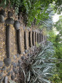
 Easy
Easy 
 Difficult
 Tourist office