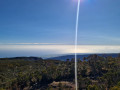
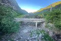
The start of the walk is just north of La Grande Chaloupe, at the Ravine à Jacques. When facing the coast, the first bridge you see is that of the old cliff-top road. Just upstream of the ravine stands the old metal railway bridge. The starting point has been chosen so that you can see this magnificent structure up close. It is no longer possible to visit the tunnel entrance to the north of this ravine. This tunnel allowed the TiTrain to reach Saint-Denis, as at the time the route around the island between Saint-Denis and La Possession ran via Chaloupe, albeit with two sections outside the tunnel at Ravine à Jacques and Grande Chaloupe.
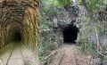
Towards the end, an alternative route presents itself; it is advisable to take the old small road tunnel which leads to the exit of the railway tunnel. This exit is situated high up and is difficult to access from this side, except for acrobats or daredevils – which is not recommended. On the other hand, the tunnel is more than happy to be photographed. You even get the impression that it is grateful to you and thanks you for your interest in Réunion’s railway heritage.
(S/E) At the Ravine à Jacques. When you’re on the coast side, the first bridge you see is that of the old cliff-top road. Just upstream of the ravine lies the old metal railway bridge. The starting point has been chosen so that you can see this magnificent structure up close. It is no longer possible to visit the tunnel entrance to the north of this ravine. This tunnel allowed the TiTrain to reach Saint-Denis, as at the time the route around the island between Saint-Denis and La Possession was travelled by chaloupe, albeit with two sections outside the tunnel at Ravine à Jacques and La Grande Chaloupe.
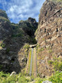
(1) The Chemin Dépêche ravine is clearly visible, although it is largely overgrown with vegetation. At the bottom of the ravine, at the edge of the road (on the cliff ledge), a pile of wire mesh has come loose from the cliff face. It is this type of wire mesh that can be found directly below most of the island’s cliffs. From time to time, we can see groups of climbers from the north training on the small cliff on the left bank of the Ravine des Colimaçons in the commune of Saint-Leu.
(2) The Ravine du Bras Isidore is also overgrown with vegetation; only the indentation at the summit of the mountain confirms its existence, which is corroborated by the GPS coordinates available on the Géoportail website (now cartes.gouv.fr). On this same website, you can access aerial views from 1950 which allow you to pinpoint the exact route of the railway line. This is, of course, only possible outside the tunnels!
(3) It is at the Pointe du Gouffre that one can see, particularly to the north of the headland, the exit from the road tunnel which cars of the time had to use on the first cliff-top road. It was only with the construction of the second cliff-top road that the Pointe du Gouffre could be bypassed.
(4) Ravine Couilloux: yet another ravine overgrown with vegetation.
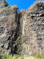
(5) The Ravine Jeanneton resembles a very vertical chimney.
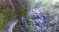
(6) The Grande Ravine is the only one where you can clearly see the waterfall filling the pool below.
(7) The Bailly Ravine features a striking indentation at its summit and a catchment basin at its base.
(8) Ravine Mas: another very beautiful ravine with safety netting on the right.
(9) Ravine des Bananiers: a lovely rainbow created by the erosion of the cliff face by the waterfall.
(10) Potasse Ravine: a little less typical than its neighbours, but clearly visible.
(11) Tunnel Window: staff entrance and rubble removal point for the railway (see description below).
(12) The Ravine des Brises is the last one before the tunnel exit at Saint-Denis
(13) Tunnel exit at Saint-Denis (see description)
On the way back: now is your chance to see all these beautiful ravines lining the old cliff-top road in a new light. Make the most of this return journey by scanning the cliff face to spot the man-sized rectangular holes, which served two purposes: firstly, to allow workers to enter the tunnel by abseiling down from the top of the cliff using ropes; and secondly, to remove the material excavated during the tunnelling work. Numerous books recount the history of Réunion’s TiTrain railway, notably those by Éric Boulogne and Patrick Barthet.
It is well worth continuing your visit now, or on another day, to the Grande Chaloupe site, particularly on the first Sunday of every month, when the Ti Train Association welcomes you with a range of heritage activities and a short ride on the TiTrain.
(S/E) It was at La Ravine à Jacques that the first quarantine facility for travellers arriving from regions where diseases such as the plague were rife was established. Subsequently, the quarantine stations were set up at La Grande Chaloupe, where their remains can still be seen today.



 Country:
 City:
City:


 Visorando Member
 Difficult
 Tourist office
 Easy
Easy